
2023 MED QSR WEB SITE INDEX
Ecological objectives and their related Common Indicators
Pollution
Marine Litter

Pollution
Key messages related to Ecological Objectives 5 and 9
The Aegean – Levantine Sea Sub-region Aegean Sea Sub-division
187. EO 5 – CI 13 (DIN – Dissolved inorganic nitrogen and TP – total phosphorus) and CI 14 (Chla – Chlorophyll a): Available literature indicates the presence of drivers and pressures with impacts related to eutrophication in the two areas found in non-good status in the present assessment, i.e., in the 1 non-good status subSAUs out of 16 subSAUs, as elaborated in 3.1.3. The non-good status in the Izmir province is related to the Izmir Bay and the southern coast of the province. Drivers that could impact eutrophication are: i) urban wastewater discharge, although many treatment plants were put into operation; ii) agriculture; iii) riverine discharge: Küçük, Menderes, Bakırçay and Gediz rivers, as the most important rivers of the Aegean Region. The main tributary of the Gediz River ,and the main streams feeding it, are considered to be under pressure in terms of point and diffuse pollution; iv) tourism; v) port operations: Izmir Port is the largest port in Turkeye after Mersin Port and vi) aquaculture. There are 66 fish farms, and 8 mussel farms operating on the coasts of İzmir province. In addition, available literature indicates the presence of drivers and pressures with impacts related to eutrophication in other areas of the AEGS which were classified in non-good status in the present assessment (see below assessment findings), for example, the Saronikos Gulf and Elfesis Bay, with extensive urbanization, industry and port activities and the Thermaikos Gulf impacted by agricultural discharges from the heavily polluted Axios River, and fish and shellfish mariculture.
188. EO 9 – CI 17 (TM, Σ16PAHs, Σ5PAHs and Σ7PCBs in sediments): Using CHASE+, the AEGS was classified as in-GES for TM in sediments when the contribution of the two very limited affected areas (Elfesis Bay and inner Saronikos Gulf and area near Aliaga and Yenisakran) were not taken into account (see below assessment findings). It was not possible to classify the AEGS sub- division for Σ16 PAHs due to insufficient data while for Σ5 the AEGS was classified as non-GES. It was not possible to classify the AEGS regarding Σ7 PCBs in sediments due to insufficient data.
189. Regarding TM in sediments, one of the very limited non-GES areas was the Elfsis Bay/ inner Saronikos Gulf. Drivers and pressures in the area are extensive urbanization (metropolitan areas of Athens), Port activities and maritime traffic (Piraeus port), Industries located in the coastal area of the Elefsis Bay, such as oil refineries, steel and cement industries, and shipyards, Discharges of wastewater treatment plant. TM pollution decreased from 1999 to 2018 in some areas due to environmental policy enforcement combined with technological improvements by big industrial polluters (Karageorgis et al., 2020 and references therein). A second limited non-GES area was near Aliaga and Yenisakran. Possible drivers and pressures are port operations, industry, tourism and agriculture Further to input provided by Turkiye43, the possible drives and pressures are mapped in the expanded area of the Balıkesir district and the Izmir province, where stations were classified as non- GES in this assessment. Those include: i) Urban waste water pressure due to increased population during the touristic summer seasons; ii) Port operations: Izmir Port is the largest port in Turkiye after Mersin Port; iii) Aquaculture is also present at some locations along the coast; iv) Agriculture also generates some pressures; v) Riverine inputs where the main streams generate pressures in terms of point and diffuse pollution.
43 Submitted after the Meeting of CORMON Pollution that took place in Athens, 1-2 March 2023
190. It was not possible to classify the AEGS Sub-division regarding data for Σ16 PAHs in sediment due to insufficient data. There are indications that the offshore zone is in GES while the enclosed areas might be found as non-GES. Regarding Σ5 PAHs in sediments, the AEGS was classified as non-GES. The same limited areas classified as non-GES for TM in sediments are also non-GES for Σ5 PAHs, with the same drivers and pressures as for Additional stations were found non-GES in the northern and central part of the AEGS, mainly in enclosed areas that are more sensitive to land-based sources pollutants.
191. The AEGS Sub-division could not be classified regarding assessment of Σ7 PCBs in sediments due to lack of An affected, non-GES area was identified in the coast around Aliaga, Yenisakran and Candarli, as for TM. Possible drivers and pressures are port operations, industry, tourism and agriculture.
192. IMPACTS. No data on biota were available for the AEGS. Drivers and pressures that can impact biota were found in the AEGS.
193. CI 18 – Level of pollution effects of key contaminants where a cause-and-effect relationship has been established: Although drivers that could exert pressure and cause impact on CI 18, were identified in the AEGS, no data were available at IMAP-IS to check for impacts in biota. Only two relevant studies in the scientific literature reported data on biomarkers in the AEGS, both for Türkiye. Both showed indications of possible effect of TM and/or pesticides on the molluscs Mytilus galloprovincialis and decussatus collected from Homa Lagoon (Aegean Sea) (Uluturhan et al. 2019) and in the fish M. barbatus, B. boops and T. trachurus collected off the coast of Türkiye (Dogan et al., 2022).
194. CI 20 – Actual levels of contaminants that have been detected and number of contaminants which have exceeded maximum regulatory levels in commonly consumed seafood: See DPSIR assessment for the LEVS sub-division.
195. CI 21 – Percentage of intestinal enterococci concentration measurements within established standards: See DPSIR assessment for the LEVS Sub-division.
Levantine Sea Sub-division
196. EO5 – CI 13 (DIN – Dissolved inorganic nitrogen and TP – total phosphorus) and CI 14 (Chla – Chlorophyll a): Drivers that could impact CIs 13 and 14 are present in the LEVS: Agriculture, Tourism and maritime activities, Coastal urbanization, Sewage discharge, Seawater Desalination, Ports operation and maritime traffic, gas and oil exploration.
197. The complete GES assessment of the AEL Sub-region for CIs 13 and 14 was impossible given the lack of quality-assured, homogenous data that prevented the application of both EQR and simplified EQR assessment Therefore, at this stage of 2023 MED QSR preparation, the assessment of eutrophication was performed by evaluating data only for Chla available from the remote sensing COPERNICUS data by applying the simplified G/M comparison assessment methodology (see below assessment findings). The assessment results show that all evaluated assessment zones can be considered in good status regarding satellite derived Chla.
198. Detailed examination showed that only 1 out of 18 SAUs, in the open waters (OW), was classified in non-good status. The SAU is located in the easternmost part of the southern Levantine Sea. The drivers and pressures in this SAU that could impact CI 14 are related to the area being one of the most densely populated areas in the world. Moreover, untreated or partially treated wastewater are discharged along the shoreline, polluting the coastal zone (Abualtayef et al., 2016).
199. EO 9 – CI 17 (TM in sediments and biota, Σ16PAHs, Σ5PAHs and Σ7PCBs in sediments): Using CHASE+, the northern and eastern (NE) LEVS was classified as in-GES for TM in sediments, when the contribution of the two very limited affected areas (off Haifa and off Beirut, see below assessment findings) were not taken into account. No assessment could be performed for the southern LEVS as no data were available. The NE LEVS was in-GES for Σ16 PAHs in sediments in Israel, Greece and Lebanon and in-GES for Σ5 PAHs in sediments in Israel, Greece and Türkiye. The LEVS could not be classified based on assessment of Σ7 PCBs in sediments due to lack of data and their uneven spatial distribution.
200. Regarding TM in sediments, non-GES stations were identified across the NE LEVS as follows: 1) In Israel, Northern Haifa Bay was non-GES (moderate status) and the main element contributing to this classification was Hg. The area is known to be still contaminated by legacy Hg, a pressure resulting from industry driver by ways of contaminated wastewater discharge. Even though there was a vast improvement following pollution abatement measures (Herut et al, 2016, 2021), the area is still contaminated; 2) In Lebanon, the main area in non-GES (moderate and poor) was off Beirut, in particular the Dora region, followed by area in the North Lebanon, with Cd and Hg concentrations contributing equally to the moderate In Beirut, the drivers contributing to the pressures and state of the coast are urban development and industry, discharge of wastewater through marine outfalls and by riverine discharge of the Beirut River. In addition, dumpsites are present in the Dora region (Ghosn et al., 2020). Tripoli, in northern Lebanon, is known for its artisanal fishing and boat maintenance activities (Ghosn et al., 2020), the latter a driver for TM introduction.
201. Stations in moderate status regarding TM in sediments were found in Cyprus in Larnaka Bay, off Zygi and in Chrisochou Bay Possible drivers are maritime activities and port operations among others. In Greece, two stations were found in moderate status (Koufonisi (S. Crete), Kastelorizo), with Pb and Cd concentrations contributing to this Possible drivers are maritime activities and traffic, and fishing. In Türkiye, 4 stations were classified as in moderate status: Akkuyu, Taşucu, Anamur, Göksu River mouth. Possible drivers are agriculture, marine activities, riverine discharge.
202. Although the areas with data for Σ16 PAH in sediments were overall characterized as in-GES, two geographically limited areas with non-GES status were identified. In Israel, at stations close to the locations of drilled wells for gas exploration (Astrahan et al., 2017). The driver was defined as maritime activities, offshore platforms of gas exploration. In Lebanon, off in Beirut. The same drivers contributing to the status of TM in sediments apply also for Σ16 PAH.
203. The LEVS sub-division could not be classified based on assessment of Σ7 PCBs in sediments due to lack of data and their uneven spatial distribution. The Dora region off Beirut was affected with possible drivers similar to TM in sediments: urban development and industry, discharge of wastewater through marine outfalls and by riverine discharge of the Beirut River.
204. Although drivers and pressures and non-GES statuses were identified for the CI 17 in the LEVS, essentially no impact was detected in the environmental status classification fish and the NE LEVS was classified as in-GES for TM in M. barbatus. The only non-GES station (1 out of 15) in poor status was located off Paphos, Cyprus and this classification was due to the concentration of Hg. No data were available for TM in sediments in this area. It should be emphasized, that concentrations not in-GES do not necessarily imply a biotic effect.
205. CI 18- Level of pollution effects of key contaminants where a cause and effect relationship has been established: Although drivers that could exert pressure and cause impact on CI18, were identified in the LEVS, no data were available at IMAP-IS to check for impacts in biota. Only two relevant studies in the scientific literature reported data on biomarkers in the LEVS. Both showed indications of possible effect of TM on various biomarkers in the mussel Ruditapes decussatus from Port Said (Egypt) (Gabr et al. 2020) and in the fish barbatus, B. boops and T. trachurus off the coast of Türkiye (Dogan et al., 2022).
206. CI 20 – Actual levels of contaminants that have been detected and number of contaminants which have exceeded maximum regulatory levels in commonly consumed seafood: The CI 20 DPSIR analysis was performed at the level of the entire AEL Sub-region due to the lack of data for the separate analysis of LEVS and AEGS Sub-divisions. Drivers that could exert pressure and cause impact on CI 20 were detected in the AEL. The examination of CI 17 results showed no impact on biota in the LEVS and while no data were reported for biota in the AEGS. In addition, data reported to IMAP-IS for CI 17 for biota in the LEVS were examined based on the concentration limits for the regulated contaminants in the EU, concentrations higher than those used for the CI 17 assessment. No impact was detected on CI 20.
207. Out of the 23 studies found in the literature for the AEL, 87% reported concentrations of TM and organic contaminants below the concentration limits for the regulated contaminants in the EU, 4% reported concentrations above the limits but without risk to human health and 9% reported concentrations above the limits for the regulated contaminants with probable risk to human health.
208. CI 21 – Percentage of intestinal enterococci concentration measurements within established standards: The CI21 DPSIR analysis was performed at the level of the entire AEL Sub- region due to the lack of data for the separate analysis of LEVS and AEGS Sub-divisions. Drivers that could exert pressure and cause impact on CI 21 are present in the AEL, among them: Urban coastal development, Tourism, sporting and recreational activities; ports and maritime works, maritime activities. However, data were available only for Israel (2021) and Lebanon in 2019-2021 in the LEVS. All stations in Israel were in excellent category. In Lebanon, 4 out of 38 stations were classified in bad category, all in the Beirut area. Possible drivers are urban development and industry, discharge of wastewater through marine outfalls and by riverine discharge.
The Adriatic Sea Sub-region
209. EO 5 – CI 13 (DIN – Dissolved inorganic nitrogen and TP – total phosphorus) and CI 14 (Chla – Chlorophyll a): The detailed status assessment results show that all the SAUs achieve GES conditions (high and good status). For all three parameters, the results show that all SAUs and sub-SAUs are in GES. The only exceptions are the results for TP in a part of CAS in the Italian offshore coast (Abruzzo region), and the TP on the SAS coastal and offshore zones (Apulia region), that were classified in moderate status. The Abruzzo and Apulia regions were identified as having aquaculture and coastal and maritime tourism (Gissi et al., 2017). Both drivers were identified as high impact to CIs 13 and 14 (Table I, Annex IV (CH 3)). Nutrients might be introduced to the area causing pressure and have the possibility to cause eutrophication and impact habitats and biodiversity. In the case of moderate status for TP, it was a localized effect, not affecting the overall assessment status and all SAUs fall under the GES status (high, good). A natural process of nitrogen limitation in the area and subsequent accumulation of phosphorus may be an additional explanation to the moderate assessment. Although the two drivers, aquaculture and coastal and maritime tourism, are present in other areas of the Adriatic Sea, they did not impact CI 13 nor CI 14, as represented by the available
210. EO 9 – CI 17 (TM in sediments and biota, Σ16PAHs in sediments and Σ7PCBs in sediments and biota): Overall, the aggregation of the chemical parameters data per SAU in the Adriatic Sub-region classified 80% of the SAUs as in GES (High or Good status), and 20% of the SAUs as non-GES under moderate status.
211. The detailed status assessment results per contaminant per SAU at the 1st level of assessment (no aggregation or integration) showed that in most cases (80% of SAUs ) GES conditions are achieved; 9% of the SAUs are classified in moderate status, 6% in poor status and 5% in bad status.
212. For the sediment matrix, the highest contamination is observed from PCBs, PAHs and Hg resulting in non-GES status for 60%, 57% and 27 % of the sub-SAUs, respectively. For the mussels matrix, the highest contamination is observed from PCBs which results in 39% of sub-SAUs in non- GES status.
213. In the NAS, 19% of sub-SAUs are classified as non-GES. The most affected sub-SAUs in the NAS are HRO-0313-BAZ, HRO-0412-PULP and HRO-0423-RILP in Croatia; Emiglia-Romana’, ‘Fruili-Venezia-Giulia-1’ and ‘Veneto-1’ in Italy. Also, offshore SAUs IT-NAS-O and MAD-Sl- MRU-12 are affected. The NAS subdivision suffers from Hg contamination (moderate status) in sediments and mussels and PCBs (poor status) contamination in sediments.
214. In the CAS, 12% of the SAUs are classified as non-GES. The most affected sub-SAUs are HRO-0313-KASP, HRO-0313-KZ, HRO-0423-KOR in The CAS sub-division suffers from Hg (poor status) and PCBs (moderate status) contamination in mussels.
215. In the SAS, 22 % of the SAUs are classified as non-GES. The most affected SAUs are HRO- 0313-ZUC, HRO-0423-MOP and HRO-0313-ZUC in Croatia; and MNE-1-N, MNE-1-C, MNE-1-S, MNE-Kotor, in Montenegro which are found in poor or bad conditions regarding several contaminants. The SAS sub-division is affected by Pb (moderate status) and PCBs (moderate status) contamination in mussels.
216. The main drivers that could put pressure on TM in sediments are industry (waste discharge and dumping of waste), tourism (litter, domestic waste water discharge), ports and maritime works (accidental discharges, dredging), shipping traffic (accidental discharges, solid waste disposal). Shipping traffic is extensive in the Adriatic Sea. In addition, Gissi et al., 2017 identified coastal and maritime tourism in Abruzzo, Apulia, Emilia Romagna, Marche, Molise, Veneto and Slovenia, although tourism is well developed in Croatia as They also identified dumping area for dredging in Emilia Romagna. See also Annex V (CH 3) with an extensive study on the DPSIR in the Adriatic Sea.
217. In the southern Adriatic Sea, Albania’s coast and offshore SAUs are non-GES concerning Hg in sediments. In Montenegro, Hg, Pb, Σ16PAHs and Σ7PCBs in sediments were classified as non- GES in the central coastal SAU as well in the Kotor Bay. The project GEF (Global Environment Facility): Adriatic Implementation of the Ecosystem Approach in the Adriatic Sea through Marine Spatial Planning, examined in detail the DPSIR elements for Albania and Montenegro marine environment. Those support the results of the NEAT assessment achieved with IMAP monitoring In Albania, about 15% of the coastline is urbanized, and tourism is increasing (drivers and pressure). Status. The initial assessment of pollution shows established significant concentrations of mercury and organochlorinated compounds in some of the assessed areas on the northern and central coast (status). In Montenegro, about 32.5% of the coastline is urbanized, while tourism consists mainly beach goers. Nearshore activities, such as shipyards and ports are also of concern (drivers and pressures). Status. The preliminary assessment of pollution shows higher concentration of contaminants in the coastal area, particularly in Boka Kotorska Bay. The levels of some contaminants exceed the established limit, specifically legacy pollutants such as heavy metals and organohalogen compounds in sediments.
218. Although drivers and pressures and non-GES statuses were identified for CI 17 in the Adriatic Sea, a few impacts were detected in the environmental status classification of the biota. Moreover, the non-GES status of a contaminant in the biota usually did not correspond to a non-GES status for the contaminant in sediment in the same sub-SAU. In the NAS, sub-SAUs for biota were in non-GES status for Hg and PCBs, with no corresponding non-GES status in the sediment or no data for PCBs in sediments. In 3 instances there was a correspondence between non-GES status for Hg in biota and sediment. In several sub-SAUs, Pb in sediments were non-GES while in-GES in biota. In the CAS there was no correspondence between the status of the sediments and the status of the biota. In the SAS, for 2 sub-SAUs, non-GES status for Pb in sediments corresponds to non-GES status for Pb in biota.
219. CI 18 – Level of pollution effects of key contaminants where a cause and effect relationship has been established: Although drivers, that could exert pressure and cause impact on CI 18, were identified in the Adriatic Sea, no data were available at IMAP-IS to check for impacts in biota. One study from the scientific literature reported impact of PAHs on some of the biomarkers measured in the specimens of the fish Mullus barbatus collected in an important fishery area in the North Adriatic Sea coming from Rimini to Ancona at a depth of 70 m (Frapiccini et al. 2020).
220. CI 20 – Actual levels of contaminants that have been detected and number of contaminants which have exceeded maximum regulatory levels in commonly consumed seafood: Drivers that could exert pressure and cause impact on CI 20 were detected in the Adriatic Sea Sub- region. The examination of CI 17 results showed no impact on biota. In additions, data reported to IMAP-IS for CI 17 for biota were examined based on the concentration limits for the regulated contaminants in the EU, concentrations higher than those used for the CI 17 assessment. No impact was detected on CI 20.
221. Out of the 25 studies found in the literature, 80% reported concentrations of TM and organic contaminants below the concentration limits for the regulated contaminants in the EU, and 8% reported concentrations above the limits but without risk to human health. Possible impact was detected in 12% of the studies that reported concentrations above the limits for the regulated contaminants with probable risk to human health.
222. CI 21 – Percentage of intestinal enterococci concentration measurements within established standards: Drivers that could exert pressure and cause impact on CI21 were detected in the Adriatic Sea, and among them the following: Tourism, sporting and recreational activities; ports and maritime works, maritime activities. However, essentially no impact was detected. Most of the bathing waters in the Adriatic were in the excellent and good GES A small percentage of bathing waters were classified as poor: 1.7% in Italy and 3.5% in Albania.
The Central Mediterranean Sea Sub-region
223. EO 5 – CI 13 (DIN – Dissolved inorganic nitrogen and TP – total phosphorus) and CI 14 (Chla – Chlorophyll a): The complete GES assessment of the CEN Sub-region for CIs 13 and 14 was impossible given the lack of quality-assured, homogenous data that prevented the application of both EQR and simplified EQR assessment methodologies. Therefore, the assessment of eutrophication was performed by applying the simplified G/M comparison assessment for evaluation of Chl an available from the remote sensing COPERNICUS data (see below assessment findings).
224. The assessment results show that despite the good status assigned to the assessment zones, the 7 out of 36 sub-SAUs are in the good status e., GREA, GREAMB, GREPAT, LBY_E, LBY_W, LBY_W; TUN_B in the Eastern and the Southern parts of the CEN Sub-region.
225. The subSAUs in Greece are located in Bays as are Ambracian Gulf (GREAMB), with pressure mainly from agriculture and Gulf of Patras (GREPAT) with pressures that include harbor operations, industries and agriculture. The more Northern subSAU (GREA) is probably influenced by the local sources of pollution (Igumenitsa port and intense aquaculture).
226. Along the Lybian coast, the influenced marine waters are in the western part of Libyan OW (subSAU LBYW), influenced by waters coming from the Gulf of Gabes where human activities contributed to the impact of eutrophication and by the city of Tripoli; in the eastern part of CW (subSAU LBYE). Several pressures that cause impacts of eutrophication are present in the Gulf of Gabes i.e., the subSAU TUNB located in CW: i) Large hurban center, ii) untreated domestic discharges, iii) industrial discharges, among them phosphogypsum, iv) agrochemical industry, v) agriculture.
227. EO 9 – CI 17 (TM, Σ16PAHs, and Σ5PAHs in sediments): It was not possible to classify the Sub-region based on the CHASE+ application due to very limited available data and they uneven areal distribution in the CEN. The assessment was performed by station. Most of the stations were in- GES with respect to TM in sediments. Stations with non-GES status for Σ16PAHs and Σ5PAHs in sediments were identified.
228. Non-GES stations regarding Σ5PAHs in sediments were located at the north-eastern and south-eastern part of Malta, in particular at the Port il- Kbir off Valetta and at the Operational Wied Ghammieq. Drivers and pressures in these areas are industrial plants and marine traffic. Non-GES stations were also located at the in the Gulf of Patras, Gulf or Corinth and in Kerkyraiki.
229. Drivers and pressures and non-GES statuses were identified for the CI17 in the CEN. However, there were almost no data for contaminants in biota in the CEN. Eight samples of M. galloprovincialis were in-GES for TM and 5 samples of M. barbatus were classified as non-GES for Hg.
230. CI 18 – Level of pollution effects of key contaminants where a cause and effect relationship has been established: Although drivers that could exert pressure and cause impact on CI18, were identified in the CEN, no data were available at IMAP-IS to check for impacts in biota.
231. Examination of the scientific literature on the impact of pollution on biota biomarkers in the CEN found 5 studies for Tunisia and 1 from Italy. Drivers and pressures reported in the studies, encompassed the whole range of them: domestic and industrial discharges, agricultural and riverine runoff, fisheries, harbor and marina utilization, maritime activities, Studies demonstrated that, in addition to anthropogenic stressors, biomarker responses were influenced also by seasonality, tissue analyzed, spawning status, and on species identity.
232. It should be emphasized that the studies used different biomarkers, with different biota species, measuring in different tissues, and different methodologies. The biomarkers studied were not listed by IMAP, and if listed, not analyzed in the organ or tissue as required by IMAP. Most of the studies measured various biomarkers in the same station, with some showing an effect and others not. All the studies below reported an impact on some of the biomarkers. Therefore, the text below addresses only the areas and species studied, and possible specific drivers, if available, with the knowledge that impact was detected in some of the biomarkers.
233. One mesocosm experiment was performed in Mytilus spp. exposed to sediment contaminated by PAH and TM collected from the Zarzis area (Ghribi et al. 2020), while the effects of hydrocarbons were studied in the mollusc Ruditapes decussatus collected from the southern Lagoon of Tunis (Mansour et al. 2021). The effect of TM on the mollusc Patella caerulea was studied in specimens collected from 4 sites in the CEN (Zaidi et al. 2022). The effect of microplastic ingestion was studied in the fish Serranus scriba collected from 6 sites along the Tunisian coast (Zitouni et al. 2020) and on the seaworm Hediste diversicolor collected from 8 sites along the Tunisian coast (Missawi et al. 2020).
234. The effect of plastic ingestion was studies in the fish Trachurus trachurus collected for the Sicily straits (Chenet et al. 2021).
235. CI 20 – Actual levels of contaminants that have been detected and number of contaminants which have exceeded maximum regulatory levels in commonly consumed seafood: Drivers that could exert pressure and cause impact on CI 20 were detected in the CEN. TM data were present for Hg in 5 specimens of barbatus in IMAP-IS. The concentrations were higher than the thresholds for CI17 but lower than the limits for the regulated Hg in the EU. No studies were found in the literature.
236. CI 21 – Percentage of intestinal enterococci concentration measurements within established Drivers that could exert pressure and cause impact on CI 21 are present in the CEN, among them: Urban coastal development, Tourism, sporting and recreational activities; ports and maritime works, maritime activities. No data were available for CI 21 in IMAP-IS.
The Western Mediterranean Sea Sub-region
237. EO5 – CI 13 (DIN – Dissolved inorganic nitrogen and TP – total phosphorus) and CI 14 (Chla – Chlorophyll a): The complete GES assessment of the WMS Sub-region for CIs 13 and 14 was impossible given the lack of quality-assured, homogenous data that prevented the application of both EQR and simplified EQR assessment methodologies. Therefore, the assessment of Common Indicator 14: Chl a was undertaken in the three Sub-divisions of the Western Mediterranean Sub- region as follows: i) in the Central Sub-division of the Mediterranean Sea Sub-region (CWMS): the Waters of France and the Southern part of the Central CWMS; the Alboran (ALB) and the Levantine Balearic (LEV-BAL) Sub-division: the Waters of Spain by applying the Simplified G/M comparison assessment methodology on the satellite-derived Chl a data; and ii) the Tyrrhenian Sea Sub-division and part of the CWMS: the Waters of Italy by applying both the Simplified G/M comparison assessment methodology on the satellite-derived Chl a data and the simplified EQR assessment methodology on in situ measured Chl a data.
238. Despite the good status assigned to the assessment zones, the assessment findings indicate some sub-SAUs in non-good status. The present assessment of the waters of Spain (see below assessment findings) showed there are 8 out of 70 subSAUs which are non-good status (the evaluation was performed on 70 out of 149 SubSAUs), and which are located close to the Mar Menor; in the Segura River mouth; near Valencia; close to the Ebro River mouth; one area close to the French border; and on the Mallorca Island in the Alcudia Gulf. There is a slight difference between the thresholds calculated from the satellite-derived data used for the present assessment and the assessment criteria calculated from in situ measurements (see below assessment findings), which resulted in the regional assessment findings which do not fully match the eutrophication evaluation performed by Spain by applying the assessment criteria calculated from in situ measurements. In the waters of Italy, there are 9 out of 54 subSAUs that are in non-good status, and they are located as follows: in front of the Arno River mouth; in front of the Tiber River mouth; close to the Napoli urban agglomeration and SW part of Sardinia Island. In the waters of France, there is 1 subSAU (Golfe de Porto Vecchio) out of the 46 SubSAU in non-good status. For four subSAUs located in the FRD_E Assessment Zone and two in the Corsica Island assessment zone (FRE), the assessment was reconsidered as in good status. In fact, a discrepancy that appeared between the national and sub- regional assessments was addressed further to the justification provided by France which is based on i) the presence of WT I in water body DC04; ii) the presence of WT IIIW in water bodies DC06A; DC07I; DC08B; EC01C; EC04B and DC04; iii) the specific national knowledge of the local hydrological and environmental conditions. Among these 6 water masses, four are located in the FRD- E assessment zone namely DC04 (Golfe de Fos), DC06A (Petite Rade de Marseille), DC07I (Cap de L’estéral – Cap de Brégançon) and DC08B (Ouest Fréjus- Saint Raphaël). Two water masses are located in Corsica Island (FRE) and correspond to EC04B (Golfe D’Ajaccio) and EC01C (Golfe de Saint Florent). Water mass DC04 (Golfe de Fos) is a highly modified water mass characterised by a high spatial heterogeneity in chl a distribution. For other water masses (DC06A, DC07I and DC08B; EF04B and EC01C in Corsica), hydrodynamic studies revealed a very low annual renewal of water masses thus explaining slight accumulation of low phytoplankton biomass levels (Ganzin et al. 201044)
239. The below findings derived from literature sources support the assessment findings as presented in assessment findings which indicate a few spatial assessment units in non-good status45. Drivers and pressures with impacts on eutrophication are found in the WMS46. The Spanish Mediterranean coastal zone may be affected by eutrophication mainly due to anthropogenic pressures, like agriculture (e.g., in Ebro Delta, rice field cultivation covers up to 65% of the area resulting in outputs of inorganic nutrients to nearby bays through drainage channels and the IMAP sub-SAUs ES100MSPFC32 in the vicinity was likely non-GES), but also by aquaculture, tourism, construction of harbors, intense urbanization, and industrialization. In French Mediterranean coast, the Gulf of Lion is one of the most historically known areas as influenced by natural and anthropogenic inputs of nutrients, receiving a large inputs of rural, urbanized, and industrialized discharges through the Rhone River. However, all sub-SAUs in the area were classified as in good status. The northern coasts of the Balearic Archipelago may be affected by the productivity imported from the Gulf of Lion, showing slightly higher concentration in the offshore north-eastern waters. Indeed, IMAP sub-SAU ES110MSPFMAMCp02 on the Mallorca Island in the Alcudia Gulf was classified as likely non-GES.
44 https://archimer.ifremer.fr/doc/00028/13931/11104.pdf
45 The present assessment undertaken at the regional level, by using the satellite-derived Chl a data, indicates also weakened status in a few assessment areas along the coast of France, however, national authorities found that some regional assessment findings do not fully match the national assessments based on the use of in situ measurements. A presence of non-optimal matching of the regional and national assessments was also expressed by the authorities of Spain.
46 Agriculture (runoff and riverine discharge), industry (land based sources; industrial wastewater discharge), aquaculture (coastal shellfish and fish farming activities), coastal urbanization and tourism (domestic wastewater discharge), seawater desalination, ports and maritime operations (dredging).
240. The Italian Western Mediterranean coast may be affected by riverine discharge e,g., the Arno river (subSAUs ITCWTCD and ITOWTCDoff Livorno), and the Tiber River (sub-SAUs ITCWLZ and ITOWLZC, Rome), as well as by the extensive population, tourism, port operations and industries, like the area of Naples (sub-SAUs ITOWCMC, ITOWCMD, ITCWCMC and ITCWCMD).
241. The Mediterranean Sea hosts around 400 coastal lagoons covering a surface of over 640 000 ha, that are important drivers for regional economies by way of fisheries, aquaculture, tourism, recreation and increased urbanization. One example of a well-studied lagoon is the Mar Menor located in the region of Murcia. The drivers and pressures on Mar Menor include tourism and agriculture along its shoreline and drainage area. In the present assessment the IMAP subSAU. ES070MSPF010300030, located close to the Mar Menor and IMAP subSAU ES080MSPFC017 located near the Segura River mouth were classified in non-good status. In addition, the area of the Gulf of Oristano in western Sardinia, is connected to the Cabras lagoon and may be influence by it (sub-SAU ITCWSDWB).
242. The present regional assessment using satellite-derived Chl a classified in non-good status one sub SAU EC03B close to Golfe de Porto Vecchio, located along the northern part of Corsica coast. As elaborated in the assessment findings, the assignment of non-good status can be explained in the context of the low number of pixels integrated into the assessment based on the use of the satellite- derived data along with the water properties complexified with sediment resuspension resulted in the uncertain computation of the mean Chl-a values. Additionally, the enclosed feature of the Gulf of Porto Vecchio with very low water renewal contributes to relatively high Chl concentrations observed in the area47.
243. Mariculture is also well developed in Italian waters, for example off Genoa and in the Gulf of Follonica, the latter south of Livorno that was classified in non-good status in the present assessment (subSAUs ITCWTCD and ITOWTCD).
244. Although the non-good status was not found in the present assessment of the Southern part of the CWMS, it must be recognized that the assessment was impossible at the level of the finest spatial assessment units (subSAUs) due to the absence of finer water bodies delineation and related water typology characterization as for other Sub-divisions in the WMS. Given a less confidential assessment in this part of the WMS, some specific examples of drivers and pressures were mapped from the scientific literature. The Oran harbor (Algeria) which receives the discharge of wastewater, while the Ghazaouet harbor is exposed to chemicals coming mainly from industrial activities. In addition, the high rate of urbanization around the harbor contributes to anthropogenic contamination (Kaddour et al. 2021). Algeria also has seawater desalination plants along its shoreline such as the Bousfer desalination plant in Oran Bay and the Beni Saf desalination plant.
47 Giret O., Mayot H., Porcheray C., Salou K., Le Bourhis K. (2023). Bilan des schémas régionaux de développement de l’aquaculture marine. Cerema – DIRM Méditerranée. 38 p.
245. EO 9 – CI 17 (TM in sediments and biota ( galloprovincialis) (ALBS); TM, Σ16PAHs and Σ7PCBs in sediments and biota (TYRS); TM, Σ16PAHs and Σ7PCBs in sediments and biota (CWMS) ): The assessment was conducted using NEAT in the ALBS and the TYRS Sub-divisions. A simplified application of NEAT (1st level, without any further spatial integration) was applied to the CWMS. Data were available only for some SAUs for the northern coast sub-division (Spain, France, Italy). No data were available for the southern CWMS coast (Algeria and Tunisia). The WMS assessment was made for the coastal zone, as 91% of data were coastal.
246. Overall, the Alboran Sea (ALBS) and the Tyrrhenian Sea (TYRS) were classified as in GES, in good status regarding all available parameters and SAUs. In the Central Western Mediterranean (CWMS) Sub-division, 6 out of 7 SAUs were classified in high or good statuses and one SAU was classified as non-GES, in moderate status regarding all available parameters.
247. A detailed examination of these classifications is presented here-below.
248. The ALBS Sub-division was in GES (high and good statuses) for TM in sediments and for Cd and Pb in biota, and non-GES (moderate status) for Hg in biota sampled along the Spanish coast. In addition, off Morocco, one SAU was in moderate status for Cd in sediments and one in moderate status for Pb in sediments.
249. The TYRS Sub-division was in GES (high and good statuses) for TM, Σ16PAHs and Σ7PCBs in sediments and biota. For the Italian coast several non-GES parameters were identified for some SAUs, as follows: one SAU was in moderate status regarding Cd and Hg in sediments, one SAU in moderate status for Cd in sediments and in poor status for Hg in sediments, and one SAU in moderate status for Cd and Σ7PCBs.
250. Non-GES SAUs for several parameters were identified in the CWMS sub-division as follows: One SAU with moderate Pb in sediment in Spain; in France, one SAU with poor status of Hg in sediments, moderate status for Cd and Hg in biota and poor status for Σ16PAHs in biota; 2 SAUs with poor and moderate statuses for Σ16PAHs in biota; in Italy, one SAU with moderate status for Cd in sediment and poor status for Σ16PAHs and Σ7PCBs in sediments.
251. Drivers and pressures are found in the WMS: Large Ports and maritime traffic, Coastal urbanization, Tourism, Riverine discharge, Agriculture and aquaculture, Some specific examples for drivers and pressures can be found in the scientific literature.
252. Drivers and pressures and non-GES statuses were identified for CI17 in the WMS however, essentially no impact was detected in the environmental status classification of biota. In the CWMS, for France, moderate status was found for Hg and Pb in biota, at the same SAU with poor status for Hg in the sediment. In addition, moderate and poor statuses were assigned to Σ16PAHs in biota in three SAUs. No concentration of Σ16PAHs in sediment were reported. In the ALBS, for Spain, Hg in biota was in moderate classification. No concentration was reported for Hg in the sediment. It should be emphasized, that concentrations not in-GES do not necessarily imply a biotic effect.
253. CI 18 – Level of pollution effects of key contaminants where a cause and effect relationship has been established: Although drivers that could exert pressure and cause impact on CI18, were identified in the WMS, no data were available at IMAP-IS to check for impacts in biota.
254. Examination of the scientific literature on the impact of pollution on biota biomarkers in the WMS found 4 relevant studies from Algeria, 2 from Italy, 5 from Spain and 4 from Tunisia. Drivers and pressures reported in the studies, encompassed the whole range of them: domestic and industrial discharges, agricultural and riverine runoff, fisheries, harbor and marina utilization, maritime activities, tourism. Studies demonstrated that, in addition to anthropogenic stressors, biomarker responses were influenced also by seasonality, tissue analyzed, spawning status, and on species identity.
255. It should be emphasized that the studies used different biomarkers, with different biota species, measuring in different tissues, and different methodologies. The biomarkers studied were not listed by IMAP, and if listed, not analyzed in the organ or tissue as required by IMAP. Most of the studies measured various biomarkers in the same station, with some showing an effect and others not. All the studies below reported an impact on some of the biomarkers. Therefore, the text below addresses only the areas and species studied, and possible specific drivers, if available, with the knowledge that impact was detected in some of the biomarkers.
256. Algeria: Mussel Donax trunculus from Annaba Bay, from 2 impacted sites ( Sidi Salem and Echatt) and one reference site (El Battah) (Amamra et al. 2019); fish, Mullus barbatus from two impacted sites (Oran, Ghazaouet) and a control site (Kristel), along the Algerian west coast (Kaddour et al. 2021); mussel Perna perna transplanted to three sites in the Gulf of Annaba (Laouati et al. 2021); mussel Patella rustica from four sites (3 affected and one reference) off the Bousfer desalination plant (Oran Bay, Algeria) (Benaissa et al. 2020).
257. Italy: Fish Parablennius Sanguinolentus collected from the port of Bagnara Calabra on the western Calabrian coast of Italy and from a reference site, Jancuia Stressor – pesticides. (Parrino et al. 2020); mussel, Mytilus galloprovincialis, and fish, Mullus barbatus, Pagellus erythrinus and Diplodus vulgaris, from different stations at the Bay of Pozzuoli, within the Gulf of Naples. Stressors: TM and PAHs (Morroni et al. 2020).
258. Spain: Three studies conducted near Integrated Multi-Trophic Aquaculture cages in Palma de Majorca as possible driver: two with Mytilus galloprovincialis, (Capo et 2021; Rios-Fuster et al. 2022) and one with the fish Sparus aurata (Capó et al. 2022). In addition, fish, Seriola dumerili collected around the Pityusic Islands, (Eivissa and Formentera; Balearic Islands) (Solomando et al. 2022); and European anchovy (Engraulis encrasicolus) collected at three areas off Catalonia (Spain): Barcelona, Tarragona and Blanes (Rodríguez-Romeu et al., 2022).
259. Tunisia: Scallop Flexopecten glaber were collected from the entrance to the Bizerte Lagoon and a site located near Menzel Abderrahmen, contaminated by inputs from the surrounded industrial manufactories and urban agglomerations (Telahigue et al. 2022); polychaete Perinereis cultrifera collected from the port of Rades and the Punic port of Carthage, S2 (Bouhedi et al. 2021); fish Serranus scriba were sampled from 6 sites along the Tunisian coast (2 WMS and 4 CEN). Stressor, microplastic ingestion as a potential vector for the transmission of adsorbed environmental chemicals to marine organisms (Zitouni et al. 2020); seaworm (Hediste diversicolor) from eight sites along the Tunisian coasts (2 WMS and 6 CEN), affected by different anthropogenic stresses. Stressor analyzed – microplastic ingestion (Missawi et al. 2020).
260. CI 20 – Actual levels of contaminants that have been detected and number of contaminants which have exceeded maximum regulatory levels in commonly consumed seafood: Drivers that could exert pressure and cause impact on CI 20 were detected in the Western Mediterranean Sea. The examination of CI 17 results showed no impact on biota. In additions, data reported to IMAP-IS for CI 17 for biota were examined based on the concentration limits for the regulated contaminants in the EU, concentrations higher than those used for the CI17 assessment. No impact was detected on CI-20.
261. Out of the 37 studies found in the literature, 78% reported concentrations of TM and organic contaminants below the concentration limits for the regulated contaminants in the EU and 11% reported concentrations above the limits but without risk to human health. Possible impact was detected in 11% of the studies that reported concentrations above the limits for the regulated contaminants with probable risk to human health.
262. CI 21 – Percentage of intestinal enterococci concentration measurements within established standards: Drivers that could exert pressure and cause impact on CI 21 were detected in the Western Mediterranean Sea, and among them the following: Tourism, sporting and recreational activities; ports and maritime works, maritime However, essentially no impact was detected. Most of the bathing waters in Spain, France and Italy were in the excellent and good GES classifications. A small percentage of bathing waters were classified as poor category: 0.1% in Spain, 1% in France, 1.7% in Italy. In Morocco, 20 out of 131 stations (15%) were classified as in bad status. Data were not available for Algeria and Tunisia.
Quality status assessments of the Mediterranean regarding Common Indicators of Ecological Objectives 5 and 9
Assessment of IMAP Common Indicators 13 and 14 (Ecological Objective 5)
263. In the region of Mediterranean Sea, four main sub-regions have been recognized for practical reasons and for the purpose of the UNEP/MAP 2011 Initial Integrated Assessment and the Med QSR 2017 assessment, namely: the Western Mediterranean Sea, the Adriatic Sea, the Central Mediterranean, and the Aegean and Levantine Seas in the Eastern Mediterranean part. The sub- divisions (i.e., subareas/seas) for IMAP Pollution Cluster have been initially identified according to availability of database sources for the purpose of development of the assessment criteria for pollution and the assessments within the preparation of the 2017 MED QSR.
264. Sub-divisions were further analyzed to support optimal application of the assessment criteria in the four Mediterranean sub-regions by considering data aggregation for update of the assessment criteria, as well as relevant sources. The nesting scheme of the Mediterranean sub-regions and sub- divisions aggregation is as follows: (i) coastal/ onshore waters; (ii) national sub-divisions; (iii) regional sub-divisions; (iv) sub-regions; (v) Mediterranean Region.
265. The distribution of the assessment methodologies used for assessment of IMAP CIs 13, 14, 17, 18, 19, 20, 21, as well as for assessment of IMAP Candidate Common Indicators 26 and 27 in the four Mediterranean sub-regions and related sub-divisions is shown in Table 3.1.2.1.
Table: Assessment of IMAP Common Indicators 13 and 14 (Ecological Objective 5)
| Geographical scale of the assessment | Sub-regional based on integration and aggregation of the assessments at sub-division levels |
| Contributing countries | Croatia, Italy, Slovenia and Montenegro |
| Mid-Term Strategy (MTS) Core Theme | Enabling Programme 6: Towards Monitoring, Assessment, Knowledge and Vision of the Mediterranean Sea and Coast for Informed Decision-Making |
| Ecological Objective | EO9. Contaminants cause no significant impact on coastal and marine ecosystems and human health |
| IMAP Common Indicators |
CI 13: Key nutrients concentration in water column CI 14: Chlorophyll-a concentration in water column |
|
CI 13: Concentrations of nutrients in the euphotic layer are in line with prevailing physiographic, geographic and climate conditions CI 14: Natural levels of algal biomass, water transparency and oxygen concentrations in line with prevailing physiographic, geographic and weather conditions |
|
| GES Targets (UNEP/MED WG 473/7) (2019) |
CI 13 · Reference nutrients concentrations according to the local hydrological, chemical and morphological characteristics of the un-impacted marine region. · Decreasing trend of nutrients concentrations in water column of human impacted areas, statistically defined. · Reduction of BOD emissions from land-based sources. · Reduction of nutrients emissions from land-based sources CI 14 · Chlorophyll a concentration in high-risk areas below thresholds · Decreasing trend in chl-a concentrations in high risk areas affected |
| GES Operational Objective (UNEP/MED WG473/7) (2019) |
CI 13 Human introduction of nutrients in the marine environment is not conducive to eutrophication CI 14 Direct and indirect effects of nutrient over-enrichment are prevented |
The NEAT GES Assessment of IMAP CIs 13&14:

Along with the application of the IMAP NEAT GES assessment methodology in the Adriatic Sea Sub-region, the application of the Ecological quality ratio (EQR); the Simplified EQR methodology, and the Simplified methodology based on G/M comparison was also explored in another three Mediterranean Sub-regions with insufficient data for the IMAP NEAT GES assessment.
The ecological quality ratio (EQR) is a dimensionless measure of the observed value of an indicator compared with reference conditions. The ratio goes from 0 (large deviation) to 1 (when the observed value is equal or better than the reference conditions).
The application of the EQR method was found relevant for assessment of IMAP Common Indicators 13 & 14 where full set assessment criteria for Chla, DIN and TP exist. Typology related assessment needs to be performed.
Given the lack of data reported by the CPs, this methodology was impossible to apply within the preparation of the 2023 MED QSR. However, key aspects of this methodology, as presented here-below, are developed for future application within the implementation of IMAP.
The EQR, which is set as the relative deviation from the reference conditions (RC), must be calculated for every boundary value using the simple equation:
EQRactual = RC/Chla annual G-mean (1)
where for Chla annual G_mean, the Chla concentrations defined for every boundary value must be used.
As Chla concentrations are derived using non-linear relationships, the corresponding EQRs are not on a linear equidistant scale. To calculate the EQRs values normalized (Anon, 2005) to the scale from 0 to 1 (EQRnorm) and set them equidistantly, with respect to the calculated values designated as EQRactual, the following conversion functions need to be used:
| Chla – EQRnorm = 0.2586 ln(EQRactual) + 0.9471 | for Type I coastal waters | (2) |
| TP – EQRnorm = 0.3183 ln(EQRactual) + 0.9521 | for Type I coastal waters | (3) |
| Chla – EQRnorm = 0.1824 ln(EQRactual) + 1.0253 | for Type I open waters | (4) |
| DIN – EQRnorm = 0.1216 ln(EQRactual) + 1.0209 | for Type I open waters | (5) |
| Chla – EQRnorm = 0.1488 ln(EQRactual) + 1.0385 | for Type I Montenegro | (6) |
| DIN – EQRnorm = 0.0966 ln(EQRactual) + 1.0378 | for Type I Montenegro | (7) |
| Chla – EQRnorm = 0.246 ln(EQRactual) + 0.981 | for Type II A Adriatic coastal waters | (8) |
| TP – EQRnorm = 0.333 ln(EQRactual) + 0.979 | for Type II A Adriatic coastal waters | (9) |
The actual and normalized EQRs for all boundary values of Types I, and II A Adriatic are shown in Tables I and II, Annex II (CH 2), respectively.
Finally, for each considered variable, sampling station or area is classified in GES or non-GES, comparing the EQR value of the indicator to the class boundary value.
The application of the simplified EQR methodology was found relevant where complementary data availability i.e. in situ and from remote sensing is found for Chla only and the typology related assessment is not possible to apply. Given the lack of homogenous quality assured data reported by the CPs even for Chla only, an application of the simplified EQR method was impossible for any sub-region/sub-division within the preparation of the 2023 MED QSR.
For the application of the simplified EQR method within the IMAP implementation, thresholds need to be used to define the boundary limits between an acceptable and unacceptable environmental status (i.e., Good Environmental Status (GES) or non-Good Environmental Status (non-GES)). In the absence of the assessment criteria for nutrients, application of the simplified EQR method is foreseen by relying on the experiences gained in the Baltic Sea (Andersen et al. 2011; HELCOM 2010). For an indicator showing a positive response (i.e., nutrients and Chla), it indicates that the threshold has an upper limit of +50 % deviation from reference conditions. Setting the threshold to 50 % implies that low levels of disturbance (defined as less than +50 % deviation), resulting from human activity, are considered acceptable, while moderate (i.e., greater than +50 %) deviations are not considered acceptable for the water body in question.
Given the lack of quality-assured homogenous data prevented the application of NEAT, EQR and simplified EQR assessment methodologies, the assessments within the 2023 MED QSR were prepared only by evaluating data available for Chla from remote sensing sources, whereby the typology-related assessment is impossible to apply. The application of the simplified methodology based on G/M comparison relied on the use of satellite-derived data for Chla (e.g. COPERNICUS, ARGANS, SMED algorithm).
Data were aggregated as a 5-year geometric mean and normalized in order to ensure their comparability between the areas of assessment. For normalization, the bestNormalize package in R was used. The best normalization transformation was identified as the Ordered Quantile normalizing transformation (Bartlett, 1947, Beasley et al., 2009). From the normalized values, the following values are back-transformed: the 10th percentile as the reference condition, the 50th percentile as the mean value of the distribution, and the 85th percentile ~ mean +1 SD that represents the G/M threshold.
Finally, each considered observation point or area was classified in GES or non-GES status, comparing the value of the indicator to the boundary limit between G/M i.e. back transformed the 85th percentile of the normalized distribution.
The comparison and harmonization of the assessment methodologies applied for IMAP CI 14: By selecting the 85th percentile of the normalized distribution as G/M boundary limit, therefore as the limit between the acceptable and the unacceptable statuses i.e. GES and non GES/ good and non-good, the compatibility of the classification within application of the Simplified assessment methodology based on G/M comparison was achieved with a five classes GES/non GES scale set for IMAP NEAT GES assessment of the Adriatic Sea Sub- region. The harmonization was achieved to the maximum possible extent given the Simplified assessment methodology based on G/M comparison and NEAT GES assessment methodology are different methodologies which application across the Mediterranean Sub-regions/Sub-divisions was conditioned with the statuses of data reported by the CPs.
Therefore, the bias assessment of CI 14 within the 2023 MED QSR was avoided as the Simplified G/M method relay on the assessment criteria corresponding to RC and G/M as stated in the Decision 22/7 on Integrated Monitoring and Assessment Programme of the Mediterranean Sea and Coast and Related Assessment Criteria. Based on statistical calculations and related selection of the 85th percentile ~ mean +1 SD represents the G/M threshold, the synchronization was achieved to the maximal possible extent between the classification statuses assigned in the AEL, CEN and WMS, and those in the Adriatic Sea Sub-region.
Assessment classification for harmonized IMAP/NEAT and IMAP/Simplified G/M assessment methodologies application for CIs14 in the Mediterannean Sea sub-regions:

The Levantine Sea (LEVS) Sub-division
289. Upon setting the reference conditions and the G/M threshold, each observation point, or area were classified in good or non- good status , by comparing the value of the indicator i.e., the satellite derived Chla to the G/M threshold, i.e. the back transformed 85th percentile of normalized distribution.
290. The results of CI 14 assessment using the satellite derived Chla data are presented in Tables 3.1.3.1.3.a. and 3.1.3.1.4.a., and Figure LEVS 3.1.3.1.5.E. The good status corresponds to the RC conditions, as well as to the values below the 85th percentile of normalized distribution set as good/non good statusboundary (i.e. blue coloured cells in the last column of Tables 3.1.3.1.3.a and 3.1.3.1.4.a). The good status corresponds to the class above G/M boundary limit (i.e. red coloured cell in the last column of Table 3.1.3.1.4.a.).
291. The assessment results show that all evaluated assessment zones can be considered in good status regarding assessment of the satellite derived Chla data. Further to good status assigned to the assessment zones, it can be preliminary found that only 1 out of 18 subSAUs is in non-good status. However, it must be noted that the present subSAUs are set at an insufficient level of fineness for a reliable assessment (Table 1.3.1.4 and Figure LEVS 3.1.3.1.5.E). This subSAU in non-good status is located in the OW in the southern part of the Eastern Levantine Sea. The local sources of pollution are probably the main driver contributing to the weakened status of this subSAU.
292. In addition, available literature indicates waters in front of Mersin and in the Iskenderun Bay as impacted areas. A slight impact can also be identified along the coast of Israel and in the OW in the southern part of the Eastern Levantine Sea, as well as in front of Port Said and Alexandria. The influence of the Nile River through the river Delta is weak and confirms the changes in the area caused by construction of the Aswan dam. There is also an indication of a coastal impact in the Tobruk area in the waters of Libya.

Figure AEL 3.1.3.1.5.E: The assessment results for CI 14 in the Levantine Sea Sub-division by applying he simplified G/M method at the level of SAUs
Table 3.1.3.1.3.a. Results of the assessment (G_NG.oN85 – the good status corresponds to all values below the 85th percentile set as G/M i.e., good/noon- good boundary limit) of the Levantine Sea Sub-division by Assessment Zones (AZ) and Spatial Assessment Units (SAUs). Blue coloured SAUs indicate good status
| AZ | SAU | CHL_N | CHL_GM | oN50 | oN50+50 | oN10 | oN85 | G_NG.oN85 |
| CW | CI | 677 | 0,050 | 0,047 | 0,071 | 0,034 | 0,065 | G |
| CW | EA | 257 | 0,458 | 0,462 | 0,692 | 0,125 | 1,402 | G |
| CW | NO | 163 | 0,199 | 0,152 | 0,227 | 0,066 | 1,454 | G |
| CW | SE | 853 | 1,111 | 1,769 | 2,653 | 0,059 | 4,773 | G |
| CW | SW | 1281 | 0,050 | 0,038 | 0,056 | 0,025 | 0,104 | G |
| OW | CI | 10383 | 0,040 | 0,039 | 0,059 | 0,029 | 0,049 | G |
| OW | EA | 9178 | 0,074 | 0,061 | 0,092 | 0,042 | 0,110 | G |
| OW | NO | 12598 | 0,083 | 0,064 | 0,095 | 0,044 | 0,140 | G |
| OW | SE | 7568 | 0,331 | 0,227 | 0,341 | 0,042 | 0,990 | G |
| OW | SW | 10458 | 0,032 | 0,031 | 0,047 | 0,023 | 0,035 | G |
CHL_N – number of grid point in the SAU; CHL_GM – geometric mean (5-year average); oN50 – mean; oN50+50 – Mean + 50%; oN10 – 10th percentile (Reference conditions)
Table 3.1.3.1.4.a. Result of the assessment (G_NG.oN85- the good status corresponds to all values below the 85th percentile set as G/M i.e., good/noon-good boundary limit) of the Levantine Sea Sub-division for the finest Spatial Assessment Units (SAUs). Blue coloured SAUs indicate good status; Red coloured SAU indicates non-good status
| AZ | SAU | subSAUs | CHL_N | CHL_GM | oN50+50 | oN10 | oN85 | G_NG.oN85 |
| CW | CI | CWCICYP | 677 | 0,050 | 0,071 | 0,034 | 0,065 | G |
| CW | EA | CWEAISR | 95 | 0,498 | 0,692 | 0,125 | 1,402 | G |
| CW | EA | CWEALBN | 91 | 0,360 | 0,692 | 0,125 | 1,402 | G |
| CW | EA | CWEAPSE | 26 | 1,362 | 0,692 | 0,125 | 1,402 | G |
| CW | EA | CWEASYR | 45 | 0,331 | 0,692 | 0,125 | 1,402 | G |
| CW | NO | CWNOTUR | 163 | 0,199 | 0,227 | 0,066 | 1,454 | G |
| CW | SE | CWSEEGY | 853 | 1,111 | 2,653 | 0,059 | 4,773 | G |
| CW | SW | CWSWEGY | 725 | 0,035 | 0,056 | 0,025 | 0,104 | G |
| CW | SW | CWSWLBY | 556 | 0,080 | 0,056 | 0,025 | 0,104 | G |
| OW | CI | OWCICYP | 10383 | 0,040 | 0,059 | 0,029 | 0,049 | G |
| OW | EA | OWEAISR | 2724 | 0,086 | 0,092 | 0,042 | 0,11 | G |
| AZ | SAU | subSAUs | CHL_N | CHL_GM | oN50+50 | oN10 | oN85 | G_NG.oN85 |
| OW | EA | OWEALBN | 3243 | 0,067 | 0,092 | 0,042 | 0,11 | G |
| OW | EA | OWEAPSE | 486 | 0,158 | 0,092 | 0,042 | 0,11 | NG |
| OW | EA | OWEASYR | 2725 | 0,062 | 0,092 | 0,042 | 0,11 | G |
| OW | NO | OWNOTUR | 12598 | 0,083 | 0,095 | 0,044 | 0,14 | G |
| OW | SE | OWSEEGY | 7568 | 0,331 | 0,341 | 0,042 | 0,99 | G |
| OW | SW | OWSWEGY | 5843 | 0,030 | 0,047 | 0,023 | 0,035 | G |
| OW | SW | OWSWLBY | 4615 | 0,033 | 0,047 | 0,023 | 0,035 | G |
CHL_N – number of grid point in the SAU; CHL_GM – geometric mean (5 year average); oN50 – mean; oN50+50 – Mean + 50%; oN10 – 10th percentile (Reference conditions);
The Aegean Sea (AEGS) Sub-division
293. The assessment results show that all three evaluated assessment zones can be considered in good status regarding assessment of the satellite derived Chla data. Further to this likely good status assigned to the assessment zones, it can be preliminary found that only 2 out of 16 subSAUs are in noon- good status. However, it must be noted that the present subSAUs are set at an insufficient level of fineness for a reliable assessment (Table 3.1.3.1.4.b, and Figure AEL 3.1.3.1.5.E). The following two non-good status subSAUs are located in the CA SAU in the waters of Turkiye in the Aegean Sea: EGE09 (Izmir Bay) and EGE_C (coast strip south of Izmir Bay). The local sources of pollution are probably the main driver contributing to the weakened status of these two subSAUs.
294. In addition, available literature indicates the presence of drivers and pressures with impacts related to eutrophication in the areas as elaborated here-below.
295. In the Saronikos Gulf and Elfesis Bay, there is evidence of a few following drivers and pressures: i) extensive urbanization in the metropolitan areas of Athens and Piraeus hosting about 1/3 of the Greek population; ii) port activities and maritime traffic (Piraeus port); and iii) industries located in the coastal area of the Elefsis Bay, such as oil refineries, steel and cement industries, and Since 2012, the eastern Elefsis Bay receives treated domestic and industrial wastewaters from the Thriasio wastewater treatment plant. The small island of Psyttaleia hosts the wastewater treatment plant of metropolitan Athens, however with pre-treatment, primary and secondary treatment, including biological nitrogen removal, and sludge treatment. Treated wastewaters are discharged into the Inner Saronikos Gulf via a system of three pipelines to the south of the island, at 62m depth (Karageorgis et al., 2020 and references therein).
296. Similarly, the national assessment by applying the NEAT tool to Saronikos Gulf55 classified this area into good status, with the pelagic habitat components contributing strongly to its overall environmental status. Sediment, benthic fauna and vegetation, mammals and alien species were the most impacted ecological components in Saronikos Gulf. The most affected areas, Elefsis Bay and Psittalia (wastewater submarine outfall), were assessed as in poor and moderate status, respectively.
297. There are also other areas where certain impacts are registered. In the Thessaloniki Bay, these are the Thessaloniki harbour, impacted by industrial, treated or partly treated sewage discharges; the Inner Thermaikos Gulf impacted by agricultural discharges from the heavily polluted Axios River, and fish and shellfish mariculture; as well as the Evoikos Gulf impacted by agriculture, mariculture, and industry. Industrial discharges, port activities, sewage discharges, aquaculture activities, and fishing are the most important pressures affecting the coastal areas of Greece. In fact, mariculture seems to have the highest impacts, and is followed by fishing, other activities and industrial discharges (Pavlidou et al., 2015).
298. A review of the existing pressures and assessment was provided by The analysis indicated the following drivers and pressures relevant to EO5: i) tourism population density; ii) urban wastewater; iii) agriculture; and iv) port operations, especially in Port of Izmir.
299. As for the Levantine Sea Sub-division, the results of the present CI 14 assessment in the Aegean Sea Sub-division represents only an indication of possible good/non-good status at the level of sub SAUs, whereby they are not set at the same level of spatial finesse.
55
55 Pavlidou, A., Simboura, N., Pagou, K. et al., (2019) Using a holistic ecosystem-integrated approach to assess the environmental status of Saronikos Gulf, Eastern Mediterranean, Ecological Indicators, 96 (1), 336-350.

Figure AEL 3.1.3.1.5.E: The assessment results for CI 14 in the Aegean Sea Sub-division by applying the simplified G/M method on the satellite-derived COPERNICUS data at the level of subSAUs
Table 3.1.3.1.3.b. Results of the assessment (G_NG.oN85 – the good status corresponds to all values below the 85th percentile set as G/M i.e., good/noon-good boundary limit) of the Aegean Sea Sub-division by Assessment Zones (AZ) and Spatial Assessment Units (SAUs). Blue coloured SAUs indicate likely GES
|
AZ |
SAU |
CHL_N |
CHL_GM |
oN50 |
oN50+50 |
oN10 |
oN85 |
G_NG.oN85 |
|
CW |
NA |
53613 |
– |
0,126 |
0,189 |
0,085 |
0,436 |
G |
|
CW |
CA |
39229 |
0,093 |
0,074 |
0,111 |
0,053 |
0,12 |
G |
|
CW |
SA |
5091 |
0,062 |
0,056 |
0,084 |
0,046 |
0,07 |
G |
CHL_N – number of grid point in the SAU; CHL_GM – geometric mean (5-year average); oN50 – mean; oN50+50 – Mean + 50%; oN10 – 10th percentile (Reference conditions)
Table 3.1.3.1.4. b. Result of the assessment (G_NG.oN85- the good status corresponds to all values below the 85th percentile set as G/M i.e., good/noon-good boundary limit) of the Aegean Sea Sub-division for the finest Spatial Assessment Units (subSAUs). Blue coloured SAUs indicate good status; Red coloured SAU indicates non-good status
|
Country |
SAU |
subSAUs |
CHL_N |
CHL_GM |
oN50+50 |
oN10 |
oN85 |
G_NG.oN85 |
|
GRE |
CA |
AEG_C_ARG |
5190 |
0,095 |
0,111 |
0,053 |
0,12 |
G |
|
GRE |
CA |
AEG_C_ISL |
19245 |
0,066 |
0,111 |
0,053 |
0,12 |
G |
|
GRE |
CA |
AEG_C_SOR |
10338 |
0,115 |
0,111 |
0,053 |
0,12 |
G |
|
GRE |
NA |
AEG_N_HAL |
11469 |
0,315 |
0,189 |
0,085 |
0,436 |
G |
|
GRE |
NA |
AEG_N_HAL_O |
943 |
0,156 |
0,189 |
0,085 |
0,436 |
G |
|
GRE |
NA |
AEG_N_ISL |
15510 |
– |
0,189 |
0,085 |
0,436 |
G |
|
GRE |
NA |
AEG_N_THE |
12128 |
0,279 |
0,189 |
0,085 |
0,436 |
G |
|
GRE |
SA |
AEG_S_KRE |
5091 |
0,062 |
0,084 |
0,046 |
0,07 |
G |
|
TUR |
CA |
EGE_C |
2032 |
0,324 |
0,111 |
0,053 |
0,12 |
NG |
|
TUR |
CA |
EGE_S |
711 |
0,058 |
0,111 |
0,053 |
0,12 |
G |
|
TUR |
CA |
EGE04 |
748 |
0,068 |
0,111 |
0,053 |
0,12 |
G |
|
TUR |
CA |
EGE09 |
965 |
1,057 |
0,111 |
0,053 |
0,12 |
NG |
|
TUR |
NA |
AEG_N |
11192 |
0,228 |
0,189 |
0,085 |
0,436 |
G |
|
TUR |
NA |
EGE_N |
1759 |
0,405 |
0,189 |
0,085 |
0,436 |
G |
|
TUR |
NA |
EGE13_2 |
612 |
0,238 |
0,189 |
0,085 |
0,436 |
G |
CHL_N – number of grid point in the SAU; CHL_GM – geometric mean (5-year average); oN50 – mean; oN50+50 – Mean + 50%; oN10 – 10th percentile (Reference conditions)
The Adriatic Sea Sub-region
330. The overall status for CIs 13 and 14 on the sub-division level for SAS, CI 14 regarding the three parameters assessed i.e. TP, DIN and chlorophyll a, is in GES. Four out of 14 SAUs are classified under Good conditions the rest under High. The Good status is observed along the Italian coast

Figure ADR 3.1.3.2.6.E: The NEAT assessment results for CIs 13 and 14 in the Adriatic Sea sub- region. Aggregation of all contaminants per sub-SAU. Blank area corresponds to not evaluated subSAUs due to no available data or not established monitoring.
The Central Mediterranean Sub-region
350. The assessment results show that all evaluated assessment zones can be considered likely in good status regarding the assessment of the satellite-derived Chl a Further to this good status assigned to the assessment zones, it can be preliminarily found that 7 out of 36 subSAUs are likely in non-good status. However, it must be noted that the subSAUs are set at an insufficient level of fineness for a reliable assessment (Tables 3.1.3.3.3 and 3.1.3.3.4). The likely non-good status subSAUs (GREA, GREAMB, GREPAT, LBY_E, LBY_W, LBY_W; TUN_B) are in the Eastern and the Southern parts of the CEN Sub-region.
351. The subSAU GREAMB is located in Ambracian Gulf and subSAU GREPAT in Gulf of Patras. These sites were also classified as moderate or a poor status by Greek research studies61. In subSAU GREAMB, the highest GM value of Chl a was observed (4,8 µg/L). The Northern subSAU GREA is probably influenced by the local sources of pollution (Igumenitsa port and intense aquaculture). The level of the finesse of the subSAU definition contributes to the lower confidence of the assessment findings, i.e., the assessment of the larger area is less confident. A finer-designed approach will contribute to a more accurate assessment of the local processes, contributing to the understanding of the very localized problem.
352. Along the coast of Libya, the marine waters impacted by eutrophication are located in the western part of Libyan OW (subSAU LBYW) and in the eastern part of CW (subSAU LBYE). It must be noticed that the G/M threshold for the Libyan waters is very low which questions the evaluation of the Southern part of the CEN Sub-region. The western part of the coast of Libya is influenced by the waters coming from the Gulf of Gabes where human activities contribute to the impacts of eutrophication62. The local influence of Tripoli should also be taken into account.
353. Further to calculations undertaken for the Gulf of Gabes, the subSAU TUNB located in CW can be indicated as an area in good status. However, it must be recognized that using the 50th percentile for the development of the assessment criteria is not applicable in heavily impacted areas, such as the Gulf of Gabes. Therefore, an adjustment by using the 25th percentile of the calculated values resulted in the classification of the subSAU TUNB in non-good status, as also recognized in the existing literature.
354. The results of the present CI 14 assessment in the Central Mediterranean Sea Sub-region represent only an indication of possible good/non-good status at the level of the subSAUs, whereby they are not set at the same level of spatial finesse.
61, 62
61 Simboura et al. (2015) Assessment of the environmental status in the Hellenic coastal waters (Eastern Mediterranean): from the Water Framework Directive to the Marine Strategy Framework Directive. Medit. Mar. Sci., 16/1, 46-64
62 Annabi-Trabelsi, N., Guermazi, W., Leignel, V., Al-Enezi, Y., Karam, Q., Ali Mohammad Ayadi, H., Belmonte, G. (2022). Effects of Eutrophication on Plankton Abundance and Composition in the Gulf of Gabès (Mediterranean Sea, Tunisia). Water. 14. 2230. 10.3390/w14142230.

Figure CEN 3.1.3.3.3.E: The assessment results for CI 14 in the CEN Sub-region by applying the simplified G/M method at the level of subSAUs.
The Tyrrhenian Sea Sub-division and part of the CWMS
392. The results of CI 14 assessment using the satellite-derived Chl a data in the Central WMS Sub-division i.e., in the French waters are presented in Tables 3.1.3.4.6 and 3.1.3.4.7, and Figure WMS 1.3.4.4.E. Despite good status assigned to the assessment zones, it should be noted that in the French CW assessment zone, for which the finest SAUs were defined in line with WFD, one out of the 46 SubSAU namely EC03b (Golfe de Porto Vecchio) was in non-good status though the low number of pixels (n=13) included in the assessment reflects the high uncertainty associated to mean computation. The Gulf of Porto Vecchio is a small embayment characterised by the presence of both muddy and sandy sediments. In such shallow coastal environments, resuspension processes complexify water optical properties leading to overestimation of Chl a concentration when using satellite-derived products (Gohin et al. 202075). Also, Ganzin et al. (2010) observed that satellite- derived products in the area can be 30% higher than the mean values computed over a 6-year period. Water renewal is also very low in this area making it more sensitive to pressures and basin derived inputs.
393. Six out of 46 SubSAUs were above the G/M threshold (oN85) but were still classified in good status given the calculated values were very close to the G/M threshold (oN85), and taking also account of the water masses features. For the present assessment, the national G/nonG back transformed values (90th percentile > GM, based on in situ measurements, corresponding to UNEP/MAP Decision 22/7) were also Amongst these 6 water masses, the four are located in the FRD-E assessment zone namely DC04 (Golfe de Fos), DC06A (Petite Rade de Marseille), DC07I (Cap de L’estéral – Cap de Brégançon) and DC08B (Ouest Fréjus- Saint Raphaël). The two revised water masses are located in Corsica Island (FRE) and correspond to EC04B (Golfe D’Ajaccio) and EC01C (Golfe de Saint Florent). Water mass DC04 (Golfe de Fos) is a highly modified water mass characterised by a high spatial heterogeneity in Chl a distribution. For other water masses (DC06A, DC07I and DC08B; EF04B and EC01C in Corsica), hydrodynamic studies revealed a very low annual renewal of water masses thus explaining slight accumulation of low phytoplankton biomass levels (Ganzin et al. 201076).
75, 76
75 J. Mar. Sci. Eng. 2020, 8, 665; https://doi.org/10.3390/jmse8090665
394. The results of the present CI 14 assessment in the French part of the CWMS represent only an indication of possible good/non-good status at the level of the subSAUs, whereby subSAUs are not set at the same level of spatial finesse. Namely, the reliability of the assessment was negatively affected by the lack of data reported by the CPs in IMAP IS, and therefore impossibility to use the IMAP NEAT GES assessment as applied to the Adriatic Sea Sub-region.

Figure WMS 3.1.3.4.4.E: The assessment results for CI 14 in the French waters of the CWMS.
The Alboran Sea and Levantine-Balearic Subdivision of the WMS: The Waters of Spain
395. The results of CI 14 assessment using the satellite-derived Chl a data in the Alboran Sea and Levantine-Balearic Subdivision of the WMA i.e., in the Spanish waters are presented in Tables 3.1.3.4.8. and 3.1.3.4.9., and Figure WMS 3.1.3.4.5.E.
396. The evaluation was performed on 70 out of 149 Despite good status assigned to the assessment zones, it should be noted that in the CW assessment zone, for which the finest subSAUs were defined in line with WFD, there are 8 out of 70 subSAUs which are in non-good status.
397 .These 8 subSAUs are located as follows: one subSAU close to the Mar Menor (ES070MSPF010300030) one subSAU ES080MSPFC017 of the Segura River mouth; two subSAUs (ES080MSPFC006 and ES080MSPFC0081) near Valencia; two subSAUs ES080MSPFC001 and ES100MSPFC32 close to the Ebro River mouth; one subSAU ES100MSPFC3 close to the French border; and one subSAU ES110MSPFMAMCp02 on the Mallorca Island in the Alcudia Gulf.
398. The local sources of pollution are probably the main driver contributing to the weakened status of most non-good The most important problem that needs to be addressed is the non- good status in the Mallorca Island area. A more detailed analysis indicates that the ranges of observed values in the Islands area is very low 0,05-0,20 µg/L. At narrow ranges the statistics is not always performed in acceptable manner. This suggests a necessity to use the satellite-derived data in these areas with caution or different elaboration strategies need to be provided.
399. As it is explained above for setting the good/non-good boundary limit there is a slight difference between the thresholds calculated from the satellite-derived data used for the present assessment and the assessment criteria calculated from in situ measurements, which resulted in the regional assessment findings which do not fully match the eutrophication evaluation performed by Spain by applying the assessment criteria calculated from in situ measurements.
400. The results of the present CI 14 assessment in the ALB and LEV-BAL Sub-divisions of the WMS represent only an indication of possible good/non-good status at the level of subSAUs, whereby the subSAUs are not set at the same level of spatial finesse.

Figure WMS 3.1.3.4.5.E: The assessment results for CI 14 in the Alboran Sea and Levantine- Balearic Subdivision of the WMS.
The Southern Part of the CWMS Sub-division: The Waters of Algeria, Morocco and Tunisia
401. All the SAUs assessed in the Southern part of the CWMS Sub-division were in good status (Tables 3.1.3.4.10. and 3.1.3.4.11., and Figure WMS 3.1.3.4.6.E). The non-good status which would correspond to the class above G/M boundary limit was not found in the assessment of the Southern part of WMS. It must be noted that the assessment was not possible at the level of the finest spatial assessment units i.e., subSAUs, as for other sub-divisions in the WMS, therefore, resulting in a less confidential assessment, given the absence of finer water bodies delineation and related water typology characterization.
402. The results of the present CI 14 assessment in the Southern part of the WMS represent only an indication of possible good/non-good status at the level of SAUs, whereby the SAUs are not set at the same level of spatial Namely, the reliability of the assessment was negatively affected by the lack of data reported by the CPs in IMAP IS, as well as the lack of finer water bodies delineation, and therefore impossibility to use the IMAP NEAT GES assessment as applied to the Adriatic Sea Sub- region.
403. Due to a less confidential assessment in this part of the WMS, some specific examples of drivers and pressures were mapped from the scientific literature, for example, the Oran harbor (Algeria) which receives the discharge of wastewater; the Ghazaouet harbour which is exposed to chemicals coming mainly from industrial activities; the shoreline such as Bousfer under the impact of the seawater desalination plant in Oran Bay and the Beni Saf desalination plant.

Figure WMS 3.1.3.4.6.E: The assessment results for CI 14 in the Southern Part of the CWMS.
The Tyrrhenian Sea Sub-division and part of the CWMS: The Waters of Italy
404. Despite likely good status assigned to the assessment zones in the waters of Italy, there are 9 out of 54 subSAUs that are in non-good status (Tables 3.1.3.4.12. & 1.3.4.13, and Figure WMS 3.1.3.4.7.E).
405. These 9 subSAUs are located as follows: in front of the Arno River mouth (ITCWTCD and ITOWTCD); in front of the Tiber River mouth (ITCWLZ and ITOWLZC); close to the Napoli urban agglomeration (ITOWCMC, ITOWCMD, ITCWCMC and ITCWCMD) and SW part of Sardinia Island (ITCWSDWB). The evaluation shows the impact of the Arno and Tiber Rivers, the two main rivers in the area related to their nutrient inputs’ contribution. Both the CW and OW are under impacts of the Napoli metropolitan area (4,250,000 residents), whereby the propagation of their effects toward the north is evident due to the water circulation777. The local effect of the Oristano lagoon, as anthropogenically heavily impacted area, probably contributes to the weakened classification of CW in SW Sardinia Island.
406. Further to the assessment of the CW in the area of Napoli, the subSAUs ITCWCMC and ITCWCMD can be indicated as in good status. However, it must be recognized that using the 50th percentile for the development of the assessment criteria is not applicable in heavily impacted areas, such as the heavily impacted urban coastal areas. Therefore, an adjustment by using the 25th percentile of the calculated values resulted in the classification of the subSAUs ITCWCMC and ITCWCMD B in non- good status, as also recognized in the existing literature sources.
407. Given the significant quantum of data reported in IMAP IS for the waters of Italy, the assessment results provided by the application of the simplified G/M comparison based on the use of satellite-derived Chl a data were complemented with the assessment results derived from the application of the EQR methodology.
408. The evaluation was possible only at the subSAU level since the SAU wider area of integration does not support the evaluation of different water types which coexist in the same Specifically, the water type IIIW cannot be evaluated by applying the EQR methodology, but by providing a simple comparison of the measured concentrations to a threshold. Namely, a five classes scale could not be set for water type IIIW since the discrimination limit between the two contiguous Chl a annual G_mean values would not allow for proper and safe classification (Giovanardi et al., 2018). Therefore, the boundary values for WT III are based on the H/G values for WT II. Mixing the assessment methods is not statistically permitted.
409. The results of assessment by applying the EQR methodology are presented in Table 3.1.3.4.14, and Figures WMS 1.3.4.8.E & 3.1.3.4.9.E. The 43 subSAUs were evaluated out of the 54 subSAUs. All evaluated subSAUs were in GES with the exception of one (ITCWLZC) located in front of the Tiber River mouth indicating the influence of freshwater input of nutrients in that area. As expected, a more accurate assessment is obtained at the level of monitoring stations. The non-GES is confirmed for the Tiber River mouth, both for CW and OW which are under the impact of the Napoli metropolitan area, as well as for CW in SW Sardinia Island close to Oristano lagoon which is an anthropogenically heavily impacted area.
410. The results obtained from an application of the simplified G/M comparison assessment methodology based on the use of satellite-derived Chl a data were confirmed by an application of the EQR methodology based on in situ Chl a data reported to IMAP IS, both at the level of subSAUs and monitoring stations. This confirms the accuracy of data obtained from the remote sensing for the assessment of This also encourages future decision-making regarding inclusion of an additional sub- indicator i.e., a parameter within the monitoring of CI 14. Namely, coupling of satellite-derived Chl a data with Chl a concentrations in situ measured would greatly enhance the IMAP monitoring and assessment.

Figure WMS 3.1.3.4.7.E: The assessment results for CI 14 in the Italian waters in the Tyrrhenian Sea and the CWMS.
Assessment of IMAP Common Indicator 17 (Ecological Objective 9)
Table: Assessment of IMAP Common Indicator 17 (Ecological Objective 9)
| Geographical scale of the assessment | The Sub-regions within the Mediterranean region based on integration and aggregation of the assessments at Sub- division levels |
| Contributing countries |
In alphabetical order: Albania, Algeria*, Croatia. Cyprus, France, Greece. Israel, Italy, Lebanon, Malta, Montenegro. Morroco, Slovenia, Spain, Tunisia*, Türkiye (*data from the literature) |
| Mid-Term Strategy (MTS) Core Theme | Enabling Programme 6: Towards Monitoring, Assessment, Knowledge and Vision of the Mediterranean Sea and Coast for Informed Decision-Making |
| Ecological Objective | EO9. Contaminants cause no significant impact on coastal and marine ecosystems and human health |
| IMAP Common Indicator | CI17. Level of pollution is below a determined threshold defined for the area and species |
| GES Definition (UNEP/MED WG 473/7) (2019) | Level of pollution is below a determined threshold defined for the area and species |
| GES Targets (UNEP/MED WG 473/7) (2019) |
· Concentrations of specific contaminants below Environmental Assessment Criteria (EACs) or below reference concentrations · No deterioration trend in contaminants concentrations in sediment and biota from human impacted areas, statistically defined · Reduction of contaminants emissions from land-based sources |
| GES Operational Objective (UNEP/MED WG473/7) (2019) | Concentration of priority contaminants is kept within acceptable limits and does not increase |
HASE+ (Chemical Status Assessment Tool) methodology was tested and then applied for assessment of IMAP CI 17 further to its application by the European Environmental Agency (EEA) to assess environmental status categories for the European Seas (Andersen et al. 2016, EEA 2019)78. This assessment methodology uses just one threshold, compared to the two used in the traffic light system.
The first step in this tool is to calculate the ratio Cmeasured/Cthreshold (C is the concentration) called the contamination ratio (CR) for each assessment element in a matrix. Then a contamination score (CS) is calculated as follows79:
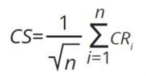
where n is the number of elements assessed for each matrix.
Based on the contamination ratio (CR) or on contamination score (CS), the elements are assessed. In line with the results of assessments, the stations/areas can be classified into non problem area (NPA) and problem area (PA), by applying 5 categories: NPAhigh (CR or CS=0.0-0.5), NPAgood (CR or CS =0.5-1.0), PAmoderate (CR or CS =1.0- 5.0), PApoor (CR or CS =5.0-10.0) and PAbad (CR or CS > 10.0). NPA areas are considered in GES while PA areas are considered as non-GES. The boundary limit of 1 between GES and non-GES is based on the choice that only values that are equal or below the threshold are considered in GES.
Both methodologies i.e. the NEAT and CHASE+ need to define decision rules to determine the quality status. One decision rule used is the “One out all out approach” (OOAO) that says that if one element of the assessment is not in good status, the whole area is described as not in GES. This decision rule is very stringent. An additional approach is based on setting a limit, such as a proportion (%) of elements, that should each be in GES for the area to be classified as in GES. Within the present work it was recommended that if at least 75% of the elements are in GES, the station should be considered in GES. The same recommendation was given when assessing certain areas or the whole Sub-region or Sub-division i.e., when 75% of the stations are in GES for a certain parameter, the whole Sub- region is in GES for this particular parameter and not the overall status of the Sub-region or Sub-division. This more lenient approach for the GES-non GES decision rule compensates for stricter thresholds applied within the CHASE+ methodology. This approach was discussed and approved by the Meeting of CorMon Pollution Monitoring, 2022, and therefore it is also applied in the 2023 MED QSR assessments.
NEAT is a structured, hierarchical tool for making marine status assessments (Berg et al., 2017; Borja et al., 2016), and freely available at www.devotes-project.eu/neat. The use of NEAT is not limited to the assessment of biodiversity but can be used for assessment of pollution impact. The analysis provides an overall assessment for each case study area and a separate assessment for each of the ecosystem components included in the assessment. The final value has an associated uncertainty value, which is the probability of being determinative in a certain class status (GES – nonGES) (Uusitalo et al., 2016). Essentially, the final assessment value is calculated as a weighted average. The weighting factors are based on the respective surface of the areas and are combined with the respective monitoring data for the indicator/chemical contaminant in question. The total weight of a SAU is not the simple ratio of each SAU area to the total area of the parent SAU. The process of distributing the weight is more complex. SAU weighting by the NEAT tool has two options: i) do not weight by SAU area: weights are calculated based just on the nesting hierarchy of the SAUs; ii) weight by SAU area: weights are calculated based on the nesting hierarchy and the SAU surface For the present assessment the option ii) was followed.
The IMAP NEAT GES assessment methodology was tested, and thereafter applied, first to the assessment of contaminants (CI 17), and then to chla (CI 13) and nutrients (CI 14) in the Adriatic Sea Sub-region. The first step in implementing the nested approach was the delimitation of the areas of assessment within the Adriatic Sea Sub-region and later on within the Western Mediterranean Sub-region based on the areas of monitoring defined by concerned Contracting Parties, along with the harmonization of the scales approach between the Contracting Parties (CPs) i.e., scaling up the marine assessment to sub-regional and regional scales within the integration process as required under IMAP. The definition of the areas of assessment is undertaken as indicated in IMAP by applying relevant criteria, e.g. representativeness/importance of the areas of monitoring for establishing areas of assessment; presence of impacts of pressures in monitoring areas; sufficiency of quality assured data for establishing the areas of assessment covering as many as possible IMAP Common Indicators to the extent possible, and ensuring that adequate consideration is given to the risk based principle (both in pristine areas and areas under pressure). The existing monitoring and assessment areas defined by the concerned CPs were used, in case they were compatible with IMAP requirements; in case inconsistency appeared, the necessary adjustments were undertaken.
The IMAP Spatial Assessment Units (SAUs) were defined in the 3 steps approach per each of the Adriatic countries separately; afterward, their nesting within three sub-divisions of the Adriatic Sea sub-region was undertaken i.e., in the North, Central and South Adriatic. Following the methodology applied in the Adriatic Sea Sub-region, the same approach was applied to the Western Mediterranean Sub-region. For the step of nesting, the areas of assessment were first classified under the 3 sub-divisions of the Western Mediterranean Sea (i.e. ALBS, CWMS, TYRS). Relevant geographical information in the form of GIS-based layers were coupled, along with application of the rules of integration and aggregation.
In order to assess the uncertainty in the final assessment value, the standard error/ standard deviation of every observed indicator value is used (Borja et al., 2016). Therefore, the standard deviation values as obtained from the monitoring data play a major role in the uncertainty associated with the final assessment result. This emphasizes the importance of the standard deviation for the accuracy and evaluation of the final assessment result. The NEAT approach ensures that a balance is achieved between a too broad scale, that can mask significant areas of impact in certain parts of a region or subregion, and a very fine scale that could lead to very complicated assessment processes.

The Aegean Sea (AEGS) Sub-division
420. For each measured parameter at each station a contamination ratio (CR) was calculated. Thresholds were the updated sub-regional AEL_BACs (Table 1.4.1.2.a). CHASE+ methodology in the AEGS was provided without spatial integration and aggregation of the areas of assessment and assessment results. Instead, aggregation was possible only for TM in sediments, and only partially. A contamination score (CS) aggregating 2-3 metals was further calculated. Table 3.1.4.1.3.a. summarizes the results of the CHASE+ application.
Table 3.1.4.1.3.a. Number of data points and their percentage from the total number of data points in each category based on the CHASE+ tool, calculated using the new AEL_BACs..

The Levantine Sea Sub-division (LEVS)
444. For each measured parameter at each station a contamination ratio (CR) was calculated. Thresholds were the updated sub-regional AEL_BACs (Table 3.1.4.1.2.b.). CHASE+ methodology in the LEVS was provided without spatial integration and aggregation of the areas of assessment and assessment results. Instead, aggregation was possible only for TM in sediments and in barbatus. A contamination score (CS) aggregating 2-3 metals was further calculated. Table 3.1.4.1.3.b. summarizes the results of the CHASE+ application.
Table 3.1.4.1.3.b. Number of data points and their percentage from the total number of data points in each category based on the CHASE+ tool, calculated using the new AEL_BACs.

The Central Mediterranean (CEN) Sub-region
478. For each measured parameter at each station a contamination ratio (CR) was calculated. Thresholds were the MED_BACs as explained CHASE+ assessment methodology in the CEN was provided without spatial integration and aggregation of the areas of assessment and assessment results. Instead, aggregation was possible only for TM in sediments, and only partially. A contamination score (CS) aggregating 2-3 metals was further calculated. Table 3.1.4.2.3 summarizes the results of the CHASE+ application, while detailed calculation of the assessment results is presented in Figures CEN 3.1.4.2.1.C. – CEN 3.1.4.2.3.C.
Table 3.1.4.2.3. Number of data points and their percentage from the total number of data points in each category based on the CHASE+ tool, calculated using the proposed new MED_BACs.

The Adriatic Sea Sub-region (ADR)
517. The results obtained from the NEAT tool are shown below in Tables 1.4.3.4.a and 3.1.4.3.4.b. Table 3.1.4.3.4.a provides detailed assessment results on the EO9/CI 17 level per contaminant and also spatially integrated within the nested scheme at i) the IMAP national SAUs & subSAUs, as the finest level; ii) the IMAP coastal and offshore assessment zones of sub-divisions (NAS Coastal, NAS Offshore, CAS Coastal, CAS Offshore, SAS Coastal, SAS Offshore); iii) the sub-division level (NAS, CAS, SAS) and iv) the sub-regional level (Adriatic Sea).
518. At the same time aggregation of all contaminants data is done in order to obtain one chemical status value (NEAT value) for all the levels of the nesting scheme. In other words data matrix in Table 3.1.4.3.4.b. shows the results per contaminant per habitat per SAU in the finest level which are i) integrated along the nesting scheme (in columns A – I bold lines); and ii) are aggregated for all contaminants and habitats per SAU (in rows) leading to one NEAT value per SAU (column EO9). The latter is further integrated along the nesting scheme (column EO9 bold lines).
519. The NEAT tool has the possibility also to provide assessment results by aggregating data per habitat in this case sediments and biota (mussels) and then spatially integrated within the nested scheme.
520. The final integrated result per SAU (NEAT value) is the same for the two ways of assessment (i.e. per contaminants (Table 3.1.4.3.4.a) or per habitats (Table 3.1.4.3.4.b) as expected.
521. The detailed status assessment results per contaminant per SAU at the 1st level of assessment (no aggregation or integration) show that in most cases GES conditions are achieved (High, Good status) i.e., for 80% of SAUs, which are indicated by the blue and green cells in Table 3.1.4.3.4.a; 9% are classified under the moderate status, 6% under the poor and 5% under the bad. For the sediment matrix, the highest contamination is observed from PCBs, PAHs and Hg resulting in non-GES status for 60%, 57% and 27 % of sub-SAUs respectively. For the mussels matrix, the highest contamination is observed from PCBs which results in 39% of sub-SAUs in non-GES status. In the NAS, 19% of sub-SAUs are classified as non-GES, in the CAS 12% are classified as non-GES, while in the SAS 22 % are classified as non-GEs. The most affected sub-SAUs in the NAS are HRO-0313-BAZ, HRO-0412-PULP and HRO- 0423-RILP in Croatia; Emiglia-Romana’, ‘Fruili-Venezia-Giulia-1’ and ‘Veneto-1’ in Italy. Also, offshore SAUs IT-NAS-O and MAD-Sl-MRU-12. In the CAS, most affected sub-SAUs are HRO-0313- KASP, HRO-0313-KZ, HRO-0423-KOR in Croatia. In the SAS, affected sub-SAUs are HRO-0313-ZUC and HRO-0423-MOP in Croatia; and MNE-1-N, MNE-1-C, MNE-1-S, MNE-Kotor in Montenegro which are found in moderate conditions due to impacts of several contaminants. Regarding the status of subSAU MNE-1-C, the present assessment does not match the good environmental status corresponding to the status of Marine Protected Area Katic located in this assessment unit, due to non-harmonized data reporting among the countries, and consequent non-harmonized use of data from different types of monitoring stations including hot spot stations, along with non-optimally harmonized size of spatial assessment units among the countries which resulted in inaccurately downgraded status of the small MNE-1-C assessment unit from good to moderate class.

Figure ADR 3.1.4.3.6.C: The NEAT assessment results for IMAP CI17 in the Adriatic Sea sub-region. Aggregation of all contaminants per sub-SAU. Blank area corresponds to no available data/decision or not established monitoring.
The Western Mediterranean Sea (WMS) Sub-region
554. The assessment was conducted in the Alboran Sea subdivision (ALBS) for Cd, Hg, Pb in sediments and biota and in the TYRS for Cd, Hg, Pb, Σ16PAHs and Σ7PCBs in sediments. The simplified application of the NEAT tool (1st level nesting) was applied for the IMAP SAUs of the CWMS for which data on contaminants exist (Cd, Hg, Pb, Σ16PAHs and Σ7PCBs in sediments and biota).
555. The results obtained from the NEAT tool using the (xBAC) threshold for the ALBS are shown below in Table 3.1.4.4.4.
556. The detailed status assessment results per contaminant show that most SAUs achieve GES conditions (high, good status) indicated by the blue and green cells. Exceptions to this are moderate classifications for SAUs MO-East-C and ALBS-ES-C for Pb in sediments, MO-Gib2-C for Cd in sediments, and SAU ALBS-ES-C for Hg in mussels.
557. The results obtained from the NEAT tool using the (xBAC) thresholds for the Tyrrhenian Sea subdivision (TYRS) are shown below in Table 3.1.4.4.5.
558. Detailed assessment results for the TYRS subdivision show that SAUs IT-TYR-1-C, IT- TYR-3-C and IT-TYR-4-C fall into moderate status regarding Cd in sediments; regarding Hg in sediments SAUs IT-TYR-1-C and IT-TYR-3-C fall into moderate and poor statuses respectively. Finally, SAU IT-TYR-4-C is classified as moderate regarding Σ7PCBs.
559. The results obtained from the simplified application of NEAT for the coastal sub-SAUs with data in the CWMS are shown below in Table 3.1.4.4.6, and Figure WMS 3.1.4.4.6.C. Detailed assessments per contaminant per SAU indicate non-GES status for several cases. In sediments, SAU ES-CWM-LEV1-C is classified under moderate status for Pb and SAU FR-CWM_E2-C under poor for Hg. The Italian SAU IT-CWM-C is classified under moderate for Cd and under poor status for Σ16PAHs and Σ7 Monitoring data for mussels show that SAU FR-CWM-E2-C is classified under moderate status for Hg and Pb and under poor for Σ16PAHs; SAUs FR-CWM-C-C and FR- CWM-W-C are classified under poor and moderate status respectively regarding Σ16PAHs.

Table 3.1.4.4.4. Status assessment results of the NEAT tool applied on the 2 levels nesting scheme in the Alboran Sea Sub-division, using the xBAC as GES-nGES threshold for the assessment of EO9/CI17. The 2nd level of spatial integration (nesting) on the coastal zone is marked in bold. Blank cells denote absence of data. The % confidence is based on the sensitivity analysis.

Table 3.1.4.4.5. Status assessment results of the NEAT tool applied on the 2 levels nesting scheme in the Tyrrhenian Sea Sub-division, using the xBAC as GES-non GES threshold for the assessment of EO9/CI17. The 2nd level of spatial integration (nesting) on the coastal zone is marked in bold. Blank cells denote absence of data. The % confidence is based on the sensitivity analysis.

Table 3.1.4.4.6. Status assessment results of the NEAT tool applied on the 1st level IMAP subSAUs in the Central part of the Western Mediterranean Sea Sub-division, using the xBAC as GES-non GES threshold for the assessment of EO9/CI17. Blank cells denote absence of data. The % confidence is based on the sensitivity analysis.
560. The aggregation of the chemical parameters data per SAU leads to the NEAT value per SAU which represents the overall chemical status of the SAUs for the ALBS, as shown in Table 3.1.4.4.4. (4th column). It is clear that all SAUs achieve High or Good status and can be considered in GES regarding trace metals. Similarly, the aggregation-integration within the nested scheme for the coastal zone of the Alboran subdivision (ALBS-C), results in Good GES status regarding trace metals (shown in bold in Table 3.1.4.4.4).
561. The integration of SAUs data per chemical parameter (Table 3.1.4.4.4., 1st line in bold), shows that the coastal zone of the Alboran Sea (ALBS-C) achieves High or Good status regarding trace metals with the exception of Hg in mussels for which it is classified under Moderate The aggregation-integration of data for the coastal zone of the Alboran sub-division (ALBS-C) results in Good GES status regarding trace metals.
562. The results of the assessment findings for the Alboran Sea provided per contaminants of EO9/CI 17 without aggregation per habitat, i.e. sediment and biota, as presented in Table 3.1.4.4.4. Also, the final GES assessment findings for the coastal IMAP SAUs in the Alboran Sea, as provided in Table 1.4.4.4.are shown by the respective color in the map included in the following Figure WMS 3.1.4.4.3.C. The map depicts the integrated NEAT value for each SAU (i.e. aggregated value for all contaminants assessed as provided in the 4th column of Table 3.1.4.4.4).
563. The overall status for the coastal assessment zone of the Alboran Sea is Assessment is integrated for metals in sediments and biota.

Figure WMS 3.1.4.4.3.C: The NEAT assessment results for trace metals TM in sediments and biota in the coastal assessment zone of the Alboran Sea. Assessment conducted using the xBAC GES-non GES threshold. All IMAP SAUs are in GES characterized by High or Good status. Shaded area corresponds to no available data for the assessment. An absence of some SAUs assessment might also be related to the decision of the countries to monitor areas that are found relevant for the assessment of contaminants and therefore excluding the areas where problems were not historically observed.
564. The aggregation of the chemical parameters data per SAU leads to the NEAT value per SAU which represents the overall chemical status of the SAUs in the TYRS as shown in Table 1.4.4.5 (4th column). . All SAUs achieve High or Good status and are in GES regarding contaminants assessed. Similarly, the aggregation-integration within the nested scheme for the coastal zone of the Tyrrhenian subdivision (TYRS-C) however, results in Good GES status regarding contaminants assessed (shown in bold in Table 3.1.4.4.5.).
565. The integration of SAUs data per chemical parameter (Table 3.1.4.4.5., 1st line in bold), shows that the coastal zone of the Tyrrhenian Sea (TYRS-C) achieves High or Good status regarding chemical contaminants assessed. Similarly, the aggregation-integration within the nested scheme for the coastal zone of the Tyrrhenian subdivision (TYRS-C) as a whole indicates it can be considered in Good GES status regarding chemical contaminants assessed (shown in bold in Table 3.1.4.4.5.).
566. The final GES assessment findings per contaminants for sediments in the coastal IMAP SAUs in the Tyrrhenian Sea, as provided in Table 1.4.4.5., are shown by the respective color in the map included in Figure WMS 3.1.4.4.4.C. The map depicts the integrated NEAT value for each SAU (i.e. aggregated value for all contaminants assessed as provided in the 4th column of Table 3.1.4.4.5).
567. The overall status for the coastal assessment zone of the Tyrrhenian Sea is Good regarding contaminants assessed. Assessment is integrated for metals, Σ16PAHs and Σ7PCBs in sediments.
568. The aggregation of the chemical parameters data per SAU in the CWMS leads to the NEAT value per SAU which represents the overall chemical status of the SAUs, as shown in Table 1.4.4.6. (4th column) and Figure WMS 3.1.4.4.5.C for the CWMS. All SAUs achieve High or Good status and are in GES with the exception of SAU IT-CWM-C where only sediments are monitored, and the overall status for this SAU is moderate regarding contaminants assessed.
569. Based on the availability of data for contaminants as delivered by the CPs in the Western Mediterranean Sea Sub-region, the present integrated assessment status results produced by applying the NEAT tool on the sub-divisions ALBS and TYRS (shown in Tables 3.1.4.4.4. and 1.4.4.5; ) can only be considered as an example of how the tool works. This is related to the fact that offshore SAUs lack of data, hence integration is meaningful only up to the 2nd level, i.e. the coastal assessment zone (ALBS-coastal and TYRS-coastal) 102. Furthermore, several coastal SAUs lack data or the countries eventually decided not to monitor the areas that are found irrelevant for the assessment of contaminants and therefore excluded the areas where problems were not historically observed (blank cells in Tables 3.1.4.4.4., 3.1.4.4.5 and 3.1.4.4.6).
102
102 Given lack of data for some SAUs, integration at a higher level that also includes these SAUs makes the uncertainty high.

Figure WMS 3.1.4.4.4.C: The NEAT assessment results for trace metals TM, Σ16PAHs and Σ7PCBs in sediments in the coastal assessment zone of the Tyrrhenian Sea. Assessment conducted using the xBAC GES-non GES threshold. All IMAP SAUs are in GES characterized by High or Good status. Shaded area corresponds to no available data for the assessment. An absence of some SAUs assessment might also be related to the decision of the countries to monitor areas that are found relevant for the assessment of contaminants and therefore excluding the areas where problems were not historically observed.

Figure WMS 3.1.4.4.5.C. The NEAT assessment results for trace metals TM, Σ16PAHs and Σ7PCBs in sediments and mussels in the SAUs of France and Spain and in sediments in the SAU of Italy in the CWMS. Assessment conducted using the xBAC GES-nGES threshold. All IMAP SAUs are in GES characterized by High or Good status except sediments assessment in IT-CWM-C which shows moderate status. Shaded area corresponds to no available data for the assessment. An absence of some SAUs assessment might also be related to the decision of the countries to monitor areas that are found relevant for the assessment of contaminants and therefore excluding the areas where problems were not historically observed.
Assessment of IMAP Common Indicator 19 (Ecological Objective 9)
Table: Assessment of IMAP Common Indicator 19 (Ecological Objective 9)
|
Geographical scale of the assessment |
Sub-regions within the Mediterranean region based on integration of the assessments at Sub-divisions level |
|
Contributing countries |
Data from MEDGIS-MAR, Lloyd List Intelligence Seasearcher, CleanSeaNet Service |
|
Mid-Term Strategy (MTS) Core Theme |
1-Land and Sea Based Pollution |
|
Ecological Objective |
EO9. Contaminants cause no significant impact on coastal and marine ecosystems and human health |
|
IMAP Common Indicator |
CI19. Common Indicator 19: Occurrence, origin (where possible), extent of acute pollution events (e.g. slicks from oil, oil products and hazardous substances), and their impact on biota affected by this pollution |
|
GES Definition (REMPEC/WG.51/9/1) |
Occurrence of acute pollution events are reduced to the minimum. |
|
GES Targets (REMPEC/WG.51/9/1) |
1. Decreasing trend in the occurrence of acute pollution events |
|
GES Operational Objective (REMPEC/WG.51/9/1) |
Acute pollution events are prevented, and their impacts are minimized |
The assessment for CI 19 in the period 2018-2021 jointly considers: (1) the information on the frequency of spill occurrence i.e., yearly average number of spills/10000 km2 and yearly average extension of areas interested by pollution/10000 km2, and (2) the information on the trend of such frequency i.e., increasing, decreasing, stable with no spill, represented by the variation in % in comparison with the previous assessment period (2013-2017). This element (variation of spill density) is based on a CHASE-like approach and capitalizes some elements of the methodology adopted by HELCOM for the assessment of oil spill in the Baltic Sea (HELCOM 2018). The spatial component of the analysis was detailed: the 2023 MED considers the sub-regions and the relative sub-divisions identified in the Mediterranean Sea.
For each of three datasets, the assessment was based on the following steps:
- Quantification of the average number of oil spills per year in the period 2018-2021 for the entire Mediterranean Sea and its sub-divisions.
- The average number of oil spills was standardised on the extension of each sub-division, thus enabling to calculate the average number of spills per 10000 km2 in the assessment period for the entire Mediterranean and its sub-divisions.
- The three sub-divisions characterised by higher values of the indicator calculated in step 2 were highlighted in dark red/red/orange to remark the three highest oil spill occurrences.
- Percentage of variation (2018-2021 2013-2017) of average yearly spill occurrence was then calculated for the entire Mediterranean and for each sub-division.
- Based on the computed percentage variation, the following colour-based classes were defined for variation in percentage: blue = no spills recorded in the sub-division, in the period of assessment (2018-2021) nor in the previous reference period (2013-2017); green = decreased frequency of spill occurrence in the sub-division; yellow = increased frequency of spill occurrence ≤ 100% in the sub- division; red = increased frequency of spill occurrence > 100% in the sub-division.
In the case of CleanSeaNet dataset, the same assessment above described was implemented also for the extension of areas interested by pollution due to oil spills, still comparing 2018-2021 with the previous 2015- 2017 period. MEDGIS-MAR enabled to implement the same assessment also on the number of spills of substances other than oil: Hazardous and Noxious Substances (HNS), other substances (non-HNS) and Unknown substances.
This integrated assessment of the evidences from the three data sets was based on the following three criteria:
- Occurrence of spills reported through MEDGIS-MAR and Lloyds, which are mainly linked to relatively large pollution events and to Occurrence of reported events is considered as a “negative” factor in the overall assessment of the quality status of a given sub-division, while the absence of reported events is considered as “positive”. As additional element to the sub-divisions ranked among the first three for frequency of occurrence of spills, an additional “negative” factor was considered.
- CleanSeaNet data are used as an indicator of relatively smaller spills, related to minor incidents or illicit discharges. This second criterion has been weighted less than the previous one, to take into consideration the possibility of overestimation of the number and extension of spills reported in this dataset. Thus, a negative contribution to the overall status was considered for the sub-divisions ranking among the first three in terms of average extension of areas affected by oil pollution.
- The temporal variation of the average number of spills (for all the three datasets) and their extension (for CleanSeaNet) between the assessment period (2018-2021) and the previous reference period (2013-2017 for MEDGIS-MAR and Lloyds; 2015-2017 for CleanSeaNet) was considered. An increasing trend was considered as negative for the overall assessment of the quality status, while a decreasing trend provided a positive indication.
630. The assessments of the ten subdivisions (Table 1.6.1) have been aggregated (Figure MED 3.1.6.2.), in order to obtain the assessment for the four Sub-regions of the Mediterranean Sea. This resulted in the following integrated assessment findings:
-
- the (Entire) Western Mediterranean Sea (WMS) Sub-region, is assigned to “Moderate”, because this category prevails in its sub-divisions (WMS and TYRS), while the “Poor” status value characterises only the Alboran Sea (ALBS);
- “Moderate” has been assigned to the Adriatic Sea (ADR) Sub-region, considering the prevalence of this category in its sub-divisions (MADR and SADR).
- “Moderate” has been assigned to the (Entire) Central Mediterranean Sea (CEN) Sub-region, by qualitative averaging of the poor status of the Ionian Sea (IONS) and the good status of the Central Mediterranean (CEN);
- In the case of the Aegean and Levantine Seas (AEL) Sub-region, the qualitative average evaluation led to d a” poor” status for this Sub-region.

Figure MED 3.1.6.2. Map of the integrated assessment of the marine environment status for CI 19 in the four Sub-regions of the Mediterranean Sea
Assessment of IMAP Common Indicators 18, 20 and 21 (Ecological Objective 9)
Due to absence of any data reporting by the CPs, data for present assessment were retrieved from the scientific literature. The studies surveyed do not include the parameters assessed in the 2017 MED QSR in mussel. The only exception is Morroni et al., 2020 that measured LMS, AChE and MN in M. galloprovincialis but not in the same organs except for MN that was measured in haemocytes with a value of 0.3 permil in reference area and a maximal value of 1.3 permil. The maximal value is slightly higher than 1 permil, the MED BAC adopted in Decision IG.23/6. Ghribi et al., 2020 and Uluturhan et al, 2019 reported AChE in haemolymph and hepatopancreas, respectively and not in gills.
Given the complete lack of data reported for CI 20, the environmental assessment of CI 20 was performed, by using the following two approaches: i) assessment of the status based on data reported to IMAP-IS for CI 17 contaminants in biota up to 31st, October 2022, the cutoff date for data reporting to be used in the 2023 MED QSR, using the EU concentration limits for regulated contaminants, and ii) assessment of present status based on bibliographic studies, following the same approach applied for preparation of the 2017 MED QSR, however by using newer available scientific literature.
he IMAP Guidance fact sheet for CI 21 provides the methodology for assessment of this indicator, This methodology is also aligned with Directive 2006/7/EC.
The methodology used in the EEA 2020 assessment of the state of bathing water quality was as defined in the EU 2006/7 Directive and in IMAP decision IG.20/9, i.e. the classification of the bathing waters was provided according to the 90th or 95th percentile of the log10 normal probability density function of microbiological data. The number of data points for each location was at least 16, over 4 bathing seasons123, at least 4 for each bathing season.
It should be mentioned that the EU 2006/7 Directive defines two indicators: Intestinal enterococci (IE) (cfu/100 ml) and Escherichia coli (E. coli) (cfu/100 ml). Therefore, the classification of the bathing waters is based on the combination of both microbiological parameters, classifying the stations based on the worse status between the two criteria124. For example, if status for IE is excellent but for E. coli the status is poor, the station is classified as poor.
The same methodology used in the EEA 2020 of the state of bathing water quality was applied to data set reported by Montenegro, Morocco and Lebanon, using just intestinal enterococci as indicator.
This methodology could not be applied to data from Bosnia and Herzegovina and Israel because 16 data points for 4 consecutive bathing seasons were not available. Therefore, for these 2 CPs, the classification was based on the geometric mean calculated for each location. The geometric mean was chosen because it reduces the effect of outliers on the mean and is not influenced by skewed distribution as the arithmetic mean.
Comparison between the methodology used by the EEA and the methodology used in present document for the assessment of Bathing waters quality (CI 21)
|
Assessment methodology |
EEA |
Present assessment of IMAP CI 21* |
|
Assessment Category |
Based on Intestinal enterococci and Escherichia coli (cfu/100 mL) |
Based on Intestinal enterococci (cfu/100 mL) |
|
Number of data points |
At least 16 |
Less than 16, depending on the CP* |
|
Number of monitoring years |
4 |
Less than 4, depending on the CP* |
|
Classification of station |
percentile evaluation of the log10 normal probability density function |
Geometric mean |
*Bosnia and Herzegovina and Israel. Lebanon, Montenegro and Morocco were classified using the same methodology as the EEA, based on 16 data points over 4 consecutive bathing seasons, but related to Intestinal enterococci values, only and by applying percentile evaluation of the log10 normal probability density function.
Assessment of IMAP Common Indicator 18: Level of pollution effects of key contaminants where a cause and effect relationship has been established
Table: Assessment of IMAP Common Indicator 18 (Ecological Objective 9)
| Geographical scale of the assessment | The Sub-regions within the Mediterranean region by using scientific literature sources |
| Contributing countries | Countries in alphabetical order: Algeria, Egypt, Italy, Spain, Tunisia, Türkiye based on scientific literature sources |
| Mid-Term Strategy (MTS) Core Theme | Enabling Programme 6: Towards Monitoring, Assessment, Knowledge and Vision of the Mediterranean Sea and Coast for Informed Decision-Making |
| Ecological Objective | EO9. Contaminants cause no significant impact on coastal and marine ecosystems and human health |
| IMAP Common Indicator | CI18. Level of pollution effects of key contaminants where a cause and effect relationship has been established |
| GES Definition (UNEP/MED WG473/7) (2019) | Concentrations of contaminants are not giving rise to acute pollution events |
| GES Targets (UNEP/MED WG473/7) (2019) |
· Contaminants effects below threshold · Decreasing trend in the operational releases of oil and other contaminants from coastal, maritime and off-shore activities. |
| GES Operational Objective (UNEP/MED WG473/7) (2019) | Effects of released contaminants are minimized. |
570. The list of bibliographic studies on biomarkers used for the preparation of the 2023 MED QSR is sorted alphabetically by country as shown in Table 3.1.5.1.
571. Based on the literature search results it can be concluded that a comparison among the studies is hard or mostly impossible. This is due to the use of different biomarkers, with different biota species, using different tissues, and different methodologies. Moreover, as found in the 2017 QSR, there are confounding factors that hinders environmental status assessment such as species, gender, maturation status, season and temperature. In addition, an inherent bias exists in publications towards studies showing an Authors and journals do not usually publish studies showing lack of effect or response. Italy submitted national data for CI 18 following the Meeting of CorMon Pollution that took place in Athens, 1-2 March 2023103.
103
103 Data included biomarkers (Acetylcholinesterase activity, Lysosomal membrane stability on cryostat sections, Micronuclei frequency, Metallothioneins, EROD-microsomal, EROD-S9, Fulton’s Condition Factor, Gonadosomatic Index and Hepatosomatic Index) were measured in the fish M. barbatus sampled in 2019 and 2020. Data were not uploaded in the IMAP- Info System because they were found not compliant given the lack of data related to the ‘maturation key’ and of the ’tissue weight’, which are considered mandatory. The national data could not be integrated into the CI 18 assessment as the 2023 MED QSR for CI18 was based on the use of regional scientific literature sources, using the evaluation provided by the authors. The newly submitted data of Italy were all for M. barbatus, for which no criteria were adopted yet, by the CPs. The assessment criteria for the biological effects on M. barbatus might be set in the future conditional to optimal data reporting by the CPs.
Moreover, no conclusions were also set in the scientific literature.
Table 3.1.5.1: Studies on biomarkers in the Mediterranean Sea since 2016 reviewed in present assessment of CI 18. The list is sorted alphabetically by country.
|
Reference |
Country |
Sub- region | Sampli ng year |
Taxa |
Species |
Organ/tissue |
Stressor |
Biomarker |
| Kaddour et al. 2021 | Algeria | WMS |
2019- 2020 |
Fish | Mullus barbatus | blood | non specific | MN, NRRT |
| Amamra et al. 2019 |
Algeria |
WMS |
2016 |
mollusc |
Donax trunculus | gonad, mantle, digestive gland |
non specific |
AChE, GST, MDA |
| Benaissa et al. 2020 | Algeria | WMS | 2016 | mollusc | Patella rustica | Soft tissue | desalination brine |
AChE, CAT, SOD, GR, GPx, GST, LPO, Genotox |
| Laouati et al. 2021 | Algeria | WMS | 2017 | mollusc | Perna perna | digestive gland and gills | non specific, TM | AChE, CAT, GSH, GST, MDA |
|
Gabr et al. 2020 |
Egypt | AEL |
2018- 2019 |
mollusc | Ruditapes decussatus | soft tissue | TM | AChE, SOD, GPx, MDA |
| Salvaggio et al. 2019 |
Italy |
FAO Area 37 |
not reporte d |
Fish |
Lepidopus caudatus |
liver, gonads |
Microplastic , TM |
VTG, MT |
| Frapiccini et al. 2021 | Italy | ADR | 2019 | Fish | Mullus barbatus | muscle | PAH | CAT,SOD,GST,LPO |
| Chenet et al. 2021 | Italy | CEN | 2018 | fish | Trachurus trachurus | liver | plastic | VTG, MT |
| Morroni et al. 2020 | Italy | WMS | 2017 | Fish | Diplodus vulgaris | various | PAH, TM | AChE, MT, MN, LMS, EROD |
| Morroni et al. 2020 | Italy | WMS | 2017 | Fish | Mullus barbatus | various | PAH, TM | AChE, MT, MN, LMS, EROD |
| Morroni et al. 2020 | Italy | WMS | 2017 | Fish | Pagellus erythrinus | various | PAH, TM | AChE, MT, MN, LMS, EROD |
| Parrino et al. 2020 | Italy | WMS |
not reporte d |
Fish | Parablennius Sanguinolentus | Brain and blood | pesticides | AChE, BChE |
| Morroni et al. 2020 |
Italy |
WMS |
2017 |
mollusc |
Mytilus galloprovincial is |
various |
PAH, TM |
AChE, MT, MN, LMS, EROD |
|
Capo et al. 2022 |
Spain |
WMS |
2019 |
Fish |
Sparus aurata |
blood, plasma, liver |
microplastic , plasticizers |
CAT,SOD,GRd,GPx, MPO, GST, MDA, EROD, BFCOD, CE |
| Solomando et al. 2022 | Spain | WMS | 2020 | Fish | S. dumerili | liver | microplastic | CAT,SOD,GST, EROD, MDA |
|
Rios-Fuster et al. 2022 |
Spain |
WMS |
2019 |
mollusc |
Mytilus galloprovincial is |
Soft tissue |
Anthrop. Particles, bisphenols , phthalate |
CAT,SOD,GRd,GPx, GST, TES, GLY, CE, LPO, CARB, GSH |
| Capo et al 2021 |
Spain |
WMS |
not reporte d |
mollusc |
Mytilus galloprovincial is |
gills |
microplastic |
CAT,SOD,GRd,GPx, GST,MDA, ROS |
| Rodríguez- Romeu et al., 2022 |
Spain |
WMS |
2019 |
Fish |
Engraulis encrasicolus | Muscle and liver | Anthopogen ic items ingestion | AChE, LDH, CS, CE, CAT, GST, EROD |
| Mansour et al. 2021 | Tunisia | CEN | 2016 | mollusc | Ruditapes decussatus | Soft tissue | hydrocarbon s | CAT,SOD,GRd,MDA, AChE |
| Reference | Country | Sub- region |
Sampli ng year |
Taxa | Species | Organ/tissue | Stressor | Biomarker |
|
Zaidi et al. 2022 |
Tunisia | CEN | 2018 | mollusc | Patella caerulea | soft tissue | TM | CAT,SOD,GPx,GST,MD A |
|
Ghribi et al. 2020 |
Tunisia |
CEN |
2017 mesoco sm |
mollusc |
Mytillus spp |
hemolymph, gills, and digestive gland |
non specific PAH, TM |
CAT, GPx, GST, AChE |
| Missawi et al. 2020 | Tunisia# | CEN | 2018 | Seaworm | Hediste diversicolor | whole (gut cleaned) | Microplastic | CAT,GST,MDA, AChE |
| Zitouni et al. 2020 | Tunisia* | WMS | 2018 | Fish | Serranus scriba | gastrointestina l tract | Microplastic | CAT,GST,MDA, AChE,MT |
| Telahigue et al. 2022 | Tunisia | WMS |
2020- 2021 |
mollusc | Flexopecten glaber | gills, digestive gland | TM | CAT,SOD,GPx,GSH, MT, MDA |
| Bouhedi et al 2021 |
Tunisia |
WMS |
not reporte d | polychaet e | Perinereis cultrifera |
whole body |
TM |
CAT,GST, AChE, MT, GSH, TBARS |
| Uluturhan et al. 2019 | Türkiye | AEL | 2015 | mollusc |
Mytilus galloprovincial is |
Hepatopancrea s |
TM, Pesticides |
CAT,SOD,GPx, AChE |
| Uluturhan et al. 2019 | Türkiye | AEL | 2015 | mollusc | Tapes decussatus | Hepatopancrea s |
TM, Pesticides |
CAT,SOD,GPx,AChE |
| Dogan et al, 2022 | Türkiye | AEL | 2021 | Fish | Mullus barbatus | muscle, liver | TM | CAT, MDA |
| Dogan et al, 2022 | Türkiye | AEL | 2021 | Fish | Boops boops | muscle, liver | TM | CAT, MDA |
| Dogan et al, 2022 | Türkiye | AEL | 2021 | Fish | Trachurus trachurus | muscle, liver | TM | CAT, MDA |
#data related to the WMS as well; * data related to the CEN as well.
Biomarkers Abbreviations: AChE-Acetylcholinesterase, BChE-Butyrylcholinesterase, BFCOD-7-benzyloxy-4- [trifluoromethyl]-coumarin-O-debenzyloxylase, CAT-Catalase, CE-Carboxylesterase, CS-Citrate synthase,EROD- Ethoxyresorufin-O21 deethylase, ETS-Electron Transport System, GLY-Glycogen, GPx-Glutathione peroxidase, GRd-Glutathione reductase, GSH- Glutathione, GST-Glutathione-S-transferase, LDH-Lactate dehydrogenase, LMS- Lysosomal Membrane Stability, LPO-Lipid peroxidation, MDA-Malondialdehyde, MN-Micronucleus Assay, MT- Metallothionein, NRTT-Neutral red retention time, SOD-Superoxide dismutase, SoS-Stress on Stress,VTG- Vitellogenin
Results of the IMAP Environmental Assessment of CI 18 in the Mediterranean region.
572. Given GES assessment was not possible for CI 18 within the preparation of the 2023 MED QSR, the regional overall assessment findings were provided for the Mediterranean as presented here- below. Instead of providing GES /non-GES classification, the assessment for IMAP CI 18 was based on the determination of biomarkers that were affected by contamination.
573. A summary of reviewed studies is sorted by sub-regions and countries. The biomarkers that were affected by contamination are marked in red, those that were not affected are marked in green, while inconclusive results are marked in blue. Moreover, the biomarkers included in the DDs and DSs are highlighted in yellow, but with no differentiation among species or tissues studied.
a) AEL sub-region (Egypt, Türkiye)
574. One study was reviewed. The effect of TM was studied in the mussel Ruditapes decussatus collected from Alexandrian Port and Port Said (Gabr et al. 2020). The concentrations of metals were higher in samples from the Alexandrian Port (Site I). Malondialdehyde (MDA) and SOD were higher in samples from Site I while GPx, Total protein and AChE were lower. The reported values in this study are considered as basic data to monitor of the anthropogenic influence on the coastal environment.
575. Türkiye. Two studies were reviewed for Türkiye: one from 2015 and one from 2022104. The effect of TM and pesticides was studied on the molluscs Mytilus galloprovincialis and decussatus collected from Homa Lagoon (Aegean Sea). The study showed marked differences on the biomarkers (CAT, SOD, GPx, and AChE) but the differences were mainly attributed to seasonal variations and to differences among the two species (Uluturhan et al. 2019). The effect of TM was also studied in the fish barbatus, B. boops and T. trachurus collected along the coast of Türkiye in the Levantine and the Aegean Seas. Correlations were found between CAT and MDA and some of the trace metals measured in the fish specimens.
104
104 Submitted to Research Square, not peer reviewed by a scientific journal
b) ADR sub-region (Italy)
576. One study reported the effect of PAHs in the fish Mullus barbatus collected in the northern Adriatic (Frapiccini et al. 2020). The expressions of CAT and GST in M. barbatus were dependent on the season, lower in the winter and higher in the summer. SOD expression did not depend on the season. LPO was higher in the winter. CAT showed a significant negative correlation with total PAH concentrations, especially total LMW-PAH, in individuals collected during winter. Both GST and SOD did not show any significant correlation with PAH levels.
c) CEN sub-region (Tunisia, Italy)
577. Seven studies were reviewed for Tunisia: 2 from the WMS, 3 from the CEN and 2 with data from both the WMS and the In the CEN, one mesocosm experiment was performed in Mytilus spp. exposed to sediment contaminated by PAH and TM collected from the Zarzis area (Ghribi et al. 2020), while the effects of hydrocarbons were studied in the mollusc Ruditapes decussatus collected from the southern Lagoon of Tunis (Mansour et al. 2021). The effect of TM on the mollusc Patella caerulea was studied in specimens collected from 4 sites in the CEN (Zaidi et al. 2022).
578. Mytilus spp exposed to contaminated sediments in a mesocosm experiment presented the highest values of the tested oxidative stress biomarkers (CAT, GST, GPx) and a significant inhibition of AChE activity in comparison with the unpolluted reference site.
579. Hydrocarbons were found to affect the biomarkers CAT, GR, SOD, MDA and AChE activities in Ruditapes decussatus.
580. SOD and GPx activities measured in caerulea were different among sites (higher in more affected stations), while CAT was similar on all four stations. MDA was inducted but no differences were found among the sites.
581. Italy. In the CEN, the effect of plastic ingestion was studies in the fish Trachurus trachurus collected for the Sicily straits (Chenet et al. 2021).
582. Vitellogenin was highly expressed in trachurus females as expected, there is also a significant expression of the VTG gene in 60% of the males analyzed, from both sampling sites. Moreover, females in Lampedusa island showed a lower expression of vitellogenin than in Mazara del Vallo (with one female sample, TT54, not expressing VTG at all). The endocrine disruption represented by the alteration of VTG expression in specimens observed in this work can be caused by microplastic ingestion, as well as by the interactions between the marine organisms and the wide variety of endocrine- disrupting chemicals possibly present in seawater.
d) WMS sub-region (Algeria, Spain, Tunisia, Italy)
583. Four studies reviewed for Algeria studied the effects of non-specific stressor in the mollusc Donax trunculus from Annaba Bay (Amamra et al. 2019) , in the fish Mullus barbatus along the Algerian west coast (Kristel, Oran, Ghazaouet) (Kaddour et al. 2021), on the mollusc Perna perna transplanted to the Gulf of Annaba initianorth-eastern coast) (Laouati et al. 2021) and on the mollusc Patella rustica affected by the brine of the Bousfer desalination plant in Oran Bay (Benaissa et al. 2020).
584. Donax trunculus specimens showed a significant inhibition of AChE and induction of GST and MDA in individuals of Sidi Salem and Echatt as compared to El Battah with significant effects of both site and season. The effects were more pronounced during summer and spring compared to the other seasons. In addition, the comparison between tissues revealed a more marked response in gonad than mantle and digestive gland.
585. In barbatus, a significant increase in the frequency of micronuclei (MN) occurrence in the summer period correlated with significantly shorter NRRT. In addition, the erythrocytes of M. barbatus populations from polluted areas presented statistically higher MN frequencies and shorter NRRT than those of the reference site.
586. GSH decreased in the gills and digestive glands of perna specimens transplanted to two of the sites affected by anthropogenic input while GST and CAT activities showed no significant variation. The MDA content in the mussel digestive glands, but not in the gills, increased significantly after the deployment period in the three caging sites, and were significantly different among the 3 sites. AChE activity was significantly inhibited registered in the gills of mussels from the 3 sites and in the digestive glands from one site.
587. A multibiomarker approach (oxidative stress, biotransformation enzyme, lipid peroxidation, neurotoxicity and genotoxicity) were applied in the soft tissue of rustica . This biomonitoring confirmed the negative impact of brine discharges of the desalination plant, with samples collected close to the outfall more affected. by all the environmental disturbances than ones from the other sites. CAT, TGPx, GR, GST, CSP-3like activities were increased in samples from the outfall. AChE was lower however not significantly different from samples collected from the reference site. Genotoxic effect revealed by ADN and lipid damages.
588. Five studies were reviewed for Spain: four studies studied the effect of microplastic ingestion and of plasticizers on the biomarker responses, while one studied the effect of anthropogenic items ingestion. Three studies were conducted in the Integrated Multi-Trophic Aquaculture cages in Palma de Majorca, where specimens of the mussel Mytilus galloprovincialis and of the fish Sparus aurata were transplanted to and analyzed at time 0, after 60 days (T60) and after 120 days (T120) of exposure (Capó et al. 2022, Capo et al. 2021, Rios-Fuster et al. 2022). One study was performed with S. dumerili collected around the Balearic Islands (Solomando et al. 2022). Anthropogenic items ingestion was studied in E. encrasicolus collected off Catalunia (Rodríguez-Romeu et al. 2022).
589. No effects of time were observed in CAT, SOD, and GRd activities galloprovincialis, but they were significantly higher in specimens sampled from the cages than in specimens from the controls. GST activity did not change with time, and it increased significantly only in samples for the cages at T60. In T120 activity was higher in the cages only if compared to one of the control sites. GPx activity was modulated by both sampling site and time: higher activities in specimens from the cages at T120. MDA was higher in samples from the cages compared to the controls at T60. In a different study with M. galloprovincialis higher expressions were observed in the biomarkers CAT, SOD, GPx and LPO in specimens from the aquaculture cages. Those could be triggered by the presence of bisphenol but also by other possible contaminant inputs from the aquaculture.
590. MDA increased throughout the study both in liver and blood cells of aurata but with a progressive decrease in plasma. EROD, BFCOD and CE, showed a comparable decrease at T60 with a slight recovery at T120. In contrast, GST activity was significantly enhanced at T60 compared to the other sampling stages.
591. SOD, CAT, and GST activity were significantly higher in dumerili with higher microplastic (MP) load, while no significant differences were observed for MDA, and EROD enzyme activity.
592. AChE, CAT and GST were lower in encrasicolus collected off Barcelona, compared to specimens collected Blanes and Tarragona; Terragona LDH, CE and EROD were higher in Terragona than in the other two locations; Blanes CS was higher than in Tarragona. These differences could not be correlated with any potential stressors nor with fish size Catalunia (Rodríguez-Romeu et al. 2022).
593. Italy. Five studies were reviewed for Italy: 2 from the WMS, 1 from FAO zone 37 (not further specified), 1 from the CEN, 1 from the ADR . In the WMS, the effect of pesticides were studied in the fish Parablennius sanguinolentus from the port of Bagnara (western Calabria) (Parrino et al. 2020), and the effect of TM and PAHs on mollusc (Mytilus galloprovincialis) and fish (Mullus barbatus, Pagellus erythrinus and Diplodus vulgaris)from the bay of Pozzuoli (Naples)(Morroni et al. 2020). Microplastics and TM effects were studied on the fish Lepidopus caudatus collected from FAO area 37 (area not further specified) (Salvaggio et al. 2019).
594. AChE activity in the brain and BChE activity in blood were significantly inhibited in specimens of sanguinolentus from the affected port area, by 23.5 and 72.0%, respectively. The esterase inhibition was primarily due to carbamate and organophosphorus insecticides presence.
595. In the Bay of Pozzuoli, the effect of pollution varied by species and biomarkers. In galloprovincialis, there was a decreased LMS and increased MN at two sites compared to organisms from other areas while no variations were observed for the AChE in haemolymph, nor for MT in digestive gland of mussels from various sites. AChE activity was not affected in M. barbatus sampled in the industrial area while a decrease of this biomarker AChE was observed in P. erythrinus and D. vulgaris. The EROD enzymatic activity was significantly induced in M. barbatus and P. erythrinus sampled in the industrial area compared to specimens from the reference site, while the cytochrome P450 biotransformation pathway was unaffected in D. vulgaris. At the same time, all the fish species exhibited higher levels of aromatic metabolites, particularly B[a]P-like and pyrene-like, in organisms sampled in the industrial compared to reference area. MN increased in gills of M. barbatus from the industrial area.
596. Immunohistochemical analysis for anti-metallothionein 1 antibody in caudatus showed a strong positivity of liver cells, both in females and males, showing a strong stress that activated a cell detoxification system. The immunohistochemical analysis for the anti-vitellogenin antibody showed in females a strong positivity both in the liver cells, and in the gonads, as expected. The analysis of the liver and gonadal preparations of the male specimens was found to be always negative except for one specimen.
597. Seven studies were reviewed for Tunisia: 2 from the WMS, 3 from the CEN and 2 with data from both the WMS and the CEN. In the WMS, the effect of TM was studied in the mollusc Flexopecten glaber collected from the Bizerte Lagoon (Telahigue et al. 2022) and on the polychaete Perinereis cultrifera collected from the port of Tades and the Punic port of Carthage (Bouhedi et al. 2021). The following 2 studies have data from the two sub-regions: WMS and CEN. The effect of microplastic ingestion was studied in the fish Serranus scriba collected from 6 sites along the Tunisian coast (Zitouni et al. 2020) and on the seaworm Hediste diversicolor collected from 8 sites along the Tunisian coast (Missawi et al. 2020).
598. The distribution of most analyzed metals in glaber tissues varied significantly between sites, seasons, and organs. The highest levels were recorded at the polluted site during the warm period. Moreover, the digestive gland was found to accumulate greater concentrations of TM than the gills. The biomarkers (MDA, GSH, GPx, SOD, CAT) in gills were higher in the polluted site while MT was not affected. In the digestive gland, only CAT and MDA showed an increase activity in the polluted site.
599. Higher level of thiobarbituric acid were found in cultrifera specimens from polluted site. In addition, CAT, GST, SOD, glutathione and MT were enhanced and AChE activities decreased in specimens from the contaminated site compared to those from the reference (or less contaminated site).
600. Biomarkers of oxidative stress (MT, CAT, GST, MDA) and neurotoxicity (AChE) responses in scriba were dependent on site and on the size of the microplastic. High content of microplastic in the gastrointestinal track increased MT levels and GST activity. CAT activity and MDA accumulation were positively related with the medium size class MP A significant negative correlation was found between AChE activity and the small size class of microplastic (MP). The study could not rule out some influence of other pollutants that may be present in some of the sites on biomarker response.
601. In the seaworm Hediste diversicolor, responses increased with increased microplastic tissue concentration, in particular CAT but also MDA. A decrease of GST activity was reported in the same sites. AChE was significantly inhibited indicating neurotoxicity.
602. Figures 3.1.5.1 and 3.1.5.2 depict the sampling areas. Figure 3.1.5.1 shows the whole Mediterranean Sea, while Figure 1.5.2 shows in detail the study areas off eastern Algeria and Tunisia, where many of the reviewed studies were performed.

Figure 3.1.5.1. Areas of study for biomarkers, reviewed in the recent (since 2016) scientific literature for the Mediterranean Sea. When no coordinates were presented in the papers, the general area was marked in the map.

Figure 3.1.5.2. Detailed map of the study areas for biomarkers reviewed in the recent (since 2016) scientific literature for eastern Algeria and Tunisia coasts. Many stations were occupied in this area of the Mediterranean Sea.
603. Further to the above results based on a review of the studies by sub-regions and countries, it can be concluded that twenty-four studies were retrieved from the scientific literature as follows: 4 studies from Algeria (WMS), 1 from Egypt (AEL), 5 from Italy (2 from WMS, 1 from ADR, 1 from CEN and one from FAO zone 37), 5 from Spain (WMS), 7 from Tunisia (2 from WMS, 2 from CEN and 3 with data from both the WMS and CEN), and 2 from Türkiye (AEL).
604. The sub-region most represented is the WMS, followed by the In the CEN all studies except one were performed in Tunisia. There was one study from the ADR and three in the AEL.
605. The monitoring species, M. galloprovincialis and M. barbatus, appeared in 5 and 4 studies, In addition, 10 fish species, 6 mollusc species and 2 polychaeta species were also studied.
606. Of the mandatory biomarkers as defined in in the DDs and DSs for IMAP CI-18, AChE appeared in 13 studies, MT in 5 studies (2 with molluscs, 2 with fish and one with a polychaete species), MN in 2 and LMS-NRTT in 1 study.
607. Data from studies cannot be compared to BAC and EACs values as agreed by Decisions 22/7 and IG.23/6 (COP 19 and COP 20) because they were not measured in the specific tissue of M. galloprovincialis.
608. The most common additional biomarkers measured in the reviewed studies were: CAT (15 studies), MDA (12 studies), GST (11 studies), SOD (9 studies), and GPx (8 studies).
609. The anthropogenic stressors identified were: Trace metals (10), Plastic/microplastic (8), non- specific (4), PAHs (3), Pesticides (2), hydrocarbons (1), anthropogenic items, and one study with desalination brine as a source.
610. Drivers and pressures reported in the studies, encompassed the whole range of them: domestic and industrial discharges, agricultural and riverine runoff, fisheries, harbor and marina utilization, maritime activities, tourism. Most of the studies described the environmental conditions at the sampling The exemption was for microplastics, where the source was not determined, and microplastics were considered ubiquitous in the environment.
611. Most biomarkers studied showed a response to anthropogenic In the case of microplastics, the size of the microplastic also influenced the response.
612. Studies demonstrated that, in addition to anthropogenic stressors, biomarker responses were influenced also by seasonality, tissue analyzed, spawning status, and on species identity.
Assessment of IMAP Common Indicator 20. Actual levels of contaminants that have been detected and number of contaminants which have exceeded maximum regulatory levels in commonly consumed seafood
Table: Assessment of IMAP Common Indicator 20 (Ecological Objective 9)
| Geographical scale of the assessment | The Sub-regions within the Mediterranean region |
| Contributing countries |
Countries reporting IMAP CI-17 data: Albania, Croatia, Cyprus, France, Israel, Italy, Lebanon, Malta, Montenegro, Morocco, Slovenia, Spain, Türkiye. Scientific literature. Algeria, Croatia, Egypt, France, Greece, Italy, Lebanon, Morocco, Spain, Tunisia, Türkiye |
| Mid-Term Strategy (MTS) Core Theme | Enabling Programme 6: Towards Monitoring, Assessment, Knowledge and Vision of the Mediterranean Sea and Coast for Informed Decision-Making |
| Ecological Objective | EO9. Contaminants cause no significant impact on coastal and marine ecosystems and human health |
| IMAP Common Indicator | CI20. Actual levels of contaminants that have been detected and number of contaminants which have exceeded maximum regulatory levels in commonly consumed seafood |
| GES Definition (UNEP/MED WG473/7) (2019) | Concentrations of contaminants are within the regulatory limits for consumption by humans |
| GES Targets (UNEP/MED WG473/7) (2019) | Concentrations of contaminants are within the regulatory limits set by legislation |
| GES Operational Objective (UNEP/MED WG473/7) (2019) | Levels of known harmful contaminants in major types of seafood do not exceed established standards |
632. The two groups of data were collected e. i) data reported to IMAP – IS for CI-17 contaminants in biota, and ii) data from scientific literature. The relevant data from IMAP-IS consisted of the concentrations of trace metals (Cd, Hg and Pb) in fish and molluscs; PAHs in molluscs and PCBs in fish and molluscs. It should be emphasized that these data were collected within IMAP monitoring programs to assess the status of the marine environment and not to protect human health. Italy submitted CI 20 data after the Meeting of CorMon Pollution (1-2 March 2023, Athens) that included contaminants in different species of fish, molluscs, crustaceans, echinoderm and tunicates sampled in 2020105
105
105 Data included, among others, concentrations of all the contaminants regulated by the EU, as listed in Annex I of document 556/Inf.12/Rev.1. Those were measured in different species of fish, molluscs, crustaceans and echinoderm and tunicates sampled in 2020. The national data of Italy were not uploaded on the IMAP Info System because they were found not compliant given the lack of complementary data (D.O., T, S) that are considered mandatory for the system. Out of 3785 relevant entries (including all species and relevant EU contaminants), 11 entries (0.3%) were found to exceed the EU regulations for the protection of human health. The analyzes of additional national data of Italy confirmed the assessment based on CI17 and on the scientific literature, which found in the Mediterranean Sea that most of the measured concentrations were below the concentration limits for the regulated contaminants in the EU.
633. CI 17 data available from IMAP-IS for the monitoring species (M. galloprovincialis and barbatus) are shown in Table 3.1.7.1.

Table 3.1.7.1. Number of data points extracted from CI-17 database, relevant for CI-20 Assessment. MG – Mytilus galloprovincialis; MB- Mullus barbatus. Table is sorted by species and alphabetical order of CPs.
634. Relevant data for additional species other than the mandatory species reported to IMAP-IS were available as presented here-below under assessment of data reported for the mandatory monitoring
635. The literature search on seafood quality in the Mediterranean Sea focused on the studies that reported data from 2016/2017 onward, emphasizing contaminants that are regulated in the Previous studies have been used in the preparation of the 2017 MED QSR.
636. The bibliographic studies reported concentrations of contaminants and compared them to EU regulation while some also addressed national regulation as well as international regulations or advisories (De Witte et al. 2022). Most of the studies provided also risk assessments to human health from consumption of the seafood by calculating the estimated daily intake (EDI), target hazard quotient (THQ), total risk (HI), Cancer risk, among others.
637. This emphasizes the fact that the risk to human health (and hence GES- non GES statuses) should not be evaluated based on concentration of a single contaminant but evaluated together with other factors such as synergy with other contaminants, temporal and spatial scales.
638. Another point to make is that recent literature emphasizes the connection between seafood safety and quality and the presence of microplastics in the marine environment (i.e.Wakkaf et al. 2020 among many others). Human health may be impacted either by consuming seafood with microplastic content, or seafood with contaminants that were leached from the microplastic to the This sets an interrelation of CI 20 with CI 23 and should be further pursued.
639. Table 3.1.7.2 provides a summary of the studies published in the peer-reviewed literature. Thirty-six studies from 11 CPs were found relevant for the present work, with 1-4 studies each, except for Italy that had 14 studies. Most (25) reported concentrations of trace metals (TM) and 12 on organic contaminants (PAHs, PCBs, PBDEs, PCDD/Fs). Concentrations in fish were reported in 26 studies and concentrations in molluscs were reported in 17 studies.
Table 3.1.7.2. The number of studies, per country, on seafood quality and safety in the Mediterranean which findings were used to support present assessment.
|
Country |
Total Number of studies |
Number of studies reporting on: |
Number of studies reporting on: |
|||
|
Trace metals |
Organic contaminants |
Fish |
Mollusc |
Other (crustaceans, cephalopods) |
||
|
Algeria |
3 |
3 |
0 |
3 |
0 |
0 |
|
Croatia |
2 |
2 |
0 |
2 |
0 |
0 |
|
Egypt |
1 |
0 |
1 |
1* |
1 |
1 |
|
France |
1 |
0 |
1 |
1 |
0 |
0 |
|
Greece |
2 |
2 |
0 |
2 |
0 |
0 |
|
Italy |
14 |
9 |
7 |
9 |
9 |
3 |
|
Lebanon |
3 |
3 |
0 |
2 |
2 |
2 |
|
Morocco |
3 |
3 |
0 |
1 |
2 |
0 |
|
Spain |
1 |
1 |
0 |
1 |
0 |
0 |
|
Tunisia |
2 |
0 |
2 |
2 |
1 |
1 |
|
Türkiye |
4# |
2 |
1 |
2 |
2 |
1 |
*fresh water fish; #one study on radioactivity as contaminants in fish.
Assessment of IMAP Common Indicator 21. Percentage of intestinal enterococci concentration measurements within established standards
Table: Assessment of IMAP Common Indicator 21 (Ecological Objective 9)
| Geographical scale of the assessment | The Sub-regions within the Mediterranean region by using scientific literature sources |
| Contributing countries | Countries in EEA 2020 assessment (Albania, Croatia, Cyprus, France, Greece, Italy, Malta, Slovenia, Spain), and, from IMAP-IS, Bosnia and Herzegovina, Israel, Lebanon, Montenegro, Morocco |
| Mid-Term Strategy (MTS) Core Theme |
Enabling Programme 6: Towards Monitoring, Assessment, Knowledge and Vision of the Mediterranean Sea and Coast for Informed Decision-Making |
| Ecological Objective | EO9. Contaminants cause no significant impact on coastal and marine ecosystems and human health |
| IMAP Common Indicator | CI21. Percentage of intestinal enterococci concentration measurements within established standards |
| GES Definition (UNEP/MED WG473/7) (2019) | Concentrations of intestinal enterococci are within established standards |
| GES Targets (UNEP/MED WG473/7) (2019) | Increasing trend in the percentage of intestinal enterococci concentration measurements within established standards |
| GES Operational Objective (UNEP/MED WG473/7) (2019) | Water quality in bathing waters and other recreational areas does not undermine human health |
672. In the 2017 MED QSR, it was recommended to prepare the future assessments of IMAP CI 21 based on the statistics from datasets submitted by national authorities or/and the corresponding However, only a few data sets were reported to the IMAP-IS. Those are presented in Table 3.1.8.1.
Table 3.1.8.1. Available data for IMAP CI 21 in IMAP-IS starting from 2015 and up to October 31st, 2022, the cutoff date for data reporting for the 2023 MED QSR.
|
Source |
IMAP file |
Country |
Sub-region |
Year |
|
IMAP-IS |
403 |
Morocco |
WMS |
2018 |
|
IMAP-IS |
404 |
Morocco |
WMS |
2019 |
|
IMAP-IS |
616 |
Morocco |
WMS |
2020-2021 |
|
IMAP-IS |
547-551 |
Spain |
WMS |
2017-2021 |
|
IMAP-IS |
262; 535 |
Bosnia and Herzegovina |
ADR |
2015-2021 |
|
IMAP-IS |
385 |
Croatia |
ADR |
2016-2020 |
|
IMAP-IS |
653 |
Croatia |
ADR |
2021 |
|
IMAP-IS |
655 |
Croatia |
ADR |
2022 |
|
IMAP-IS |
# |
Montenegro |
ADR |
2017-2021 |
|
IMAP-IS |
146 |
Slovenia |
ADR |
2019 |
|
IMAP-IS |
440 |
Slovenia |
ADR |
2020 |
|
IMAP-IS |
642 |
Slovenia |
ADR |
2021 |
|
IMAP-IS |
490 |
Malta |
CEN |
2016-2020 |
|
IMAP-IS |
147 |
Lebanon |
AEL |
2019 |
|
IMAP-IS |
649 |
Lebanon |
AEL |
2017-2021 |
|
IMAP-IS |
605 |
Israel |
AEL |
2021 |
# Reported directly to MED POL, still to be uploaded in the IMAP-IS
673. Given lack of data reported by the CPs prevents implementation of the recommendations of COP 19, the assessment of IMAP CI 21 within the 2023 MED QSR was performed using the approach applied for the 2017 MED QSR. Namely, it combines the assessment results as presented in the assessment report121 from the European Environment Agency (EEA) on the State of Bathing Water Quality in 2020122 and the assessment of monitoring data reported for IMAP CI 21 from Bosnia and Herzegovina, Israel, Lebanon, Montenegro and Morocco (Table 3.1.8.1).
674. Recent data of Croatia (2021-2022) and Slovenia (2021) were reported into IMAP-IS. However, for consistency, the status of Croatia and Slovenia were not re-assessed by applying the approach used for the dataset reported by Montenegro, Morocco and Lebanon and the assessment was based on the EEA 2020 assessment of the state of bathing water quality. Data were analyzed only to check for possible problem areas.
121, 122
121 https://www.eea.europa.eu/themes/water/europes-seas-and-coasts/assessments/state-of-bathing-water/state-of-bathing- waters-in-2020
122 The updated IMAP Guidance fact sheet for CI 21 provided in 2019 mentions the EEA as an available data source for some Mediterranean countries European and non-European.
Table 3.1.8.2. Details of data on CI 21 available from IMAP_IS.
|
Source |
IMAP file |
Country |
Sub- region |
Year |
Number stations |
Number of data points per station |
|
IMAP- IS |
403-404 |
Morocco |
WMS |
2018- 2019 |
129 |
10* |
|
IMAP- IS |
616 |
Morocco |
WMS |
2020- 2021 |
147 |
15 |
|
IMAP- IS |
262 |
Bosnia and Herzegovina |
ADR |
2017- 2020 |
3 |
9,10,13 |
|
IMAP- IS |
# |
Montenegro |
ADR |
2017- 2020 |
23 |
30-39 |
|
IMAP- IS |
605 |
Israel |
AEL |
2021 |
105 |
20-184 |
|
IMAP- IS |
649 |
Lebanon |
AEL |
2017- 2021 |
38^ |
12-47 |
# Reported directly to MED POL, still to be uploaded in the IMAP-IS, *9 stations with less than 10 data points. ^ Not all stations available for all years.
Quality status assessments of the Mediterranean regarding Common Indicators of Ecological Objective 11
Assessment of IMAP Candidate Indicator 26 (Ecological Objective 11)
704. For the year 2018 and for all the 4 species considered (bottlenose dolphin, fin whale, sperm whale, Cuvier’s beaked whale), 3 sub-regions are below threshold of affected habitat (ADR, CEN, WMS).
705. In 2018, the proportion of affected habitat was higher than 10% i.e. the GES/non GES boundary value/threshold in the Aegean and Levantine Sea Sub-region (AEL) considering sperm whale and Cuvier’s beaked whale habitats, but was lower than 10% considering the bottlenose dolphin habitat. AEL Sub-region presents the higher likelihood to be in non-tolerable i.e., non-GES based on available data and adapted assessment methodology (Figure 3.1.9.9).
706. The proportion of affected habitat was higher than 10% i.e. the GES/non GES boundary value/threshold in the Aegean and Levantine Sea Sub-region (AEL) considering sperm whale and Cuvier’s beaked whale habitats, but was lower than 10% considering the bottlenose dolphin habitat. AEL Sub-region presents the higher likelihood to be in non-tolerable e., non-GES based on available data and adapted assessment methodology (Figure 3.1.9.9).
707. Overall, for the Mediterranean Sea region, the environmental status is probably acceptable based on the present preliminary assessment findings, since the whole Mediterranean seems to comply with the 10% GES/non-GES boundary value of impacted habitat of cetaceans selected for this assessment. This conclusion is also supported by the computation of the simple coverage (i.e., without considering the habitat of cetaceans) of the Mediterranean Sea by impulsive noise events, which is below 10% for all year considered (Figures 3.1.9.7.and Figure 3.1.9.8).
708. Figures 3.1.9.9 and 3.1.9.10. provide a mapping of main assessment findings, especially highlighting potential non-GES situations found for the year 2018. It is noteworthy that the red areas highlighted in those maps do not correspond to non-tolerable, e., non-GES, positions, but are simply the position of all noise events for periods and areas considered (2018, all sub-regions). Tolerable or non-tolerable status is derived by dividing the extent of habitat of a species which is covered by impulsive noise events in the sub-region by the overall extent of the habitat area in that subregion.
Tolerable or non-tolerable status is therefore indicated by one number (i.e., the proportion of affected habitat, in % which is assigned to a sub-region plotted and is plotted in Figures 3.1.9.9 and 3.1.9.10. Beyond this, highlighting the areas that determine the exceedance of the 10% threshold (non-tolerable, i.e. non-GES areas) during a year will be possible when the ACCOBAMS International Noise Register will be fed with enough data to allow for an optimal assessment. However, from a management perspective the way the red areas are interpreted has little importance as bringing a sub-region below thresholds will imply to take measures to reduce the extent of the red areas, wherever they are found.
709. The refinement of the assessment, when the INR-MED will reach a higher level of completeness, should enable simulation of the effect of the concurrent activities of impulsive noise sources through appropriate simulation techniques (including acoustic modelling), and application of the optimal methodological framework.

Figure 3.1.9.9. Percentages of habitat (PUHA) exposed to impulsive noise events, in 2018, per four IMAP Sub-regions in the Mediterranean and considering sperm whale as target species. Red grid cells indicate the position of noise events in 2018, irrespective if they are classified as GES or non-GES. The 4 sub-regions are indicated in different colours.

Figure 3.1.9.10. Percentages of habitat exposed to impulsive noise events, in 2018, per four IMAP Sub-regions and considering Cuvier’s beaked whale habitat. Red grid cells indicate the position of noise events in 2018. The 4 sub-regions are indicated in different colours.
Assessment of IMAP Candidate Common Indicator 26: Proportion of days and geographical distribution where loud, low, and mid-frequency impulsive sounds exceed levels that are likely to entail significant impact on marine animal
Table: Assessment of IMAP Common Indicator 26
|
Geographical scale of the assessment |
The Sub-regions within the Mediterranean region |
|
Contributing countries |
Data for the following countries available either reported to the International Noise Register (INR- MED) of through the Noise Hotspots project led by ACCOBAMS: Algeria, Cyprus, Egypt, France, Greece, Israel, Italy, Lebanon, Lybia, Monaco, Malta, Montenegro, Morocco, Spain, Tunisia, Türkiye, |
|
Mid-Term Strategy (MTS) Core Theme |
Enabling Programme 6: Towards Monitoring, Assessment, Knowledge and Vision of the Mediterranean Sea and Coast for Informed Decision- Making |
|
Ecological Objective |
EO11. Energy including underwater noise |
|
IMAP Common Indicator |
cCI26. Proportion of days and geographical distribution where loud, low, and mid-frequency impulsive sounds exceed levels that are likely to entail significant impact on marine animal |
|
GES Definition (UNEP/MED WG473/7) (2019) |
Noise from human activities causes no significant impact on marine and coastal ecosystems |
|
GES Targets (UNEP/MED WG.473/7) (2019) |
Number of days with impulsive sounds sources, their distribution within the year and spatially within the assessment area, are below thresholds |
|
GES Operational Objective (UNEP/MED WG.473/7) (2019) |
Energy inputs into the marine, environment, especially noise from, human activities, are minimized |
Assessment of IMAP Candidate Indicator 27 (Ecological Objective 11)
728. The computation of the extent of exposure results in non-tolerable i.e. in non GES for the Western Mediterranean Sea and the Aegean Levantine Sea Sub-regions e., % affected habitat > 20%, while the status is tolerable i.e., GES in the Adriatic Sea and Central Mediterranean Sea Sub-regions.
729. The overlap between continuous noise (median noise in July 2020) and the habitat of cetacean species clearly shows the exceedance of the 20% boundary value/threshold of the habitat area affected by continuous low frequency noise in the Western Mediterranean Sea and the Aegean Levantine Seas Sub-regions. Given that the implementation of the methodology for cCI 27 is overall complete for the month of July 2020, it can be concluded that these two sub-regions were in non- tolerable status e., non-GES during that one month. While it cannot be said much regarding the status during other months, one single month exceeding the 20%, is sufficient to induce non tolerable environmental status, i.e. nonGES for continuous noise, for the entire year. Therefore, the assessment finding for 2020 appears to be non-tolerable status, i.e. non-GES, for WMS and AEL sub-regions.
730. Figures 3.1.10.3 and 3.1.10.4 provide such mapped assessment findings. It is worth noting that tolerable/non tolerable, i.e. GES/non-GES status is indicated by the proportion of affected habitat to see whether the value is above the 20%. Red areas determine the non-tolerable status of a sub- region but are not to be considered non-GES However, from a management perspective the way red areas are interpreted has little importance as bringing a sub-region below thresholds will induce taking actions to reduce the extent of the red areas, wherever they are found.
731. For the Adriatic Sea (ADR) and Central Mediterranean (CEN) sub-regions, the result of the assessment was a tolerable status, i.e. GES for continuous noise, considering that the proportion of habitat of the species considered (bottlenose dolphin) affected by continuous noise was below 20%. As elaborated above, the summer months are those with the highest levels of vessel traffic and hence the analysis done on a month of July 2020 can be seen as the worst-case scenario. Therefore, even though quantitative data were not produced for other months, it is possible to conclude that if the month representing the worst case scenario results in tolerable status, i.e., GES for continuous noise, this result can be generalized for the entire year, i.e., the ADR and CEN sub-regions were likely in GES in 2020.
732. Finally, based on these preliminary results, the environmental status of the Mediterranean Sea region is not fully in tolerable status i.e., GES status since the Western Mediterranean Sea and the Aegean Levantine Sea Sub-regions do not comply with the 20% threshold of impacted habitat over the monthly scenario.

Figure 3.1.10.3. Percent of fin whale habitat (PUHA) exposed to a monthly noise level higher than 125 dB re 1 µPa (LOBE) in the Western Mediterranean Sea Sub-region (WMS). Red cells indicate the area where the Level of Onset of Biological Effects (LOBE, set as median noise level = 125 dB re 1µPa) is exceeded for the month of July 2020.

Figure 3.1.10.4. Percent of bottlenose dolphin habitat (PUHA) exposed to a monthly noise level higher than 125 dB re 1 µPa (LOBE) in the Western Mediterranean Sea Sub-region (WMS), Adriatic Sea (ADR), Central Mediterranean (CEN) and Aegean and Levantine Sea (AEL) sub-regions. The picture shows exceedance of thresholds (20% of habitat affected by continuous noise) in the WMS and AEL sub-regions, and compliance in the ADR and CEN sub-regions. Red cells indicate the area where the Level of Onset of Biological Effects (LOBE, set as median noise level = 125 dB re 1µPa) is exceeded for the month of July 2020. Different sub-regions are indicated in different colours.
Assessment of IMAP Candidate Common Indicator 27: Levels of continuous low frequency sounds with the use of models as appropriate
Table: Assessment of IMAP Common Indicator 27
|
Geographical scale of the assessment |
The Sub-regions within the Mediterranean region |
|
Contributing countries |
All ACCOBAMS Contracting Parties which participate in setting and maintenance of the NETCCOBAMS platform: Albania, Algeria, Bulgaria, Croatia, Cyprus, Egypt, France, Georgia, Greece, Italy, Lebanon, Libya, Malta, Monaco, Montenegro, Morocco, Portugal, Romania, Slovenia, Spain, Syria, Tunisia, Türkiye, Ukraine |
|
Mid-Term Strategy (MTS) Core Theme |
Enabling Programme 6: Towards Monitoring, Assessment, Knowledge and Vision of the Mediterranean Sea and Coast for Informed Decision- Making |
|
Ecological Objective |
EO11. Energy including underwater noise |
|
IMAP Common Indicator |
cCI27. Levels of continuous low frequency sound with the use of models as appropriate |
|
GES Definition (UNEP/MED WG473/7) (2019) |
Noise from human activities causes no significant impact on marine and coastal ecosystems |
|
GES Targets (UNEP/MED WG473/7) (2019) |
Noise levels at monitoring stations are below thresholds; The extent (% or km²) of the assessment area which is above levels causing disturbance to sensitive marine animal is below limits, or such limits are exceeded for a limited amount of time |
|
GES Operational Objective (UNEP/MED WG473/7) (2019) |
Energy inputs into the marine, environment, especially noise from, human activities, are minimized |
")
Marine Litter
779. Given the seriousness of the marine litter issue, most of the important relevant global and regional processes including the 2030 Agenda for sustainable Development and SDGs called for its assessments and urgent action to address it. In the Mediterranean, marine litter has been an issue of concern since 1970s and the importance of dealing with it was explicitly recognized by the Contracting Parties to the Barcelona Convention when adopting in 1980 the Protocol for the Protection of the Mediterranean Sea against Pollution from Land-Based Sources. Annex I of the Protocol, as amended in 1996, defined Litter as “any persistent manufactured or processed solid material which is discarded, disposed of, or abandoned in the marine and coastal environment”.
780. The Mediterranean Sea is one of the special areas established under MARPOL Annex V (Regulations for the Prevention of Pollution by Garbage from Ships). In April 2008, the Marine Environment Protection Committee (MPEC) of IMO adopted its Resolution MEPC.172(57) by which it decided “that the discharge requirements for Special Areas in regulation 5 of MARPOL Annex V for the Mediterranean Sea area Special Area shall take effect on 1 May 2009, in accordance with the requirements set out in regulation 5(4)(b) of MARPOL Annex V”.
781. At their 18th Meeting (Istanbul, Decembre 2013), the Contracting Parties of the Barcelona Convention adopted the Regional Plan on the Management of Marine Litter in the It provides for programmes of measures and implementation timetables to prevent and reduce the adverse effects of marine litter on the marine and coastal environment.
782. In relation to the IMAP Ecological Objective 10 (Marine and coastal litter do not adversely affect coastal and marine environment), the Contracting Parties to the Barcelona Convention adopted the following Indicators:
Common Indicator 22: Trends in the amount of litter washed ashore and/or deposited on coastlines (CI22);
Common Indicator 23: Trends in the amount of litter in the water column including microplastics and on the seafloor (CI23);
Candidate Indicator 24: Trends in the amount of litter ingested by or entangling marine organisms focusing on selected mammals, marine birds, and marine turtles.
783. Since 2016, the Mediterranean countries with the support of UNEP/MAP and the EU-funded EcAp MED II Project have supported the Mediterranean Countries to establish national IMAP-based monitoring programmes for the 2 IMAP Common Indicators, i.e., Common Indicator 22 (CI22) and Common Indicator 23 (CI23). The focus for CI22 has been given on monitoring beach macro litter, whereas the focus for CI23 has been given on monitoring seafloor macro-litter and floating microplastics. Monitoring for CI22 has been also supplemented by numerous pilots in the Adriatic and South Mediterranean areas, having as a prerequisite the inclusion and integration of the respective IMAP methodology. Moreover, the regional data repository (IMAP InfoSystem) has been developed and is operational, including the development of reporting templates for CI22 (M1 Module) and CI23 (M2 and M3 Modules).
784. Two additional EU-funded projects, i.e., the Marine Litter MED (2016-2019) and Marine Litter MED II (2020-2023) projects have supported IMAP implementation through the development of knowledge for IMAP Candidate Indicator 24, as well as touching upon, new novel aspects of marine litter monitoring (e.g., monitoring riverine inputs of marine litter and monitoring microplastics coming from wastewater treatment plants).
Methodology for GES Assessment for IMAP Ecological Objective 10
Given the assessed data availability for EO10 CI22 and CI23 for the Mediterranean Sea, the following approach is followed for the quality status assessment. For each CI and each measured parameter (Beach litter, Seafloor Litter, Floating Microplastics) temporal data are averaged per monitoring station. The resulting average value is compared against the respective TV and the score ratio is calculated. No further aggregation on the EO 10 level or spatial integration is conducted for the Mediterranean region as a whole. For the Adriatic sub-region, for which spatial assessment units have been defined in 2022 for the Eutrophication-Pollution and Marine litter cluster, the application of the NEAT methodology was made possible for the 2 IMAP Common Indicators on marine litter (CI22 and CI23).
The assessment focuses one 3 main elements: (a) GES – nonGES assessment; (b) quantitative findings and assessment, and (c) qualitative findings and assessment.
Assessment Criteria for IMAP Ecological Objective 10
UNEP/MAP established in 2016 Baseline Values (BV) and environmental targets for IMAP EO10 Common Indicators (COP19, Decision IG.22/10). Further to the advancement of marine litter monitoring within IMAP EO10 and the acquisition of relevant data, UNEP/MAP, in cooperation with the Contracting Parties of the Barcelona Convention, undertook an update for the 2016 BV and established Threshold Values (TV) for the IMAP Common Indicators 22 and 23.
Baseline Values (BV) and Threshold Values (TV) as adopted in 2021 by COP22.
|
IMAP Indicators |
Categories of Marine Litter | BV-2021 | TV-2021 |
| CI22 | Beach Marine Litter | 369 items/100m | 130 items/100m |
Baseline Values and Threshold Values for IMAP CI23, seafloor macrolitter and floating microplastic, 2016 (Agreed) and 2023 (Proposed/Updated).
|
IMAP Indicators |
Categories of Marine Litter | BV-2016 | Updated BV-2023 |
Proposed TV-2023 |
| CI23 | Seafloor Macro-litter | 130-230 items/km2 | 135 items/km2 | 38 items/km2 |
| CI23 | Floating Microplastics | 0.2–0.5 items/m2 | 0.044338 items/m2 | 0.000845 items/m2 |
Monitoring Floating marine litter with aerial observation survey (ACCOBAMS)
The ACCOBAMS Survey Initiative (ASI) project was launched in 2016 and carried out large-scale surveys in summers 2018 and 2019 (ACCOBAMS, 2021). Its primary aim was to establish an integrated, collaborative and coordinated monitoring system for the status of cetaceans and other species of conservation concern at the whole ACCOBAMS area level (sea turtles, seabirds, fishes). The ASI project also aimed at better understanding the presence and distribution of anthropogenic activities (ships), as well as of floating marine litter (FML), known to acutely plague the Mediterranean.
The Mediterranean was divided into large blocks, subsequently divided into sub-blocks within which the observation transects were laid out. The data collection on the target species and floating marine litter was ensured by eight teams of trained observers each of them was associated to a plane, operating in a predefined sector of the survey. To ensure all observers follow the same principles and carry out the protocol similarly, training flights were operated to simulate real field conditions.
Application of the ΝΕΑΤ Assessment Tool for EO10 for the Adriatic Sub-region
The use of the NEAT tool for the Adriatic Sub-region should be considered as an example showing how the tool should be applied for GES assessment further to sufficient data reporting by the Contracting Parties. the nested approach ensures that a balance is achieved between a too broad scale, that can mask significant areas of impact in certain parts of a region or subregion, and a very fine scale that could lead to very complicated assessment processes. The first element that needs to be considered for the implementation of the nested approach is the delimitation of the areas of assessment based on the areas of monitoring.
The used methodologies as well as information about data availability are detailed in the following sections of Document UNEP/MED WG.550/12:
-
-
-
-
- GES Assessment / Alternative Assessment for IMAP EO10 Common Indicator 22
- GES Assessment for Floating Microplastics (IMAP EO10 CI23
- The Mediterranean litterscape assessed from the air during the ACCOBAMS survey initiative
- Application of the ΝΕΑΤ Assessment Tool for EO10 for the Adriatic Sub-region.
-
-
-
Key messages for IMAP EO10 Common Indicator 22:
- The monitoring efforts in the Mediterranean region and within each sub-regions vary significantly and further alignment and strengthening of IMAP EO CI22 is required from the Mediterranean Countries.
- Overall, 16% of the monitored beaches achieve GES, 79% do not achieve GES of which 29% fall into the poor status class and 25% in to the bad one.
- Plastic/polystyrene pieces (2.5 cm – 50 cm) are the most commonly found marine litter items in the Mediterranean, followed by cigarette butts and filters, and plastic caps and These 3 items account for approximately 60% of the recorded marine litter.
Key messages for IMAP EO10 Common Indicator 23:
Floating Marine Litter:
-
-
- Average floating microplastics concentration on the Mediterranean Sea surface is found equal to 0.36 ± 1.9 items/m2.
- Almost all stations (99%) that have been monitored do not achieve GES, and most of them fall into the poor (44 %) and bad (49 %) status classes.
- The Mediterranean region and its subregions suffer from elevated microplastics concentrations in surface waters, reaching up to 100 times and 1000 times higher than the IMAP TV.
- From the recorded floating microplastics, Sheets (37%), followed by Filaments (30%), Pellets (21%), Fragments (7%), Foam (4%), and Granules (1%).
- Some 41,000 floating mega-litter were recorded in total during the ACCOBAMS Aerial Survey Initiative, with an average encounter rate of 0.8 mega-debris per km, ranging between 0 and 111 litter items per km.
- The total number of floating mega-litter was estimated at 2.9 million items (80% confidence interval was 7 to 3.1 million) and average density 1.5±0.1 items per km2.
- More than two thirds of the mega-litter recorded were identified as plastics (68.5%; g., plastic bags, bottles, tarpaulins, palettes, inflatable beach toys, etc.), while 1.7% were fishery debris and 1.9% were anthropogenic wood-trash. The remaining quarter (27.9%) was anthropogenic mega-litter of an undetermined nature.
-
GES Assessment / Alternative Assessment for IMAP EO10 Common Indicator 22
|
Geographical scale of the assessment |
Regional and Sub-regional |
|
Contributing countries |
Bosnia-Herzegovina, Cyprus, Croatia, France, Greece, Israel, Italy, Lebanon, Montenegro, Morocco, Spain, Slovenia, Türkiye |
|
Mid-Term Strategy (MTS) Core Theme |
Enabling Programme 6: Towards Monitoring, Assessment, Knowledge and Vision of the Mediterranean Sea and Coast for Informed Decision- Making |
|
Ecological Objective |
EO10: Marine and coastal litter do not adversely affect coastal and marine environment |
|
IMAP Common Indicators |
Common Indicator 22 (CI22): Trends in the amount of litter washed ashore and/or deposited on coastlines (including analysis of its composition, spatial distribution and, where possible, source) |
|
GES definition |
Number/amount of marine litter items on the coastline do not have negative impact on human health, marine life and ecosystem services |
|
Related Operational Objective |
10.1 The impacts related to properties and quantities of marine litter in the marine environment and coastal environment are minimized |
|
GES Target(s) |
Decreasing trend in the number of/amount of marine litter (items) deposited on the coast |
|
Baseline and Threshold Values |
BV: 369 items/100m | TV: 130 items/100m |
785. Beach Litter (CI22) data are reported in the IMAP InfoSystem from 13 CPs covering all 4 sub-divisions (ADR, CEN, EM, WM). In total 191 beaches are monitored during the period 2017- 2021 in the following countries: Bosnia-Herzegovina, Croatia, Cyprus, France, Greece, Italy, Israel, Lebanon, Morocco, Montenegro, Spain, Slovenia, Türkiye. A total of 931 surveys were stored and uploaded to IMAP InfoSystem reflecting the collection and removal of ~300,000 marine litter items from the Mediterranean In line with the agreement of the Contracting Parties in 2021135on a unified list of marine litter items under IMAP, the Secretariat for the purpose of this report discarded those items which could not be categorized in accordance with the IMAP/ MED POL list for beach marine litter items.
135
135 Meeting of the Ecosystem Approach Correspondence Group on Marine Litter Monitoring (CORMON Marine Litter), 30 March 2021 (UNEP/MED WG.490/6).
786. Concentrations of Beach Litter (items/100m) are highly variable fluctuating between 8 and 47,361 items /100m. Average beach litter concentration on the Mediterranean coastline is found equal to 961 ± 3664 items/100 m.
787. Following the assessment methodology explained in Chapter 2.2, and using the TV of 130 items/100m, temporal average data from the 191 beaches are compared against the threshold, resulting in their classification under 5 status classes (high, good, moderate, poor, bad) shown in Table 13.
788. Overall, 79% of the beaches monitored do not achieve GES, and most of them fall into the moderate (24 %) and poor (29 %) and bad (25 %) categories, e., beach litter concentrations are up to two to five times higher than the TV. In Table 14 the classification results are given for each sub- Region separately.
Table 13: The GES – nonGES classification of the 192 monitored beaches in the Mediterranean Region

789. On the sub-Region level, the Central Mediterranean appears the least affected by beach litter with 32 % out for the 22 beaches monitored falling into the GES category The Adriatic, Eastern and Western Mediterranean sub-regions show an equal distribution of beaches under GES (14 -16 %) and non-GES (84 -86 %) classes. These results are depicted spatially in the maps of Figure 23 to Figure 26.
Table 14: The GES – nonGES classification of the monitored beaches in the 4 Mediterranean sub-Regions


Figure 23: GES assessment classification of the beaches monitored for marine litter in the Mediterranean Region.

Figure 25: GES assessment classification of the beaches monitored for marine litter in the Eastern and Central Mediterranean sub-Regions.

Figure 24: GES assessment classification of the beaches monitored for marine litter in the Adriatic and Central Mediterranean sub-regions.

Figure 26: GES assessment classification of the beaches monitored for marine litter in the Western Mediterranean sub-Region.
790. The average beach marine litter density from the 10 countries varied between a maximum of 5,716 to 105 items/100m. The average beach marine litter densities are presented hereunder (Table 15).
Table 15: Average beach marine litter densities in the Mediterranean Countries
|
Country |
Average Density (items/100m) |
|
Bosnia & Herzegovina (BA) |
1,443 (±1743) items/100m |
|
Croatia (HR) |
258 (±1743) items/100m |
|
Cyprus (CY) |
396 (±301) items/100m |
|
France (FR) |
1,499 (±1,253) items/100m |
|
Greece (GR) |
1,232 (±1,203) items/100m |
|
Israel (IL) |
483 (±251) items/100m |
|
Italy (IT) |
435 (±1352) items/100m |
|
Lebanon (LB) |
5,716 (±3252) items/100m |
|
Montenegro (ME) |
680 (± 106) items/100m |
|
Morocco (MA) |
697 (±343) items/100m |
|
Slovenia (SI) |
436 (±240) items/100m |
|
Spain (ES) |
265 (±267) items/100m |
|
Türkiye (TR) |
105 (±46) items/100m |
791. An analysis was undertaken on the Top-10 items that have been recorded in the respective countries. For 11 countries, the top-10 item list represents more than 70% of the collected litter items, and for 2 Countries represents slightly lower share (approximately 68-69%) of the collected litter items. Bosnia and Herzegovina gave an extreme value of 97.4%, followed by Lebanon (86.9%), Slovenia (81.6%), Croatia (81.1%), Italy (79.2%), France (78%), Cyprus (77.1%), Montenegro (73.8), Greece (72.2%), Israel (72.0%), Türkiye (71.5%), Spain (68.9%), and Morocco (67.7%). The analysis and detailed list of the Top-10 item list per country is provided hereunder
792.
Table 16: Top-10 item list of beach marine litter found in the Mediterranean Countries


793. The aforementioned analysis provides very interesting results for the top item list at the level of the Mediterranean. The Top-item lists from the 13 countries, extracts into 39 common items of which:
-
- 3 items have a share of more than 10%, respectively: Plastic/polystyrene pieces 2.5 cm > < 50 cm (G76) with 6%, Cigarette butts and filters (G27) with 13.4%, and Plastic caps and lids (including rings from bottle caps/lids) (G21/24) with 10.7%.
- 2 items have a share between 5-10%, respectively: Crisps packets/sweets wrappers/Lolly sticks (G30/31) with 6.2% and Other plastic/polystyrene items (identifiable) including fragments (G124) with 5.0%.
10 items have a share between 5-1%: Cotton bud sticks (G95) with 4.8%, Foam sponge [items (i.e. matrices, sponge, etc.)] (G73) with 2.4%, Glass fragments >2.5cm (G208a) witg 2.4%, String and cord (diameter less than 1 cm) (G50) with 2.1%, Small plastic bags, e.g. freezer bags incl. pieces (G4) with 1.7%, Shopping bags incl. pieces (G3) with 1.5%, Straws and stirrers (G35) with 1.2%, Sheets, industrial packaging, plastic sheeting (G67) with 1.2%, Glass Bottles (including identifiable fragments) (G200), and Drink bottles (G7/G8) with 1.0%. - 24 items have a share of less than 1%, respectively: G45, G33, G26, G145, G5, G10, G37, G95, G100, G204, G178, G158, G153, G70, G–, G28. G158, G175, G154, G198, G165, G53, G152, G49.
2.1.3 GES Assessment / Alternative Assessment for IMAP EO10 Common Indicator 23
|
Geographical scale of the assessment |
Regional and Sub-regional |
|
Contributing countries |
Bosnia-Herzegovina, Croatia, Cyprus, France, Greece, Israel, Israel, Italy, Lebanon, Malta, Slovenia, Spain, Tunisia and Türkiye |
|
Mid-Term Strategy (MTS) Core Theme |
Enabling Programme 6: Towards Monitoring, Assessment, Knowledge and Vision of the Mediterranean Sea and Coast for Informed Decision- Making |
|
Ecological Objective |
EO10: Marine and coastal litter do not adversely affect coastal and marine environment |
|
IMAP Common Indicators |
Common Indicator 23 (CI223): Trends in the amount of litter in the water column including microplastics and on the seafloor |
|
GES definition |
Number/amount of marine litter items in the water surface and the seafloor do not have negative impacts on human health, marine life, ecosystem services and do not create risk to navigation |
|
Related Operational Objective |
10.1. The impacts related to properties and quantities of marine litter in the marine and coastal environment are minimized |
|
GES Target(s) |
Decreasing trend in the number/amount of marine litter items in the water surface and the seafloor |
|
Baseline and Threshold Values |
BV: 0.044338 items/m2 | TV: 0.000845 items/m2 |
2.1.4 GES Assessment for Floating Microplastics (IMAP EO10 CI23)
794. Floating microplastics (CI23) data are reported in the IMAP InfoSystem from 10 CPs covering all sub-divisions of the Mediterranean region (ADR, CEN, EM, WM). In total 679 surface manta net trawls/stations are monitored during the period 2016-2022 in the following countries: Bosnia-Herzegovina, Croatia, France, Greece, Israel, Italy, Lebanon, Türkiye, Slovenia, Spain.
795. Concentrations of Floating Microplastics (items/m2) are highly variable fluctuating between 0 and 31 items /m2. Average floating microplastics concentration on the Mediterranean Sea surface is found equal to 0.355 ± 1.99 items/m2.
796. Following the assessment methodology explained in Chapter 2.2 and using the TV of 0.000845 items/m2, temporal average data from the 679 stations are compared against the TV, resulting in their classification under 6 status classes (high, good, moderate, poor, bad, very bad) shown in Table 17. Practically all stations monitored (99%) do not achieve GES, and most of them fall into the poor (5244 %) and bad (45 %) classes, i.e., floating microplastics litter concentrations are up to 100 and 1000 times higher than the TV respectively. In Table 15 the classification results are given for each sub-Region separately.
Table 17: The classification of the 679 stations monitored for surface floating microplastics in the Mediterranean Region

797. It is clear from Table 18 that all Mediterranean subregions suffer from elevated microplastics concentrations in surface waters 100 times and 1000 times higher than the IMAP TV. In particular, in the EM, the 44% of monitored stations exceed the bad class with concentrations more than 1000 times the TV and are classified as ‘very bad’. In the ADR and WM only 1% and 2 % of stations respectively are found above 1000xTV. These results are depicted spatially in the maps of Figure 27 to Figure 30.
Table 18: The classification of the monitored stations for surface floating microplastics in all Mediterranean sub-Regions


Figure 27: GES assessment classification of the monitored stations for sea surface floating microplastics CI23 in the Mediterranean Region.

Figure 29: GES assessment classification of the monitored stations for sea surface floating microplastics CI23 in the Eastern and Central Mediterranean sub-regions.

Figure 28: GES assessment classification of the monitored stations for sea surface floating microplastics CI23 in the Adriatic Mediterranean sub-region.

Figure 30: GES assessment classification of the monitored stations for sea surface floating microplastics CI23 in the Western Mediterranean sub-region.
798. The data submitted for floating microplastics from the 10 countries, also provide interesting results regarding the qualitative composition and the different types of microplastics. Predominant in abundance are the Sheets (37%), followed by Filaments (30%), Pellets (21%), Fragments (7%), Foam (4%), and Granules (1%).
799. The graphs below are representing the qualitative composition (different types of microplastics) per respective country:


The Mediterranean litterscape assessed from the air during the ACCOBAMS survey initiative.
800. Detection and presence probabilities of mega-debris were estimated over the entire Mediterranean Sea and abundance estimate was eventually derived from the presence probability. Some 41,000 floating mega-litter items were recorded in total during the ASI (Figure 32), with an average encounter rate of 0.8 mega-litter per km (standard deviation 3.2), ranging between 0 and 111 debris per km. More than two thirds of the mega-litter recorded were identified as plastics (68.5%; e.g., plastic bags, bottles, tarpaulins, palettes, inflatable beach toys, etc.), while 1.7% were fishery debris and 1.9% were anthropogenic wood-trash. The remaining quarter (27.9%) was anthropogenic mega-debris of an undetermined nature. Plastic litter was largely dominant in all blocks. Beaufort sea state, turbidity and glare extent had a negative effect on detection, whereas subjective conditions had a positive one and detection probability differed among the eight observer teams. Overall, the estimated probability of detecting floating mega- litter during the ASI ranged from 0.1 in the worst conditions to 0.9 in optimal observation conditions: i.e., about 90% of debris actually present are not detected when seas are rough, while near perfect detection is probable when seas are calm, which was the case in 73% of the total survey effort.
801. During the ASI, only 20% of the Mediterranean was free of floating mega-litter. The estimated presence probability was highest in the central and western Mediterranean, in the Tyrrhenian, northern Ionian, and Adriatic Seas and in the Gulf of Gabes (> 80%). The lowest presence probabilities occurred in the Levantine basin, in the southern Ionian Sea and in the Gulf of Lion (< 50%). The total number of floating mega-litter was estimated at 2.9 million items (80% confidence interval was 2.7 to 3.1 million and average density 1.5±0.1 items per km2), taking into account imperfect detection. Considering that items larger than 30 cm represent only one fourth of the complete load of anthropogenic debris (>2 cm) in the Mediterranean, it scales up the estimate to 11.5 million floating debris.
802. The spatially explicit modelling of mega-litter presence revealed a very heterogeneous distribution of floating mega-debris during summer: highest densities of litter were observed in the central Mediterranean (Tyrrhenian Sea, Adriatic Sea, northern Ionian Sea, off north-eastern Algeria and the Gulf of Gabes; Fig.11), while the lowest densities were found in the eastern basin. Highest densities occurred along the Tyrrhenian coast of Italy and in the Adriatic Sea, with up to 20 items per km2. This acute marine pollution might disrupt entire ecosystems through its impact on marine fauna (entanglement, ingestion, contamination), eventually impacting associated ecosystem services such as the tourism industry and the well-being of Mediterranean populations. The higher prevalence of litter in the western and central basin compared to the relatively spared eastern basin mimics that of the megafauna, which is both more abundant and more diversified in the western basin. This general overlap suggests that the threat to Mediterranean fauna would be maximum in the western

Figure 31: ACCOBAMS Survey Initiative (ASI) blocks, sampled transects and distribution of sighted floating mega-litter. Transects were sampled once by 14 different teams operating 8 planes simultaneously in different areas. There was no aerial survey effort off the coasts of Morocco, Libya, Egypt and east of Cyprus where the ASI survey was conducted by boat.
803. Many endangered or vulnerable species, some of them endemic to the area, are at risk of entanglement or of ingesting debris. This work sets a reference situation allowing the efficiency of future plastic pollution remediation strategies to be It constitutes the first ground-truthing of previous numerical simulations based on surface debris drifting simulations. On a methodological point of view, the present work showed that departing from sea-state 0 to 3 resulted in a drop of c. 31% in the detection probability of mega-debris, violating the assumption, inherent to strip transect approaches, that detection is perfect across the sampled strip.
804. Therefore, accounting for imperfect detection in density estimation procedure based on strip- transect visual surveys is crucial. The line-transect protocol, which is the standard methodology to be used in case of varying detectability of objects with distance from the transect line and observations conditions, cannot readily be implemented in aerial surveys for floating mega-debris, because those are too numerous to allow the necessary distance data to be collected without disrupting the observers’ observation capabilities. The use of strip-transect protocol has proven to be operationally effective for collecting debris along with marine fauna and anthropogenic activities, provided that the analytical procedure can take imperfect detection into account.

Figure 32: (A): Estimated presence probability (posterior mean) of floating mega-debris. (B): Uncertainty in estimated presence probability (coefficient of variation). Isolines corresponding to contours 20% probabilities are shown in dotted black lines and 80% contours in solid black lines. ASI survey blocks are shown in solid white lines.
GES Assessment for Seafloor Macrolitter (IMAP EO10 CI23)
805. Seafloor marine litter (CI23) data are reported in the IMAP InfoSystem from 11 CPs covering all sub-divisions of the Mediterranean region (ADR, CEN, EM, WM). In total 367 seafloor trawls/stations are monitored during the period 2017-2021 in the following countries: Croatia, Cyprus, France, Israel, Malta, Montenegro, Morocco, Slovenia, Spain, Tunisia, Türkiye. Most samplings (364) are situated on fishing grounds and were conducted by fishing trawls, thus in most of the cases in soft- bottom grounds, and only 3 samplings in Morocco were conducted by scuba diving in sub-littoral seafloor and correspond to maximum outlier seafloor macro-litter concentrations.
806. Concentrations of seafloor marine litter (items/km2) excluding the scuba diving outlier data are highly variable fluctuating between 0 and 28,228 items /km2. Average seafloor litter concentration on the Mediterranean coastline is found equal to 570 ± 2,588 items/km2. The outlier seafloor concentrations are 662,500 items/km2, 1,882,500 items/km2, and 372,500 items/km2 and are not included in the analysis below because they are based on a different monitoring methodology.
807. Following the assessment methodology and using the TV of 38 items/km2, temporal average data from the 367 seafloor stations are compared against the threshold, resulting in their classification under 5 status classes (high, good, moderate, poor, bad) shown in
808. Table 19. Overall, 88% of the seafloor stations monitored do not achieve GES, and most of them fall into the bad (53 %) and moderate (23 %) categories, e., seafloor litter concentrations are up to five times higher than the TV. In
811. Table 20 the classification results are given for each sub-Region separately.
Table 19: The classification of the 364 seafloor stations monitored in the Mediterranean Region

812. On the sub-region level the Western Mediterranean appears highly affected by seafloor marine litter since all stations monitored (100%) are classified in the nonGES category. The Central Mediterranean sub-region appears also highly affected with 81% of stations monitored classified under nonGES. The Adriatic and Eastern Mediterranean sub-regions follow with 65 and 68% of the stations monitored falling into the nonGES class respectively. The Eastern Mediterranean is the only area where a considerable percentage (24 %) of trawling stations achieve high status. These results are depicted spatially in the maps of Figure 33 to Figure 37 from where the uneven distribution of stations within each sub-region, attributed to limitations in data submission, can be seen, for example the CEN is covered only by Malta and Tunisia.

Figure 33: GES assessment classification of the seafloor stations monitored for marine litter in the Mediterranean Region.

Figure 34: GES assessment classification of the seafloor stations monitored for marine litter in the Adriatic Mediterranean sub-regions.

Figure 35: GES assessment classification of the seafloor stations monitored for marine litter in the Central Mediterranean sub-region.

Figure 36: GES assessment classification of the seafloor stations monitored for marine litter in the Eastern Mediterranean sub-region.

Figure 37: GES assessment classification of the seafloor stations monitored for marine litter in the Western Mediterranean sub-region.
813. Further to the submission of data for seafloor macro-litter, an analysis was undertaken with an explicit focus on fisheries-related items. The purpose of this analysis is to identify hotspot areas in the Mediterranean where high abundance rates can be associated with impact on biota (e.g., through ghost fishing, Abandoned Lost or Otherwise Discarded Fishing Gear (ALDFG). Seafloor litter can harm marine organisms of all sizes by various mechanisms, including entanglement, smothering (i.e., in soft bottom environments) and ingestion.
814. A small component (10%) of seafloor macrolitter was represented by fishery-related items. The most common items recorded from the trawl surveys are:
-
- “L1i – Synthetic ropes/strapping bands” (39%);
- “L1f – Fishing nets (polymers)” (27%);
- “L1g – Fishing lines (polymers)” (25%);
- “L5c – Natural fishing ropes” (6%);
- “L1h – Other synthetic fishing related” (2%); and
- “L3f – Fishing related (hooks, spears, )” (1%).
815. Fishery-related marine litter items varied among countries, from a mean value of approximately 26 items/km2 in France to approximately 1 item/km2 in Intermediate values have been recorded in Türkiye approx. 19 items/km2, Malta approx. 15 items/km2, Tunisia approx. 8, and Croatia with approx. 3 items/km2.
816. In Morocco, fishery-related litter monitored through SCUBA diving represented just the 4% of all the items found. The most common litter item was “L1j – Fishing lines (polymers)” (34%), followed by “L1f – Fishing nets (polymers)” (19%), “L1h – Other synthetic fishing related” (12%), “L3f – Fishing related (hooks, spears, etc.) (12%), “L5c – Natural fishing ropes “ (12%) and “L1i – Synthetic ropes/strapping bands” (9%). The distribution of the fisheries-related items in 3 Mediterranean sub-regions is provided under Figure 38, Figure 39 and Figure 40, below:

Figure 38: Fishing gear distribution on the seafloor of the Central Mediterranean sub-region.

Figure 39: Fishing gear distribution on the seafloor of the Eastern Mediterranean sub-region.

Figure 40: Fishing gear distribution on the seafloor of the Western Mediterranean sub-region.
Application of the ΝΕΑΤ Assessment Tool for EO10 for the Adriatic Sub-region
Defining the assessment areas
817. For IMAP EO10/CI 22, integration of assessments up to the subdivision level is considered meaningful. Three main subdivisions of the Adriatic Sea, namely, North, Central and South Adriatic have been chosen following the specific geomorphological features as available in relevant scientific sources (e.g., bottom depths and slope areas, existence of deep depression, salinity and temperature gradient, water mass exchanges).
818. Geographical data for the 3 Adriatic subdivisions have been retrieved from (Cushman-Roisin et , 2001). The coverage of the 3 sub-divisions is shown in Figure 41. The 3 sub-divisions are nested under the Adriatic Sea, while within each of them are nested the areas of assessment set further to the spatial coverage of the areas of monitoring of each of the CPs. Following the rationale of the IMAP national monitoring programmes as well as the methodology described in UNEP/MAP 2021, two zones for integration of areas of monitoring are defined. These two zones are set based on monitoring stations distribution and anticipation of the relevant IMAP monitoring areas as follows: (i) the coastal zone including monitoring stations within 1nm from the coastal line; and (ii) the offshore zone including monitoring stations beyond 1 nm up to 12nm from the coastal line (i.e., the area 1 nm < <12 nm).
819. For the nesting of the areas, these were first classified under the 3 subdivisions of the Adriatic Sea (North: NAS, Central: CAS, South: SAS), then a nesting scheme was followed. The approach followed for the nesting of the areas is 4 levels nesting scheme (1 – being the finest level, 4 – the highest): 1st: nesting of all national IMAP SAUs & subSAUs under key IMAP assessment zones per country (i.e. coastal and offshore); 2nd: IMAP assessment zones (i.e. coastal, offshore) on the subdivision level (NAS coastal, NAS offshore; CAS coastal, CAS offshore; SAS coastal, SAS offshore); 3rd: under the 3 subdivisions (NAS, CAS, SAS); 4th: under the Adriatic Sea Sub Region. Similarly, the integration of the assessment results is conducted as follows: 1st Detailed assessment results per subSAUs and SAUs; 2nd Integrated assessment results per NAS coastal, NAS offshore; CAS coastal, CAS offshore; SAS coastal, SAS offshore; 3rd Integrated assessment results per subdivision NAS, CAS, SAS; 4th Integrated assessment results for the Adriatic Sub Region.

Figure 41: The 3 subdivisions of the Adriatic subregion.
820. The suggested nesting scheme of the IMAP SAUs leads to the aggregation of data on the subdivision level within the coastal and offshore IMAP monitoring/assessment zones and follows the regional/sub-regional approach as required by the IMAP. In line with the integrated assessment approach at the level of Pollution-Marine Litter Cluster, for EO10 CI22/CI23 the assessment is conducted for the same IMAP SAUs and subSAUs (the finest coastal assessment areas on the national level) and the respective nesting scheme, in line with the approach used for IMAP EO9 (Figure 42).
The NEAT assessment methodology is applied on the nesting scheme of SAUs and SubSAUs which has the ability to provide aggregated-integrated assessment results.
Data availability
821. Data on IMAP EO10/CI22-Beach Litter have been collected from 6 CPs bordering the Adriatic Sea for the years 2016 to 2021 (i.e. Albania, Bosnia & Herzegovina, Croatia, Italy, Montenegro, Slovenia), except from Beach Litter data used were either reported by the CP to the IMAP IS or shared with the IMAP Secretariat. Data on IMAP EO10/CI23- Seafloor Litter were reported to the IMAP IS only by Slovenia, Croatia and Montenegro. IMAP EO10/CI23- Sea surface floating microplastics (MPs) data sets were reported by 5 CPs (Bosnia & Herzegovina, Croatia, Greece, Italy, Slovenia).

* For Italy the offshore SAUs areas (IT-NAS-12, IT-CAS-12, IT-SAS-12) is calculated as the difference of the coastal- intercoastal ones from the official MRUs
(IT-NAS-0001, IT-CAS-0001, IT-SAS-0001)
Figure 42: The nesting scheme of the SAUs defined for the Adriatic Sea based on the available information. Shaded boxes correspond to official MRUs declared by the countries that are EU MS and that were decided to be used as IMAP SAUs. The finest SAUs nested under national coastal waters are the subSAUs.
Setting the assessment criteria
822. The baseline and threshold values for IMAP CI 22 in the Mediterranean Sea have been endorsed by COP22 (Antalya, Türkiye, 7-10 December 2021) and have been annexed to Decision IG.25/9. The respective values for IMAP CI23 in the Mediterranean were first submitted for review to the CORMON Meeting for Marine Litter Monitoring on 3 March 2023 and an updated version was prepared for the Integrated CORMON Meeting (27-28 June 2023). The threshold value between Good and non-Good Environmental Status used in the NEAT assessment is the TV equal to 130 items/100m for beach litter, the TV equal to 135 items/km2 for seafloor litter, and the TV equal to 0.000845 items/m2 for floating microplastics.
823. According to the IMAP implementation all stations/beaches having concentrations equal or below the TVs are considered in GES, and those with concentrations higher than the TV value are considered not in GES (nonGES). Apart from the GES-nonGEs threshold/boundary values and their interrelation with the threshold/assessment criteria values, the NEAT tool requires also two more boundary values within the nonGES range of concentrations which defines the ‘worse’ conditions. In this way a 5-status class is produced which further discriminates the above GES threshold concentration range into two more classes depending on the distances from the GES threshold value. For this boundary (worse conditions) the maximum concentration value of the data set was used.
824. The 5 NEAT status classes for CI22 and CI23_SFL are: the high status with concentrations in the range 0 < ≤0.5xTV; the ‘good’ status with concentrations in the range 0.5xTV< ≤TV; the moderate status with concentrations in the range TV< ≤2xTV; the poor status with concentrations in the range 2xTV< ≤5xTV. Finally, the ‘bad’ status is defined by concentrations falling above the 5xTV boundary value. For CI23_ Sea surface MPs the boundary values for the 5 classes are modified as follows: high status with concentrations in the range 0 < ≤0.5xTV; the ‘good’ status with concentrations in the range 5xTV < ≤TV; the moderate status with concentrations in the range TV<≤10xTV; the poor status with concentrations in the range 10xTV< ≤100xTV. Finally, the ‘bad’ status is defined by concentrations falling above the 100xTV boundary value.
825. Following the IMAP methodology, NEAT class named ‘high’ is considered as ‘good’ sensu IMAP e., in GES; NEAT classes named ‘moderate’ and ‘poor’ sensu NEAT are considered as ‘Bad’ sensu IMAP i.e., not in GES. These boundary values and their relation to the IMAP and the NEAT status classes are shown in
826. Table 21 and Table 22.
Table 21: Relation of assessment status classes between the IMAP methodology and NEAT tool and respective colour coding. The position of the 3 required thresholds for the NEAT tool are shown.

Table 22: Boundary/Threshold values introduced in the NEAT tool
|
|
Low Boundary limit |
Threshold High/Goo d |
Threshold Good/Moderat e |
Threshold Moderate/poo r |
Threshold Poor/Bad |
Upper Boundary Limit |
|
Beach Litter (items/100m) |
0 |
65 |
130 |
260 |
650 |
2000 |
|
Seafloor |
0 |
67.5 |
135 |
270 |
675 |
2000 |
|
Floating Microplastics (items/m2) |
0 |
0.000422 |
0.000845 |
0.00845 |
0.0845 |
1.076 |
827. A data matrix to be used for the NEAT software was prepared and given below in
828. Table 23.
Table 23: Average values and standard error for beach litter (items/100 m) per SAU of the Adriatic subregion. (n: the number of records per SAU, i.e., station number x times visited)
|
Sub- division |
Zone |
SAU |
Sub-SAU |
Beach Litter (items/100m) |
Seafloor Litter (items/km2) |
Sea surface Floating Microplastics (items/m2) |
|
North Adriatic (NAS) |
|
|
|
|||
|
|
NAS coastal |
|
|
|
||
|
|
MAD-HR-MRU-3 |
|
|
|
||
|
HRO-O423-KVJ |
99 ± 31 n=7 |
|
|
|||
|
IT-NAS-C |
|
|
|
|||
|
|
Emilia Romagna |
233 ± 21 n=40 |
|
0.330 ± 0.093 n=4 |
||
|
|
Friuli Venezia Giulia |
759 ± 167 n=40 |
0.042 ± 0.006 n=4 |
|||
|
|
Veneto |
363 ± 61 n=38 |
0.270 ± 0.046 n=6 |
|||
|
MAD-Sl-MRU-11 |
436 ± 120 n=12 |
59 ± 3 n=2 |
0.1250 ± 0.023 n=24 |
|||
|
NAS Offshore |
|
|
|
|||
|
MAD-Sl-MRU-12 |
|
33 ± 7 n=10 |
0.123 ± 0.027 n=8 |
|||
|
MAD-HR-MRU-5 |
|
491 n=1 |
|
|||
|
IT-NAS-O |
|
|
0.144 ± 0.027 n=7 |
|||
|
Central Adriatic (CAS) |
|
|
|
|||
|
|
CAS coastal |
|
|
|
||
|
|
MAD-HR-MRU-2 |
|
|
|
||
|
HRO-0423-BSK |
484 n=1 |
|
0.083 n=1 |
|||
|
HRO-0423-KOR |
93 n=1 |
1103 n=1 |
0.085 n=1 |
|||
|
IT-CAS-C |
|
|
|
|||
|
|
Abruzzo |
694± 92 n=40 |
|
0.122 ± 0.026 n=4 |
||
|
|
Marche |
1556 ± 908 n=37 |
0.151 ± 0.009 n=4 |
|||
|
|
Molise |
150 ± 26 n=10 |
0.025 ± 0.015 n=3 |
|||
|
Sub- division |
Zone |
SAU |
Sub-SAU |
Beach Litter (items/100m) |
Seafloor Litter (items/km2) |
Floating Microplastics (items/m2) |
|
|
CAS offshore |
|
|
|
||
|
|
MAD-HR-MRU_4 |
|
654 ± 178 n=4 |
0.056 n=1 |
||
|
IT-CAS-O |
|
|
0.066 ± 0.014 n=10 |
|||
|
South Adriatic (SAS) |
|
|
|
|||
|
|
SAS coastal |
|
|
|
||
|
|
IT-SAS-C |
Puglia |
305 ± 31 n=30 |
|
0.195 ± 0.026 n = 14 |
|
|
MAD-HR-MRU-2 |
|
|
|
|||
|
HRO-O423-MOP |
852 ± 599 n=4 |
|
0.114 ± 0.047 n=2 |
|||
|
HRO-0313-NEK |
|
|
0.028 n=1 |
|||
|
MNE-SAS-C |
|
|
|
|||
|
MNE-1-N |
1129 ± 281 n=5 |
|
|
|||
|
|
MNE-1-S |
802 ± 293 n = 2 |
|
|
||
|
MNE-Kotor |
968 ± 190 n=2 |
|||||
|
AL-SAS-C |
757 ± 187 n=4 |
|
|
|||
|
BiH-SAS-C |
1240 ± 611 n=2 |
|
0.011 n=1 |
|||
|
SAS offshore |
|
|
|
|||
|
|
IT-SAS-O |
|
|
0.391 ± 0.230 n=4 |
||
|
MNE-SAS-O |
|
|
||||
|
MNE-12-N |
118 ± 66 n = 2 |
|
||||
|
MNE-12-C |
22 n = 1 |
|
||||
|
MNE-12-S |
25 ± 1 n = 2 |
|
||||
|
MAD-EL-MS-AD |
|
|
0.168 n=6 |
|||
Results of the NEAT tool for the Assessment of the IMAP EO10/CI22/CI23 status in the Adriatic subregion
829. The results obtained from the NEAT tool are shown in Table 24 and in Figure 43 to Error! Reference source not found.
830. On the individual parameter level the classification results of subSAUs regarding CI22- Beach Litter show that three subSAUs in Croatia are classified under ‘Good’ status (HRO-0423-KVJ, HRO-0423-KOR) and three under ‘Moderate’ (MAD-HRU-MRU-2, IT-Em-Ro-1, IT-Mo-1). All other subSAUs are classified under ‘Poor’ or ‘Bad’ status. For the case of CI-23 Seafloor Litter the subSAUs monitored in Slovenia and Montenegro (MAD-SI-MRU-12, MNE-12-C, MNE-12-S) are classified under’Good’ status while all other subSAUs are classified under ‘Poor’ or ‘Bad’ status. Finally, for CI23 Sea surface floating MPs all subSAUs monitored are classified as non-GEs and under ‘Poor’ and ‘Bad’ status classes.
831. Integration of data per each EO10 parameter on higher levels within the nesting scheme (bold lines in Table 7) shows that the NAS subdivision is classified under ‘Good’ status regarding Beach Litter, under ‘Bad’ regarding Seafloor Litter and Floating MPs. The CAS subdivision is classified as ‘Poor’ regarding Beach Litter and Sea surface Floating MPs and under ‘Bad’ regarding Seafloor Finally, the SAS subdivision is classified under ‘Poor’ status for Beach Litter, ‘Good’ status for Seafloor Litter and ‘Bad’ status for Sea surface Floating MPs.
832. When aggregating all EO10 parameters data per SubSAU, the SubSAUs HRO-0423-KVJ and MNE-12-C, MNE-12-S fall into ‘Good’ status class and the subSAUs IT-Mo-1, MAD-SI-MRU- 12 into ‘Moderate’. All other subSAUs are classified under ‘poor’ or ‘bad’ status classes.
833. Based on the data available the assessment results obtained by the NEAT methodology show that most areas of the Adriatic subregion do not achieve GES regarding EO10.
Table 24: Results of the NEAT tool on the assessment of IMAP EO10 in the Adriatic subregion (CI22_BL:Beach Litter; CI23_SFL:Seafloor Litter; CI23_MP:Floating Microplastics). The various levels of spatial integration within the nested scheme are shown in bold. Blank cells denote absence of data.


Figure 43: The aggregated-integrated assessment of EO10 in the Adriatic sub-Region following the NEAT assessment methodology.

Figure 44: The assessment of CI22-Beach Litter spatial integration in the Adriatic sub-Region following the NEAT assessment methodology.

Figure 45: The assessment of CI22-Seafloor Litter spatial integration in the Adriatic sub-Region following the NEAT assessment methodology.

Figure 47: The assessment of CI23-Seasurface Floating MPs spatial integration in the Adriatic sub- Region following the NEAT assessment methodology.
Sensitivity analysis of the assessment results
834. Based on the standard deviation of beach litter per SAU the NEAT tool provides a sensitivity analysis for calculating the uncertainty of the assessment results using a Monte-Carlo simulation model for 1000 iterations. In
835. Table 25 the results of the error analysis are presented.
836. In other words, 1000 assessments are run using different random combinations of the data. Instead of using the average value of the parameters inserted by the user, other random values are used by the tool to run the assessment. The selection of these random values is done based on the standard deviation and it is repeated 1000 times. The resulting assessment value of each of these 1000 assessment runs is recorded and may lead to a different assessment The number of times (out of 1000) of the appearance of these different assessments is given in
837. Table 25 For example, the overall status for the SAU MAD-HRU-MRU-3 is reported as ‘good’. However, from
838. Table 25 it is understood that out of 1000 iterations, 690 lead to Good status, and 164 to Moderate and 146 to High These results imply a rather high uncertainty (confidence 69%), in contrast to MAD-HRU-MRU-5 where all 1000 iterations led to High status (confidence 100%).
Table 25: Confidence assessment of all SAU/assessment class combinations as absolute counts falling into the specified classes (maximum possible count = 1000).
|
SAU |
bad |
poor |
moderate |
good |
high |
Confidence % |
|
Adriatic Sea |
4 |
947 |
49 |
0 |
0 |
94.7 |
|
Northern Adriatic Sea |
0 |
1000 |
0 |
0 |
0 |
100 |
|
Southern Adriatic Sea |
610 |
335 |
5 |
37 |
13 |
61 |
|
Central Adriatic |
0 |
1000 |
0 |
0 |
0 |
100 |
|
NAS-C |
0 |
0 |
678 |
322 |
0 |
67.8 |
|
NAS-O |
993 |
7 |
0 |
0 |
0 |
99.3 |
|
SAS-C |
325 |
581 |
93 |
1 |
0 |
58.1 |
|
SAS-O |
696 |
248 |
6 |
0 |
50 |
69.6 |
|
CAS-C |
0 |
1000 |
0 |
0 |
0 |
100 |
|
CAS-O |
36 |
964 |
0 |
0 |
0 |
96.4 |
|
MAD-HR-MRU-3 |
0 |
0 |
164 |
690 |
146 |
69 |
|
IT-NAS-C |
0 |
1000 |
0 |
0 |
0 |
100 |
|
MAD-Sl-MRU-11 |
0 |
1000 |
0 |
0 |
0 |
100 |
|
MAD-HR-MRU-5 |
1000 |
0 |
0 |
0 |
0 |
100 |
|
IT-NAS-O |
989 |
11 |
0 |
0 |
0 |
98.9 |
|
MAD-Sl-MRU-12 |
0 |
247 |
753 |
0 |
0 |
75.3 |
|
MAD-HR-MRU-2 |
553 |
333 |
89 |
23 |
2 |
55.3 |
|
IT-SAS-1 (Ap-1) |
0 |
1000 |
0 |
0 |
0 |
100 |
|
MNE-SAS-C |
683 |
316 |
1 |
0 |
0 |
68.3 |
|
AL-SAS-C |
727 |
271 |
2 |
0 |
0 |
72.7 |
|
BH-SAS-C |
849 |
104 |
17 |
7 |
23 |
84.9 |
|
IT-SAS-O |
902 |
42 |
6 |
0 |
50 |
90.2 |
|
MNE-SAS-O |
0 |
0 |
0 |
948 |
52 |
94.8 |
|
MAD-EL-MS-AD |
|
|
|
|
|
|
|
MAD-HR-MRU-2 |
1000 |
0 |
0 |
0 |
0 |
100 |
|
IT-CAS-C |
0 |
1000 |
0 |
0 |
0 |
100 |
|
MAD-HR-MRU-4 |
0 |
959 |
41 |
0 |
0 |
95.9 |
|
IT-CAS-O |
257 |
743 |
0 |
0 |
0 |
74.3 |
|
SAU |
bad |
poor |
moderate |
good |
high |
Confidence % |
|
HRO-0423-KVJ |
84 |
916 |
0 |
0 |
0 |
91.6 |
|
IT-Em-Ro-1 |
|
|
|
|
|
|
|
IT-Fr-Ve-Gi-1 |
|
|
|
|
|
|
|
IT-Ve-1 |
|
|
|
|
|
|
|
HRO-0423-MOP |
|
|
|
|
|
|
|
MNE-1-N |
|
|
|
|
|
|
|
MNE-1-S |
|
|
|
|
|
|
|
MNE-Kotor |
|
|
|
|
|
|
|
MNE-12-N |
|
|
|
|
|
|
|
MNE-12-C |
|
|
|
|
|
|
|
MNE-12-S |
|
|
|
|
|
|
|
HRO-0313-NEK |
0 |
0 |
164 |
690 |
146 |
69 |
|
HRO-0423-BSK |
|
|
|
|
|
|
|
HRO-0423-KOR |
|
|
|
|
|
|
|
IT-Ab-1 |
|
|
|
|
|
|
|
IT-Ma-1 |
|
|
|
|
|
|
|
IT-Mo-1 |
0 |
999 |
1 |
0 |
0 |
99.9 |
839. As for any assessment results, the accuracy of the results described above, is dependent also on the amount of data available for each Many subSAUs totally lack data, so that the integrated results on the SAU level actually reflect the status of one or two subSAUs and cannot be considered indicative of the overall SAU status with confidence.
Comparison of the two assessment methodologies applied for the Adriatic sub-region
840. Given the assessed data availability for EO10 CI22 and CI23 for the Mediterranean Sea as described in Chapters 2.1 and 2.2 the following approach is followed for the quality status For each CI and each measured parameter (Beach litter, Seafloor Litter, Floating Microplastics) temporal data are averaged per monitoring station. The resulting average value is compared against the respective TV and the score ratio (CR) is calculated. No further aggregation on the EO 10 level or spatial integration is conducted for the Mediterranean region as a whole. For the Adriatic sub-division, for which spatial assessment units have been defined in 2022 for the Eutrophication-Pollution and Marine litter cluster, the application of the NEAT methodology was made possible for the 2 IMAP Common Indicators on marine litter (CI22 and CI23).
841. For the Adriatic sub-region a comparison was made between the two assessment approaches, i.e. the assessment results on the CI level based on the CHASE+ methodology (Chapters 4.2.1; 4.2.2.1; 4.2.2.3) and the results on the EO10 level using the NEAT methodology (Chapter 4.3.1), further to the recommendations for the harmonization of the two assessment.
842. The first assessment approach on the CI level (Chapters 4.2.1; 4.2.2.1; 4.2.2.3) provides assessment per individual stations, while the second one, using NEAT, provides assessments either on the EO10 or CI level spatially integrated (Chapter 4.3.1) along a predefined hierarchical nesting scheme of assessment areas. Therefore, the comparison of the results obtained from the two methods was made possible only on the first level of aggregation i.e. on the subSAUs, for each of the EO10 components separately (CI22-BeachLitter, CI23-Seafloor Litter, CI23-Seasurface MPs). The score ratios (CR) for each of the EO10 components as obtained from the first assessment approach, were grouped for all stations belonging to a specific subSAU and averaged to get one CR per subSAU per EO10 component. Then the subSAU was classified following the rationale already described in Chapters 4.2.1; 4.2.2.1; 4.2.2.3 and shown here below in
843. Table 26 for both All thresholds used were identical in the two methodologies (
844. Table 26). The resulting classification is then compared to the respective NEAT value of the subSAU (Table 24). The two alternative assessment results per subSAU and per EO10 component are shown in Table 27.
Table 26: Assessment classification boundary limits/thresholds for a harmonized application of NEAT and simplified CHASE+ tools in the Adriatic Sea sub-region.

Table 27: Comparison of the two assessment methodologies applied in the Adriatic sub-region for the status assessment of EO10 components. Discrepancies in assessment results marked in bold.

845. The comparison of the two methodologies (Table 27) shows that out of the 45 individual assessments per subSAU per EO10 component only 6 discrepancies were found, most of them between the ‘poor’ and ‘bad’ The two methods agree on 87 % of cases, while the GES/nGES classification, with the exception of one SAU, is identical between methods and thus results can be considered comparable.
Key findings for IMAP EO10 Common Indicator 22:
-
- The monitoring efforts around the region and between the sub-regions vary significantly and further alignment and strengthening of IMAP EO CI22 is required from the Mediterranean
- Concentrations of beach marine litter are highly variable around the region ranging between 8 and 12,842 items/100m.
- Overall, 16% of the monitored beaches achieve GES, 79% do not achieve GES of which 29 % fall into the poor status class and 25% in to the bad (i.e., beach litter concentrations are up to two to five times higher than the TV).
- The Central Mediterranean appears the least affected by beach litter with 32% out for the 22 beaches monitored falling into the GES category.
- The Adriatic, Eastern and Western Mediterranean sub-regions show equal distribution between GES and non-GES classes with only ~14-16 %% of the beaches monitored falling into the GES class, with the highest percentages of beaches (34 – 38%) being classified under the poor or bad
- For 11 countries, the top-10 item list represents more than 70% of the collected litter items (Bosnia and Herzegovina Lebanon, Slovenia, Croatia, Italy, France, Cyprus, Montenegro, Greece, Israel, and Türkiye), and for 2 Countries represents slightly lower share (approximately 68-69%) (Spain and Morocco).
- At the level of the Mediterranean Plastic/polystyrene pieces (2.5 cm – 50 cm) are the most commonly found marine litter, followed by cigarette butts and filters, and plastic caps and These 3 items account for more than 60% of the recorded marine litter.
- The predominant source seems to be human activities on beaches, whereas the “beaching” process seems to play an important role, especially through the fragmentation process.
Key findings for IMAP EO10 Common Indicator 23:
A. Floating Marine Litter:
-
- Monitoring efforts are evident in several parts of the Mediterranean, however monitoring efforts for IMAP EO10 CI23 floating microplastics should be further strengthened also in the Southern part of the Mediterranean.
- Concentrations of Floating Microplastics (items/km2) are highly variable fluctuating between 0 and 31 items /m2.
- Average floating microplastics concentration on the Mediterranean Sea surface is found equal to 0.36 ± 1.9 items/m2.
- Almost all stations (99%) that have been monitored do not achieve GES, and most of them fall into the poor (44 %) and bad (49 %) classes (i.e., floating microplastics litter concentrations are up to 100 and 1000 times higher than the TV respectively).
- The Mediterranean region and its subregions suffer from elevated microplastics concentrations in surface waters, reaching up to 100 times and 1000 times higher than the IMAP TV.
- In the Eastern Mediterranean 44% of monitored stations exceed the bad class with concentrations more than 1000 times the TV and are classified as ‘very bad’.
- In the Western Mediterranean only 2 % of stations are found above 1000xTV.
- From the recorded floating microplastics, Sheets (39%) have been found to be predominant, followed by Filaments (29%), Pellets (21%), Fragments (5%), Foam (5%), and Granules (1%).
- The ACCOBAMS Survey Initiative (ASI), was the first international basin-wide survey of the Mediterranean Sea for floating mega-litter (>30cm) following an opportunistic approach while the main interest was to provide estimations about the mega-fauna.
- ACCOBAMS (ASI) has developed a well-elaborated monitoring protocol for monitoring mega- litter through aerial surveys.
- Some 41,000 floating mega-litter items were recorded in total during the ASI, with an average encounter rate of 0.8 mega-litter per km, ranging between 0 and 111 litter per km.
- The total number of floating mega-litter was estimated at 2.9 million items (80% confidence interval was 2.7 to 3.1 million) and average density 1.5±0.1 items per km2.
- More than two thirds of the mega-litter recorded were identified as plastics (68.5%; g., plastic bags, bottles, tarpaulins, palettes, inflatable beach toys, etc.), while 1.7% were fishery debris and 1.9% were anthropogenic wood-trash. The remaining quarter (27.9%) was anthropogenic mega-debris of an undetermined nature.
- During the ASI, only 20% of the Mediterranean was free of floating mega-debris.
- Many endangered or vulnerable species, some of them endemic to the area, are at risk of entanglement or of ingesting debris.
B. Seafloor Marine Litter:
-
- Concentrations of seafloor marine litter are highly variable fluctuating between 0 and 28,228 items /km2.
- The average seafloor litter concentration collected by seafloor trawling on the Mediterranean is found equal to 570± 2,588items/km2.
- The majority (88%) of the seafloor stations monitored do not achieve GES, and most of them fall into the poor and bas categories (23 % and 53 % respectively) (i.e., seafloor litter concentrations are up to five times higher than the TV).
- The Western Mediterranean highly appears affected by seafloor marine litter since all stations monitored (100%) are classified in the nonGES category.
- The Central Mediterranean is highly affected by seafloor litter with 81 % of stations monitored classified under nonGES classes.
- In the Adriatic sub-region 65% of the stations monitored falling into the nonGES class with the highest percentage of seafloor stations to be classified under the moderate (35%) and poor (26 %) classes.
- The Eastern Mediterranean subregion is also affected by seafloor litter, since 68 % of the monitored stations are classified under nonGES class, with more or less equal share among the 3 nonGES classes.
- An uneven spatial distribution of stations within each sub-region is evident in the present study, for example the CEN is covered only by Malta and Tunisia.
- Fisheries-related items comprise up to 10% of the total recorded marine litter.
- 3 items are the most commonly recorded among fisheries related items : (i) Synthetic ropes/strapping bands (L1i) with 39%; Fishing nets (polymers) (L1f) with 27%; and Fishing lines (polymers) (L1g) with 25%.
- Another set of 3 items are recorded in minor percentages: (i) Natural fishing ropes (L5c) with 6%; (ii) Other synthetic fishing related” (L1h) with 2%; and (iii) Fishing related (hooks, spears, etc.) (L3f) with 1%.
- Interesting results have been obtained from limited scuba-dive surveys (972,500 ± 801,311 items/km2) and IMAP should further provide additional support and guidance to further expand this monitoring component for marine litter (IMAP EO10).
Measures and actions required to achieve GES
846. The legally binding Regional Plan on Marine Litter Management in the Mediterranean was introduced in 2013 (Decision IG.21/7, COP18); entered into force in 2014; and updated in COP 22 (Antalya, Turkey, 7-10 December 2022; Decision IG.25/9) to further reflect global and regional agenda relevant to marine litter management.
847. The Updated Regional Plan on Marine Litter Management includes stronger links to global agenda, i.e. the United Nations Environmental Assembly (UNEA) Resolutions on marine plastic litter, microplastics and single-use plastic products pollution; UNEP marine litter partnerships and initiatives like the Global Partnership on Marine Litter (GPML) and the Clean Seas Campaign; the IMO Action Plan to Address Marine Plastic Litter from Ships; the Basel Convention – Plastic Waste Partnership (PWP); as well as the EU Policies on Marine Litter and Plastic.
848. The Updated Regional Plan on Marine Litter Management:
-
- Introduces a number of new, region-wide agreed definitions on marine litter (e.g., ALDFG, BAT-BEP, Circular Economy, EPR, Fishing Gear, Lightweight plastic carrier bags, monitoring, micro-litter/plastics, primary/secondary microplastics, SUPs etc.);
- Expands the scope of measures in four key areas: (i) economic instruments, (ii) circular economy of plastics, (iii) land-based and (iv) sea-based sources of marine litter;
- Introduces ambitious, amended targets for plastic waste and microplastics; and
- Introduces two new appendices with lists on (i) single-use-plastic items, and (ii) chemical additives of concern used in plastic production further to the Stockholm Convention.
849. The Regional Plan also incorporates a number of additional, important principles and measures, including:
-
- Phasing out single-use plastic items and promote reuse options;
- Setting targets for plastic recycling and other waste items;
- Introducing economic instruments such as environmental taxes, bans and design requirements, and Extended Producer Responsibility (EPR) schemes (land and sea-based sources);
- Promoting new technologies and measures for the removal of marine litter;
- Applying prevention measures to achieve a circular economy for plastics addressing the whole life cycle of plastics;
- Reducing packaging;
- Promoting voluntary agreements with industry;
- Integrating the informal sector into regulated waste collection and recycling schemes;
- Strengthening measures related to Sustainable Consumption and Production (SCP) programmes;
- Phasing-out chemical additives used in plastic products, in particular those under Stockholm Convention;
- Introducing concrete measures on microplastics reduction;
- Implementing measures to prevent and reduce marine litter in Marine Protected Areas (MPAs);
- Minimizing the input of marine litter associated with fisheries and aquaculture;
- Establishing national marine litter monitoring programmes as part of IMAP EO10, including on riverine inputs and wastewater treatment plants (WWTP);
- Enhancing public awareness and education; and
- Introducing measures to Specially Protected Areas of Mediterranean Importance in the (SPAMIs) to combat marine litter.
850. Monitoring and assessment should be further linked and connected with the implementation of measures. Specific and well-elaborated findings can provide the basis for the implementation of targeted measures.
851. The presence of marine litter in the Mediterranean is variable, however tackling few items may yield promising and encouraging results pertinent to the health status of the marine and coastal environment.
852. Based on the assessment findings for both IMAP CI22 and CI23, most of the stations are under nonGES status and urgent action is required.
853. Cigarette butts and filters are predominant in the Mediterranean beaches and primarily require a behavioral change along with the implementation of strong anti-smoking policies and measures, including a strengthen communication campaign linking the damage in human health with the damage in the marine Cigarette filters do not contain only plastic, but also a cocktail of toxic substances (e.g., arsenic, lead, nicotine and pesticides, etc.) for which their effects in the marine biota and the marine environment still are unknown. The engagement of the cigarette companies in this process is of great importance, including their potential inclusion in a “polluters- pay” principle.
854. The vast presence of plastic bottles is documented by the third main item on the Mediterranean beaches, comprising of plastic caps and The introduction of sound alternatives and incentivizing the use of re-use caps could be among the possible options. Strengthening recycling and Extended Producer Responsibility schemes, targeted and tailored to tackle plastic bottles are also part of the solution, including the minimization of the small-sized bottles (<0.5 liters) which are easier to escape in the marine and coastal environment.
855. Microplastics of various types and shapes are escaping into the marine and coastal environment through wastewater treatment plants (WWTP). At the Mediterranean level, the Contracting Parties to the Barcelona Convention in their 22nd COP (Antalya, Turkey, 7-10 December 2021) adopted Decision IG.25/8 related to the Regional Plans on Urban Wastewater Treatment and Sewage Sludge Management in the framework of Article 15 of the Land-based Sources Protocols. Among several measures to ensure their sustainable and safe use and discharge of wastewaters, the regional plan on wastewater treatment addresses for the first time in its scope microplastics. The updated Regional Plan calls for the introduction of emission limit values for emerging pollutants considering the identification of potential microplastic sources and adoption of related policy and methodology further to state of the art on related research on this topic.
856. The Regional Plan on Sewage Sludge Management gives particular attention to the presence and effective management of microplastics on Pharmaceuticals and Personal Care Products (PPCP) (e.g., lotions, soaps, facial and body scrubs and toothpaste) being present in sewage sludge and proposes methods for reduction at the source as provided hereunder:
-
- Regulatory approvals for new products potentially harmful to the environment to be introduced for most/all of personal care materials or However, the said measure may be difficult to be applied for medication products.
- Education on the correct use of substances containing drugs, and especially the use of the right dose without excess, including ecolabels to raise awareness of ecological impacts of PPCPs.
- Encouraging the return of unused or expired pharmaceuticals to specific collection points; and
- Subjecting wastewater originating from pharmaceutical industries, hospitals or healthcare centres to regulations that limit the concentration of organic pollutants in their effluents.
857. Wastewater treatment plants (secondary + tertiary levels of treatment with adequate sludge management) to efficiently remove microplastics from sewage, trapping the particles in the sludge and preventing of entrance into aquatic environments. Treatment plants are essentially taking the microplastics out of the wastewater and concentrating them in the sludge (Corradini et al., 2019). Therefore, sludge management is of great importance for microplastic removal. Controls should be exercised however on the subsequent use of sludge.
858. Measures that can contribute toward reducing sewage concentrations of microplastics include:
-
-
- Bans on single-use plastics and microplastics in personal care and cosmetic products;
- Behavior changes and campaigns to reduce the use of such products;
- Certain textile designs can reduce microfibre generation during washing;
- Development of household-based systems to prevent microplastics from being released into sewer lines or directly into the environment; and
- Incineration of sewage sludge to avoid soil and water contamination by microplastics. Care should be exercised however to monitor and regulate pollutants in air emissions with a view to minimise these emissions as much as possible.
-
859. As rivers in most of the cases is the final repository of litter coming from the various land- based sources the application of measures on land are very relevant for the control and effective management of litter in riverine systems.
860. A Conceptual flow of plastic from production to consumption, waste management and leakage into the environment (i.e., land, rivers and ocean), including possible points of action for policies should be considered. Minimizing leakage on land will subsequently minimize the riverine inputs deriving from wind and rain transportation, as well as from direct dumping and sewerage, and will further reduce the amount of plastics (incl. microplastics) entering the ocean.
861. The updated Regional Plan on Marine Litter Management in the Mediterranean:
-
- Takes into consideration the occurrence and extent of marine litter accumulations, and calls for identification and assessment by the year 2025, on the impacts of these accumulations in upstream regions of rivers and their tributaries, and to apply measures to prevent or reduce their leakage into the Mediterranean, particularly during flood seasons and other extreme weather events;
- Envisages the application of enforcement measures to prevent, reduce and sanction illegal dumping and illegal littering in accordance with national and regional legislation, in particular on coastal zones and rivers, in the areas of application of the Regional Plan; and
- Couples the aforementioned provisions with aspects related to monitoring of marine litter originating from riverine inputs.
862. Storm water is an important contributor of riverine inputs of marine litter especially for the Mediterranean where seasonal, on several occasions extreme, weather events take place such as flash floods. And with the impacts of climate change, this aspect is becoming more significant as the Mediterranean is experiencing rainfalls, more intense and in shorter periods of time, the impact of which is less infiltration into the ground and more surface run-off.
863. A more systematic approach should be also offered when developing urban storm water management plans. Those plans typically address how urban storm water quantity and quality should be managed to protect ecological, social/cultural, and economic values. Urban storm water management plans are used to assist decision making to ensure that remedial measures (structural and non-structural) in existing developed areas are undertaken in a cost-effective, integrated and coordinated manner, and that decisions in relation to areas of new expansion (including redevelopment) are made with the implications for storm water impacts taken into account in order to achieve the quality goals for water bodies.
864. Urban storm water management (USWM) plans have been developed to a various extent across the This ranges from major cities having USWM Plans to smaller municipalities where such plans are non-existent, or at best are under preparation. USWM Plans in the Mediterranean mostly include only flooding control segments, i.e., no pollution control, while segments on risk management and information on location of land-based activities are covered only on a basic level. In some cases, some elements of the USWM plans are incorporated into Urban Plans but only to a limited extent, such as collection systems layout, principles and recommended techniques regarding flood and pollution control management, as well as principles on how to achieve environmental water quality goals for water bodies.
865. The Establishment of separate collection systems for surface water run-off should be also promoted. A separate storm water sewer system is a collection of structures, including retention basins, ditches, roadside inlets and underground pipes, designed to gather storm water from built-up areas and discharge it, with or without treatment, into local water bodies, e.g., streams, rivers, coastal waters (National Research 2009). Separate collection prevents the overflow of sewer systems and treatment stations during rainy periods and the mixing of the relatively little polluted surface run- off with chemical and microbial pollutants from municipal wastewater. Separate storm water systems allow for design of sewers and treatment plants that consider the volume of the wastewater only, while surface run-off and rainwater can be reused after a simplified treatment (e.g., for landscaping or agriculture).
866. Measures for combined collection systems are of great importance. Combined collection systems are sewer networks designed to collect rainwater runoff, domestic sewage, and industrial wastewater in the same pipe. Most of the time, combined sewer systems transport all of their wastewater to a wastewater treatment plant (WWTP) where it is treated and then discharged to a water body (National Research Council, 2009). During periods of heavy rainfall, however, the wastewater volume in a combined collection system can exceed the capacity of the sewer system or the treatment facilities, for which reason the combined collection systems are designed to overflow occasionally and discharge excess wastewater directly into nearby streams, flood drainage canals rivers, lakes or coastal waters.
867. A variety of additional measures could be also proposed with the aim of reducing the occurrence and impacts of storm water overflows and associated floods and pollution (Milieu, 2016), including the following:
-
-
- End-of-pipe solutions such as building water storage capacity to optimising the use of the wastewater treatment plant and sewer system (e.g., using sewer networks for additional storage and optimising pumping operations);
- Reduction of clean storm water entering a sewer system (e.g., de-connecting impervious areas from combined sewer systems);
- Alternative green infrastructures as potentially cost-effective measures to reduce storm water (e.g., retention basins, infiltration trenches).
-
868. In addition, it would be valuable to close the knowledge gaps by gathering comparable information across the Mediterranean on the extent of storm water overflows from combined collection systems, which should include inventory of the locations of overflow structures, inventory of functioning of the overflow structures, inventory of sewage storage capacity structures (e.g. starting with agglomerations of more than 100,000 p.e.), with the aim of acquiring better understanding of the occurrence of storm water overflows and their impacts on the quality of receiving water bodies.
869. Promoting Sustainable Urban Drainage Systems (SUDS) is another measure which aims to minimize the impervious cover by promoting infiltration, ponding, and harvesting of storm water runoff. Furthermore, in this decentralized management approach, storm water runoff and pollution are primarily controlled by measures located near the source to strive towards well-integrated measures that perform multiple functions, including flood protection, pollution removal and groundwater recharge, as well as recreation, biodiversity and urban aesthetics.
870. The Fisheries sector, including both fishing and aquaculture activities have a contribution on marine litter generation.
871. In the past years, considerable attention has been brought to the scale of abandoned, lost and discarded fishing gear (ALDFG), the impacts on the marine environment through ghost fishing, and possible measures for reducing its occurrence like the FAO Voluntary Guidelines on the Marking of Fishing Gear. Given that aquaculture now supplies over half the seafood produced worldwide, it is considered of great importance that this issue is also examined at farm level, especially given the continued expansion of global aquaculture development (Huntington, 2019).
872. Measures targeting specifically on aquaculture farming should focus on overall recommendations and to propose measures scoping to reduce marine litter from aquaculture, block the relevant pathways to the marine environment and reduce the contribution to marine plastic pollution by Moreover, a second level of measures should be introduced touching upon the specific requirements and standards to be applied on a mandatory basis for aquaculture practices.
873. Measures that can contribute to reduced generation of marine litter from aquaculture include the following:
-
- Replace to the extent possible plastic infrastructure components with other of physical nature.
- Use higher density plastics (e.g., Polyethylene terephthalate (PET) or Ultra-high molecular weight polyethylene (UHMWPE)) which are more resistant to fragmentation, UV-irradiation.
- Reduce single-use plastic with the introduction of relevant alternatives and invest in developing recovery, cleaning and re-distribution schemes.
- Minimize the use of plastic types with low levels of recyclability.
- Reduce to the extent possible the use of equipment consisting of different types of plastic (i.e., different lifespan and different approach for collection and recycling).
- Ensure to the extent possible that all packaging is reusable or recyclable.
- Reduce to the extent possible packaging and over-packaging to minimize packaging waste.
- Develop awareness raising trainings for aquaculture staff similar to those offered from the shipping sector (e.g., HELMEPA).
- Reduce to the extent possible the use of single-use plastics and establish relevant policies;
- Minimize the use of plastic types with low levels of recyclability;
- Reduce to the extent possible the use of equipment consisting of different types of plastic (i.e., different lifespan and different approach for collection and recycling).
874. Moreover, aquaculture should ideally apply a circular approach planning considering the whole life cycle of the used High procurement standards should be introduced, especially when dealing with purchasing of equipment, packaging, polystyrene boxes and other types of consumables and equipment.
875. With regards to plastic pollution, the updated Regional Plan on Marine Litter Management calls for:
-
-
- Innovative business practices to prevent plastic waste generation in line with the Extended Producer Responsibility approach through the establishment of Deposit/Refund System for expandable polystyrene boxes in the commercial and recreational fishing and aquaculture sectors; and
- Prevention measures aiming to achieve, to the extent possible, a circular economy for plastics (Regulate the use of primary microplastics, Implement Sustainable Procurement Policies, Establish voluntary agreements, Establish procedures and manufacturing methodologies, Identify single-use plastic products, Set targets to phase out production and use, increase the reuse and recycling, Phase-out chemical additives used in plastic products, Promote the use of recycled plastics, substitute plastics, Implement standards for product labelling, Establish dedicated collection and recycling schemes, minimize the amount of marine litter associated with fishing/aquaculture, Scale-up and replicate sustainable models).
-
876. During the 21st Meeting of the Contracting Parties to the Barcelona Convention, Decision IG.24/14 was It provides a clear mandate for the development/update of technical guidelines addressing estimation techniques for pollutant releases from agriculture, catchments runoff and aquaculture in the Mediterranean. The proposed techniques and guidelines constitute effective tools that would enable the generation of compatible data to evaluate the effectiveness of adopted measures in the National Action Plans (NAPs) and in the Regional Plan for Aquaculture Management in the Mediterranean.
877. Shipping is particularly evident in the Mediterranean, thus contribution proportionally to waste and marine litter generation. Although most of the marine litter in the Mediterranean region originates from land-based sources, studies confirmed that ship-originated litter are found at sites under major shipping routes and lost fishing gear are also recognized as an important source of marine litter in the region (UNEP/MAP 2015).
878. While the international maritime organization IMO adopted in 1973 the International Convention for the Prevention of Pollution from Ships (MARPOL) which is the main international convention covering the prevention of pollution of the marine environment by ships from operational and accidental causes. The MARPOL convention under its Annex IV Prevention of pollution by sewage from ships present requirement to control the pollution of sewage into the sea.
879. MARPOL Annex V seeks to eliminate and reduce the amount of garbage being discharged into the sea from ships, which means all ships operating in the marine environment, from merchant ships to fixed or floating platforms to non-commercial ships like pleasure crafts and yachts must follow the same regulation.
880. The IMO’s Marine Environment Protection Committee (MEPC) recently adopted its strategy to address marine plastic litter from ships with substantial actions to reduce marine plastic litter from, fishing vessels; shipping, and improve the effectiveness of port reception and facilities and treatment in reducing marine plastic litter. The strategy also aims to achieve further outcomes, including enhanced public awareness, education and seafarer training; improved understanding of the contribution of ships to marine plastic litter; improve the understanding of the regulatory framework associated with marine plastic litter from ships; strengthened international cooperation; targeted technical cooperation and capacity-building.
881. Under the Mediterranean Strategy for the Prevention of, Preparedness, and Response to Marine Pollution from Ships (2022-2031) in its common strategy also addresses the prevention and reduction of litter, in particular plastics entering the marine environment from ships thought the fully implementation of the IMO Action Plan and the UNEP/MAP updated Regional Plan on Marine Litter Management in the Mediterranean.
882. Through the updated Regional Plan on Marine Litter Management in the Mediterranean, the Contracting Parties of the Barcelona Convention have set measures and a timetable to be implemented in relation to sea-based sources of marine litter, especially related to the establishment of best practices to create incentives for fishing vessels to retrieve derelict fishing gear, collect other items of marine litter, and deliver it to port reception facilities. It also presents incentives to the delivering of waste in port reception facilities such as the non-special fee system.
883. Under the Prevention and Emergency Protocol of the Barcelona Convention in its article 14 relevant to the provision of adequate Port Reception Facilities, the Contracting Parties to the Barcelona Convention are invited to explore ways to charge reasonable costs for the use of Port facilities.
884. When facing plastic pollution at large, the following measures or aspects can be also considered:
-
- Introducing a number of prevention elements/measures at regional, sub-regional and national levels, having a focus to minimize the production, use and consumption of plastics (especially of single-use plastics), as well as to minimize their leakage into the marine and coastal environment (so, before the introduction of effect/impact);
- Revising of the current legal framework of the Mediterranean Countries at the National level (e.g., updated/new National Action Plans and/or Programmes of Measures) and development of data base on the production and consumption of plastic products at the national level;
- Development of compulsory, legally binging EPR systems for priority products (e.g., food and beverage packaging);
- Progressive minimum recycled content in priority products;
- Reduction targets in production and consumption of virgin plastic feedstock;
- Promote behavioral change for achieving sustainable consumption patterns and increase rates of separation, collection, and recycling;
- Develop mandatory requirements with the industry with a focus on specific, priority single- use plastic items (e.g., information on the composition of plastics on the market and even standards to ease the recycling of certain single-use plastic products);
- Strengthen the acceptance criteria of the plastics for admission to the organized landfill, facilitating the recycling, reducing plastic disposal at organized landfills, and solicitating and promoting the separation, and recycling at sub-national level (i.e., municipalities, cities, or agglomerations);
- Minimize the introduction of incentivized interventions, and rather focus on structural changes at governance/national administration, industry, and society levels.
